Serwis wymaga plików cookies do prawidłowego działania strony. Korzystanie z serwisu bez zmiany ustawień dla plików cookies oznacza, że będą one zapisywane w pamięci urządzenia. Ustawienia te można zmieniać w przeglądarce internetowej.
The best Polish website dedicated to the Greek island Crete and to a small extent of continental Greece. You will find useful information related to visiting Crete that goes beyond the offer of optional tours. On the website you will also find descriptions of the most interesting places that we visited by visiting this largest Greek island. The content complements the current news, photographs and recipes of Greek cuisine.
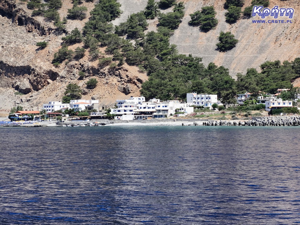
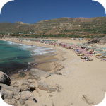
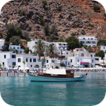
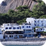
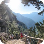
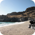
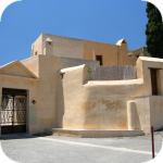
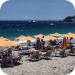
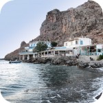
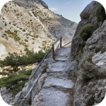
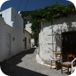
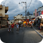
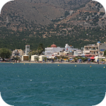
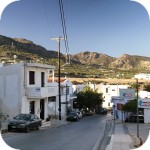
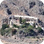
For tourists who have gone to the Samaria Gorge, which is one of the most popular trips in the western part of Crete, the white buildings of Agia Roumeli emerging at the end of the trip are one of the most pleasant views that they will see that day. For most people, the passage of a dozen or so kilometers of trail leading through the gorge is so bad that the opportunity to rest, or drink a cold fresh juice squeezed out of oranges seems to be invaluable.
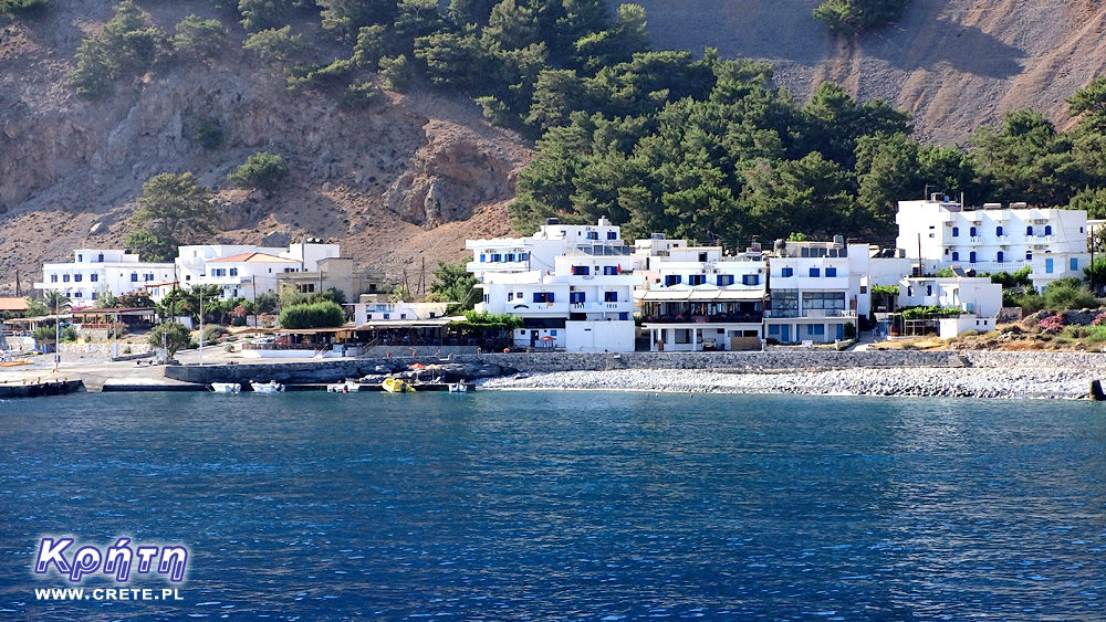
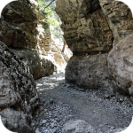
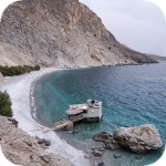
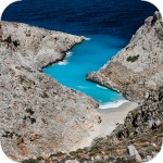
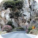
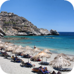
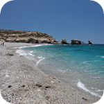
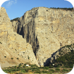
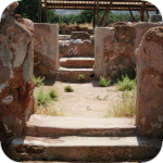
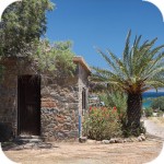
It is at Agia Roumeli that a long hours of wandering through Samaria, the longest gorge of Crete and Europe, ends. This coastal town is located in the south-western part of Crete in one of its wildest regions, which is famous for its rare specimens of fauna, flora and geological formations. On the one hand, surrounded by the amazing high peaks of the White Mountains, and on the other closed by the blue Libyan sea. This natural isolation means that Agia Roumeli is one of those towns of Crete, which can only be reached on foot or by boat.
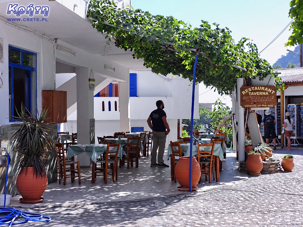
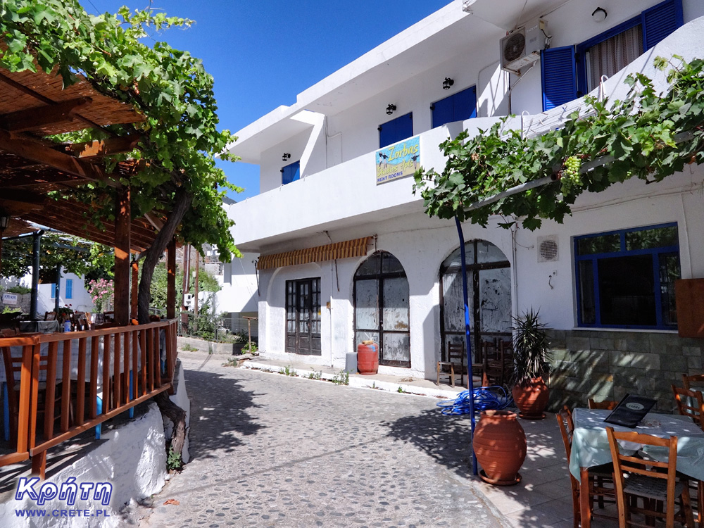
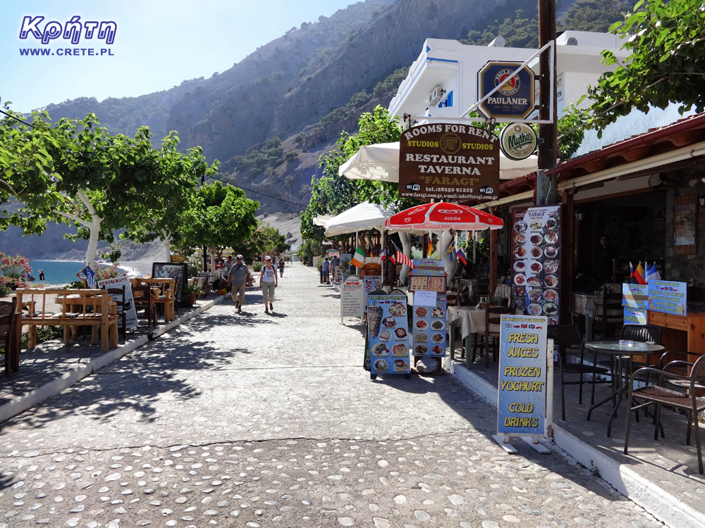
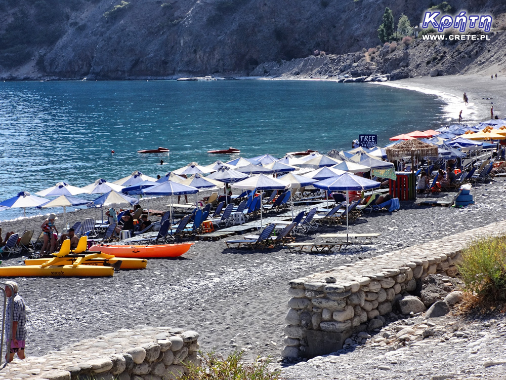
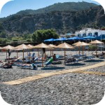
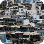
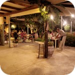
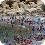
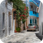
The permanent residents of Agia Roumeli have relatively few, their total number oscillates around a hundred people. However, during the summer it is one of the more crowded and noisy places in Crete. This should not be surprising because it is here in the high season almost every day meets more than a thousand people, which after passing the ravine Samaria and waiting for an afternoon ferry regenerates its strength in one of the many taverns located in this town. Despite the fact that the lower floors of almost every building are allocated for this type of premises, it is difficult to find a place in the late afternoon, especially in the central part of the village.
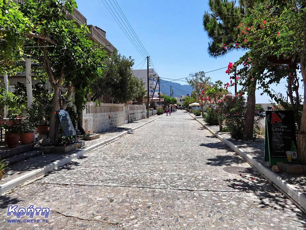
Although most tourists still treat this place as only one of the points of a tiring one-day trip, there are more and more regular fans of this place who rent rooms in one of the many hotels and stay in this place for a little longer. It is a great way to get to know Agia Roumeli and the surrounding area, because only after departure of evening ferries you can experience the uniqueness, incredible calm and Cretan character of this place. Wild nature, uncontaminated nature and the isolation of Agia Roumeli from the outside world is a perfect recipe for an interesting and unforgettable holiday. You can find here not only tourist trails, secluded beaches, but also the tranquility that is missing in the tourist towns of Crete.
Samaria Exprerience
The Roussos Viglis, one of the permanent residents of Agia Roumeli, is also an active recreation in this region. He created the 4-day program Samaria Exprerience, which combines active mountain tourism with the opportunity to learn about the rich history of this beautiful place. As part of the program, workshops are organized to show the everyday life of the former inhabitants of the ravine. Tourists under the eye of Roussos Viglis have the opportunity to learn the art of preparing traditional Cretan dishes based on local ingredients. During the hiking on the routes crossing the surrounding mountains, the participants of the program learn about traditional Cretan herbs and have the opportunity to take a look at work in local apiaries. The unusual feature of this offer is also the fact that Roussos Viglis with his family for generations lives in Agia Roumeli, and his father lived in the now abandoned village of Samaria, which hikers pass on the trail. So this is a man who knows everything about this region of Crete.
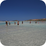
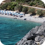
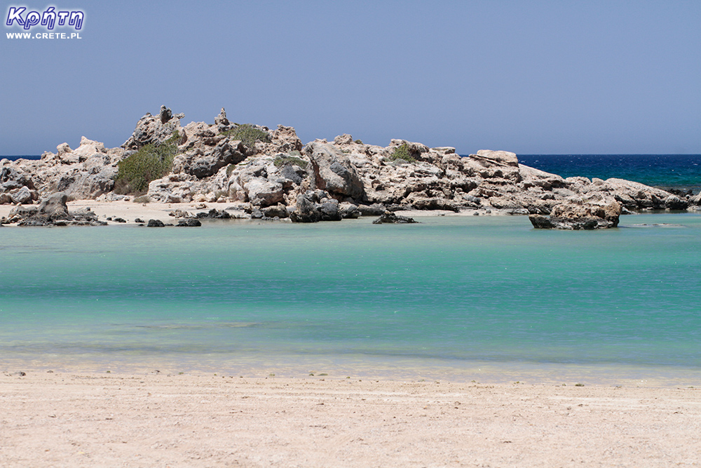
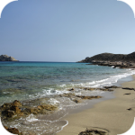
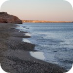
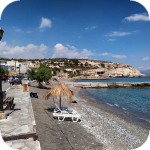
However, if you can not afford a longer stay in Agia Roumeli, it is worth staying here after passing Samaria even for one night. It is only when the crowd of tourists leaves and the everyday noise fades away and the time comes to appreciate the charms of this place. On a pebble and quiet beach you can watch the sunset and twilight, and later enjoy culinary specialties in one of the many local taverns. This is a good place to look at the sky, where stars shine here particularly intensely.
accommodation
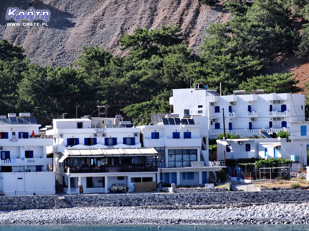
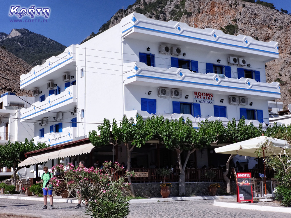
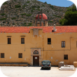
Hotels located in Agia Roumeli are usually small family-owned enterprises, which in addition to rooms decorated in a simple Greek way, also offer delicious Cretan cuisine and famous Greek hospitality. Prices in the high season are not excessive, and a double room can be rented from 35-40 € per night. It is worth noting that some hotels also accept the presence of pet pets. Although the townThis is located in a quite secluded place, the isolation is not so complete, because you can easily find access points for wi-fi networks that allow you to connect to the Internet. With a slightly longer stay, small purchases can be made in one of the two local mini-markets. Of course, due to the location of Agia Roumeli, the selection of products offered by these stores is somewhat limited and quite selective, but you can easily buy all the basic things in them.
For the active there is no place for boredom
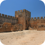
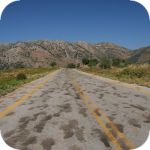
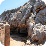
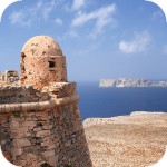
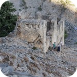
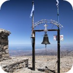
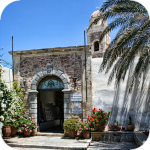
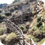
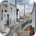
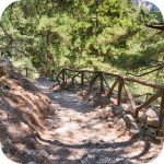
If you decide to have a short stay in Agia Roumeli, one thing is certain - you will not have time to get bored. This place is simply perfect for people who like hiking. On the nearby hill above the village you can visit the ruins of the Turkish fortress. From here, there is a view of the mouth of the gorge, the white houses of Agia Roumeli and the beaches and the sea. The walk itself is not particularly difficult. A little further there are the ruins of the second fortress, but it is in a pretty bad condition. 3.5 km east of the beach you will find the small Byzantine church of Agios Pavlos. For more persistent walkers, the challenge may be walking to the Marmara beach (4 hours) at the exit near the Aradena ravine, then further to Loutro (5 hours), from where the path to Chora Sfakion (7 hours) also leads. With Agia Roumeli also runs a longer route towards the west to Sougia. However, it is only recommended to people with experience, good condition and without fear of heights. In places the path is badly damaged, so it may be too difficult for an average tourist to walk. Both directions are basically a part of the E4 route, which simply runs through Agia Roumeli.
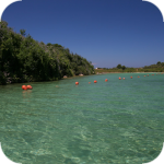
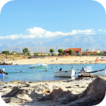
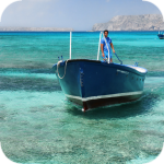
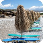
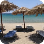
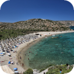
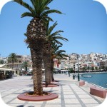
In this village for the most part of the day you can enjoy an empty beach that fills up slightly in the afternoon. Sun loungers and umbrellas are rented on it. There is also a possibility to take a rented boat in the east direction to Marmara, Glyka Nera and Loutro , as well as to the west: Domata, Kalogeros or Trypiti.
History
Formerly Agia Roumeli was located inland near the entrance to the Samaria Gorge. However, in 1954 there were such heavy rains that the river flowing through the ravine caused huge damage to the village. During this period, a decision was made to move the town to the current location closer to the coast.
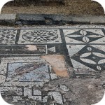
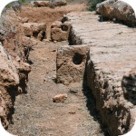
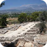
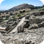
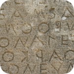
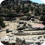
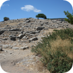
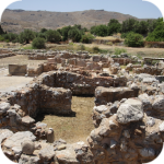
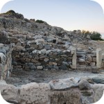
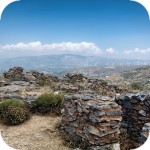
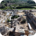
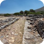
In ancient times, near the modern Agia Roumeli, there was the city of Tarra (or Tara). It was an important religious center of Dory, and its greatest development was in the Greco-Roman period. During the Roman occupation, the city was fully independent, an example of which was even its own coins. Excavations that were carried out in the area of the modern village allowed the discovery of the ruins of an ancient cemetery. The bay over which it was located probably played the role of its port. However, this was not finally proved, because after the great earthquake that took place in 365 AD, the western part of Crete rose by about 4 meters. Nevertheless, these are the assumptions and assumptions of archaeologists.
This place also has strong links with Greek mythology. The Tarra was revered by Apollo, who apparently was here just looking for a shelter after the python snake-killing and after taking over the oracle in Delphi. In this place there was also a fiery romance between Apollo and the Cretan princess Akalle. The sons of this relationship were abandoned in the mountains and fed by wild goats.
The large amount of trees and the presence of the river meant that during the Venetian and Turkish times, Agia Roumeli was an ideal place to build ships. In this period, sawmills and a shipyard were built here.
The city also found its place on the pages of history written by World War II - it was from here that after the fall of Crete in 1941, the King of Greece, George II, sailed away from Egypt.
The genesis of the name
The origin of the name of this place is ambiguous, according to one of the most interesting theories the genesis is the Arabic words AIA (water) and RUMELI (Greek) which can be translated into Greek Water.
How to get there
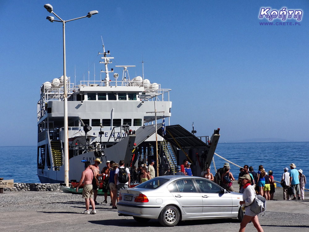
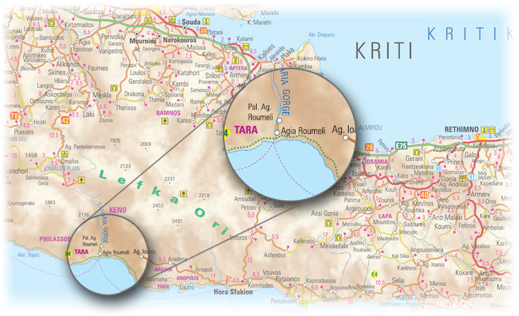
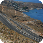
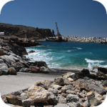
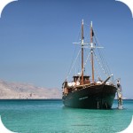
Agia Roumeli is located on the southern coast of Chania Prefecture, between the villages of Chora Sfakion and Paleochora. The specific location between the White Mountains and the Libyan Sea makes it impossible to reach by car. To get here you have to go on foot through the Samaria Gorge. On average, overcoming this long and tiring road takes about 6 hours of walking at a moderate pace. The second opportunity to get to Agia Roumeli is a sea route, which is definitely more convenient and faster. In summer, the ferry network is quite large. Several times a day, ships arrive from Chora Sfakion , calling Loutro, which is a dozen or so kilometers away. In the morning there is also a ferry from Paleochora, calling on the road to Sougia. In the evening, both ferries perform return cruises. Ticket prices for adults are around € 10 for a cruise from Chora Sfakion and € 14 for a cruise from Paleochora. The ferry from Chora Sfakion to Agia Roumeli flows an hour, while the cruise from Paleochora is slightly longer and lasts 1.5 hours.
With the advent of late autumn, from the beginning of November to the end of March, the frequency of ferries travels drops to 1-2 flights a week (2 cruises from Sfakia, 1 from Paleochory). This is quite a challenge for the permanent residents of Agia Roumeli. In addition, this situation is further aggravated by storm days often occurring during this period. Bad weather conditions combined with high waves prevailing at sea make these rare cruises sometimes canceled.
west
central
east
Interesting places on Crete
↤ click the appropriate part of the island to change the bottom map
W 2002 roku Falasarna zdobyła tytuł najlepszej plaży w Grecji. Wyróżnienie to nie jest bynajmniej przypadkowe, gdyż miejsce to jak na standardy Krety jest naprawdę unikalne.
Elafonisi is a small island located at the end of the southwestern edge of Crete. A characteristic feature of Elafonisi is the shallow lagoon connecting it with Crete.
Elafonisi is a small island located at the end of the southwestern edge of Crete. A characteristic feature of Elafonisi is the shallow lagoon connecting it with Crete.
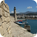
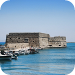
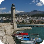
Chania (Χανιά) is the second largest (after Heraklion) city of Crete. The biggest advantage of Chania is the area of the Old Town and the beautiful Venetian Harbor.
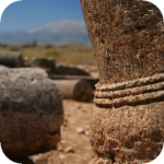
Aptera is a city whose history dates back to at least a thousand years before our era. In the peak period, about 20,000 lived in it. people, of which only 1/5 were free people.
Chania (Χανιά) is the second largest (after Heraklion) city of Crete. The biggest advantage of Chania is the area of the Old Town and the beautiful Venetian Harbor.
Omalos is a perfect starting point for exploring the Samaria Gorge. Located over 1,100 m above sea level extends over an area of 25 km2. Its size corresponds more or less to the size of the Lasithi Plateau.
Located 47 km from the city of Chania, it is the only freshwater lake in Crete. Its area is about 580 thousand. sqm. and the maximum depth is about 45 meters
Omalos is a perfect starting point for exploring the Samaria Gorge. Located over 1,100 m above sea level extends over an area of 25 km2. Its size corresponds more or less to the size of the Lasithi Plateau.
The steel crossing, which in the central part is separated from the ground by nearly 150 m, is at the leading position of the places where the longest bungee jumps are made.
Chania (Χανιά) is the second largest (after Heraklion) city of Crete. The biggest advantage of Chania is the area of the Old Town and the beautiful Venetian Harbor.
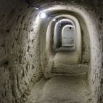
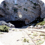
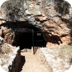
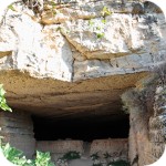
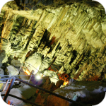
The cave is less than 1 km from Moni Gouvernetou Monastery. You will reach it using the pedestrian trail that has been marked out along the slope of the Avlaki Gorge.
Balos is one of Crete's flagship beaches if not all of Greece. We can assure you that the landscapes you see during your trip to Balos will remain with you for a very long time.
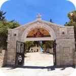
The Orthodox monastery of Agia Triada, located on the northern part of the Akrotiri peninsula, is one of the most beautiful and richest monasteries in Crete.
The Orthodox monastery of Agia Triada, located on the northern part of the Akrotiri peninsula, is one of the most beautiful and richest monasteries in Crete.
On the north-western coast of Crete, at the foot of the Gramovous peninsula, there are ruins of the ancient port of Korikos, later known as Falassarna.
Polyrinia was one of the most important city-states of western Crete during the Hellenistic and Roman periods. It was built amphitheater on a steep hill, rising to a height of 481 meters above sea level
The island of Gramvousa, or in fact Imeri Gramvousa (Ήμερη Γραμβούσα), is an inseparable point of a trip that combines a stay in the Balos Lagoon with visiting the remains of a fortress located on the top of the island of Imeri Gramovousa.
There is a beach in Crete that literally makes some people shiver. This place is Seitan Limania which can be translated as Satan's Ports or Cursed Ports.
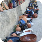
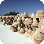
Dozens of craft workshops located in this small mountain village make Margarites one of the four main centers where traditional Cretan ceramics are made.
The date of the foundation of Moni Arkadiou (Arkadi) is not exactly known. According to tradition, the name of this church refers to the name of the Emperor Arkadiusz, who supposedly was to be its founder.
The date of the foundation of Moni Arkadiou (Arkadi) is not exactly known. According to tradition, the name of this church refers to the name of the Emperor Arkadiusz, who supposedly was to be its founder.
Rethymnon with around 40,000 inhabitants are the third largest city of Crete. This place was populated already in the Minoan period. Historically, the city was an important commercial center.
Skinaria is a small beach located along a small bay, whose outlet on both sides ends with a rocky coast. It is still a little-known place overlooked by mass tourism
Skinaria is a small beach located along a small bay, whose outlet on both sides ends with a rocky coast. It is still a little-known place overlooked by mass tourism
According to Greek mythology, Zeus hid (and perhaps even gave birth) in the Ida cave. This myth is the greatest asset of this cave, which is not as interesting and beautiful as the Dikte cave.
Tripiti is a small beach covered with a mixture of gray sand, gravel and stones. Despite the fact that the beach is unorganized and has a semi-natural appearance, one small tavern works here.
Tripiti is a small beach covered with a mixture of gray sand, gravel and stones. Despite the fact that the beach is unorganized and has a semi-natural appearance, one small tavern works here.
Tripiti is a small beach covered with a mixture of gray sand, gravel and stones. Despite the fact that the beach is unorganized and has a semi-natural appearance, one small tavern works here.
Plakias is a perfect place for people who like to spend time hiking. In the area of the town and the surrounding area, there are several hiking trails that lead to interesting beaches.
Currently, the lower monastery is still not open to the public and is not used by the monks. The buildings of the upper monastery have undergone partial renovation and are the main seat of the Preveli monastery.
Currently, the lower monastery is still not open to the public and is not used by the monks. The buildings of the upper monastery have undergone partial renovation and are the main seat of the Preveli monastery.
Currently, the lower monastery is still not open to the public and is not used by the monks. The buildings of the upper monastery have undergone partial renovation and are the main seat of the Preveli monastery.
The Kourtaliotiko Gorge, also known as the Asomatos Gorge, is perhaps one of the most spectacular natural attractions available in the central part of Crete.
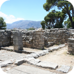
Agia Triada is a small Minoan archaeological site in the south of Crete, located near Timpaki, located on the western slope of the hill about 40 meters above sea level.
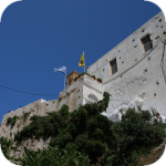
This fortress is a perfect example of Crete's multiculturalism. Located today in Greek hands, it was built by the Venetians, but is called a name taken from the Turkish language.
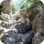
Rouvas Gorge is one of the most interesting places in this part of Crete. The interesting trail leads in a perfect way to the changing appearance of this gorge.
Matala is one of the most popular towns not only of the southern coast but also of the whole of Crete. In the 1960s and 1970s, this small fishing village was a mecca for hippies.
The Odigitrias Monastery is one of the most famous monasteries of southern Crete. Unfortunately, in terms of popularity, he is far from other Cretan monasteries.
In addition to the famous grand palaces on the island in the Minoan period, a number of smaller residences were created. One of the most important examples is the Vathipetro discovered about 5 km north of Archanes, on the southeastern slope of Mount Juchtas in the central part of Crete.
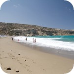
When traveling around Crete, it is not difficult to pay attention to the fact that most of the beaches there are relatively small and short. For this reason, people who are used to our national Baltic standards, where the sandy coast stretches for kilometers, may experience a special disappointment. However, fortunately, nothing is lost, because Crete in its rich arsenal of various beaches can boast of those that allow for long walks along the coast. One of them, our favorite is the Kommos beach located in the south of the central part of the island.
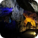
Although there are countless caves in Crete, only a few can be visited. Sfendoni is the largest cave open to the public. content comes from: http://www.crete.pl www.CRETE.pl
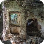
Only a few kilometers separate the bustling city of Rethymno from Mili, a village abandoned by its inhabitants. This place is also known as the village hidden in the gorge.
Information about one of the more known tourist cities of Crete, or about Malia. Description of attractions located in the city of Malia and a description of the specificity of this town.
The Lasithi Plateau is located about 70 kilometers from the capital of Crete - Heraklion. The average height at which the terrain of this plateau is located is 840 m above sea level.
One of the tourist attractions eagerly visited by people spending their holidays in Crete is the Dikte (Psychro) cave. The main factors that attract people to this cave are a rich and varied dripstone robe and a close connection with mythology.
Among the olive groves in the place called Logari, which is less than a kilometer from the village of Kritsa, there is a small Byzantine church of Panagia Kera from the 13th-14th centuries.
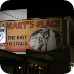
Stalida is located directly along the coast and is one of the most famous tourist destinations in Crete, which definitely comes alive with the advent of the tourist season
Most people crossing the route between Agios Nikolaos and Ierapetra will definitely notice the large crack which is marked by the mountain located east of this road. This majestic geological creation called Ha was probably created as a result of an earthquake.
Xerokambos is a small settlement in which you will find literally several taverns, and most of the buildings are single-storey and one-story houses. The big advantage of this beach is a gentle sandy descent to the sea.
Agios Nikolaos (Άγιος Νικόλαος) is a small town with less than 20,000 inhabitants. permanent residents (according to statistical data from 2001). This city is the capital of the Lasithi nomos.
Although Elounda seems to be a sleepy fishing town to this day, however, appearances should not fool you, because this town and its surroundings can boast of probably the largest number of the best hotels.
Although Elounda seems to be a sleepy fishing town to this day, however, appearances should not fool you, because this town and its surroundings can boast of probably the largest number of the best hotels.
Stalida is located directly along the coast and is one of the most famous tourist destinations in Crete, which definitely comes alive with the advent of the tourist season
Zakros is the fourth-largest Minoan palace in Crete in importance and size. This latest found, built on the east coast of the island is located in the village of Káto Zákros.
Zakros is the fourth-largest Minoan palace in Crete in importance and size. This latest found, built on the east coast of the island is located in the village of Káto Zákros.
The first palace was built around 1900 BC. in the place where there was a quite impressive settlement whose remains were later transformed into the central part of the city.
The ruins of the ancient city of Itanos are located at the eastern tip of Crete, less than 3 kilometers north of the famous palm beach of Vai. Although there are also nice beaches at Itanos, unlike its well-known neighbor, this place does not attract crowds. There are either accidental stray tourists or excavation enthusiasts here.
Less than 10,000 population of Sitia makes the city the smallest in Crete. Some even go a step further and say perversely that it is rather the largest village of Crete.
Napoleon's house is one of the few typically tourist attractions in Ierapetra. About what could have happened here in the summer of 1798 and possibly how much in this legend is the truth we write in the article on the page below.
Moni Kapsa Monastery is one of the most interesting monasteries in Crete. Its massive buildings were erected on rocky, gray slopes surrounding the nearby Pervolakia Gorge.
Przeszedłem z Anna Michlewicz i Robert Michlewicz było pięknie i ciężko :)
1
Brygida Cieślik
2015-02-26 19:58:34
komentarz z
A ta kąpiel w morzu po przejściu wąwozu- rewelacja.
5
Tomasz Syty
2015-02-26 21:13:33
komentarz z
no to ponad 12km w upale, raj dla stóp :)
Zet Anna
2015-02-26 22:04:29
komentarz z
ja na kąpiel w tym morzu nie miałam czasu, ledwie zdążyłam na prom...
2015-02-26 20:41:14
komentarz z
I świeżo wyciskany sok z pomarańczy.
1
2015-02-26 20:56:13
komentarz z
taaak.....byłam w raju :)
2015-02-26 21:11:44
komentarz z
byłem, pamiętam, polecam każdemu :)
2
2015-02-26 22:17:13
komentarz z
Po kilkunastu kilometrach wędrówki w upale przez Samarię, najlepsze jest zimne piwko w Agia Roumeli i kąpiel w bardzo słonym Morzu Libijskim ;-)
1
2015-02-27 08:37:50
komentarz z
Wystarczą dobre buty i chęć nie ma znaczenia wiek , należy tam być!!!
2015-02-27 11:06:16
komentarz z
Sok z pomarańczy to zbawienie
1
2015-02-27 12:37:46
komentarz z
Ka El *
2016-07-04 13:11:59
komentarz z
Przejście wąwozu Samaria jest "punktem obowiązkowym" w czasie pobytu na Krecie. Kto tego nie zrobi nie wie jak piękna jest Kreta.
2016-07-04 13:15:51
komentarz z
Przestrzegam jedynie przed wizytą w tawernie niedaleko kas biletowych na prom (po przekątnej). Właściciel nas oszukał. Zapłaciliśmy za najgorsze jedzenie jakie nam zaserwowano na Krecie trzykrotnie więcej niż we wszystkich pozostałych. Byliśmy zbyt zmęczeni, więc zorientowaliśmy się dopiero na promie
CRETE - Kreta
2016-07-04 13:28:50
komentarz z
Oj to faktycznie bardzo słabo. W naszym najnowszym opisie wycieczki do wąwozu Samaria, zachęcamy właśnie do korzystania jednej z wielu tawern znajdujących się w głębi Agia Roumeli.
gość patryk
2016-08-29 13:20:44
promy
Mam pytanie. Czy można się dostać z powrotem z miejscowości Sougia lub Paleochora do miejscowości Omalos??? Gdyż chciałbym tam przyjechać autem aby zejść w dół wąwozu, następnie prom.
Piotrek | www.crete.pl
2016-08-29 13:56:02
Jak najbardziej
Patryk, wedle rozkładu umieszczonego na stronie masz możliwość skorzystać z autobusu, który o 18.30 jedzie z Sogia do Omalos. Autobus czeka na przypłynięcie promu, więc jest to tylko orientacyjna godzina odjazdu.
Byłem 22 lata temu i teraz znowu planuję przejść ten wąwóz
Fantastyczna sprawa. Tatry i morze w jednym miejscu :) W 1996 roku w maju przeszliśmy z żoną ten wąwóz i pamiętam jak dziś ten niesamowity widok krystalicznie czystej wody w zatoce po wyjściu z wąwozu. Teraz też może uda nam się znaleźć czas by w tę majówkę przejść cały wąwóz. Maj to dobra pora. Nie jest tak gorąco.
gość PiotrWie
2018-02-19 20:54:09
Jak będziesz miał do dyspozycji tydzień to polecam przejście E4 z Hora Sfakion do Elafonisi - bardzo ładny szlak w sam raz na majówkę. Poza odcinkiem Aghia Roumeli - Sougia ( który jest dość trudny, a przede wszystkim nie ma gdzie uzupełnić wody - trzeba wziąść ze sobą zapas na dwa dni marszu) nie ma jakiś większych trudności, można iść tak by znależć na nocleg zawsze jakiś pensjonat, a można spokojnie spać na plażach, jak nie czujesz się na siłach iść z Aghia Roumeli do Soughii to zawsze można go obejść - podchodząc Samarią w górę na Omalos następnie schodząc do Soughii przez wąwóz Aghia Irini. Polecam wszystkim jako początek chodzenia po kreteńskich górach - jak przejdziesz to dalej już pójdzie "z górki" - Białe, Idi, Dikti i inne.
Piotrek | www.crete.pl
2018-02-20 08:37:29
W pełni popieram propozycje Piotra. Odcinkami przeszedłem szlaki o których wspomina w swoim komentarzu i osobiście uważam, że to jedne z przyjemniejszych i ciekawych pieszych wędrówek jakie realizowałem na Krecie :)
gość PiotrWie
2018-02-20 11:01:04
Chciałbym jeszcze jedno dodać do tych informacji - jeśli ktoś wybiera się pochodzić po górach Krety polecam mapy turystyczne wydawnictwa Anavasi - dostępne są Góry Białe podzielone na 3 części, Idajskie, Dikti, Asterousia i wschodni kraniec ( po nazwą Zakros - Vai ) mapy w skali 1:25000 i 1:30000, dobrze czytelne. Szlaki są znakowane różnie - akurat E4 nadmorski w Górach Białych był kilka lat temu poprawiany i jest niezły, ale ogólnie to rekomenduję GPS, może być z telefonu ( ale wtedy niezbędny silny powerbank). Ślady GPS dostępne np na Wikiloc.com, a mapy Anavasi możne kupić w wersji cyfrowej w aplikacji Avenza Maps - ja korzystam równolegle z obu wersji.
Wypełnij poniższy formularz aby dodać komentarz
lub kliknij w poniższy link aby skorzystać z możliwosci komentowania przez facebooka: https://www.facebook.com/crete.poland/posts/10152757441952551
Matala is one of the most popular towns not only of the southern coast but also of the whole of Crete. In the 1960s and 1970s, this small fishing village became a mecca for hippies. Its hallmark is a rock with cavernous caves, where the beach is located. For several years, Matala Beach Festival has been organized here, which attracts fans of good music and entertainment for one June weekend.
Loutro is famous for the fact that you can get to it only from the sea or walk on the mountain trail, because there is no other road here. Located on the southern coast of Crete in Chania, it is only a few kilometers from Chora Sfakion. Loutro is located right on the shore of the bay, which is affected by a ferry that runs regularly between Chora Sfakion and Paleochora.
Chora Sfakion is an extremely picturesque mountain village of the mountainous and wild region of Sfakia located in the south-west of Crete. This special placement on the Libyan Sea in a way behind the mountain range of Lefka Ori makes the Chora quite isolated from towns dominated by mass tourism. Currently, access here is not a major difficulty because the roads, although narrow and winding are already covered with asphalt.
gość PiotrWie Jeździliśmy na Kretę od 2008r, bywały lata że byliśmy w kilku kawałkach w sumie czterdzieści kilka dni ( samoloty z Wrocławia latały w piątek wieczorem tak że można było polecieć po pracy, powrotem był w poniedziałek w nocy więc za 11 dni urlopu można było być 17 dni, jak się zaplanowało z jakimś świętem to można było być 2 x 17 dni i raz 10 dni) i z roku na rok było coraz więcej ludzi - nie tylko na plażach ale ... (...)
Czy wyspa jest w stanie pomieścić 15 mln turystów, zapewne tak. Pytanie moje: skąd będzie woda?! Jak już brakuje, tama na Aposelemis sucha, gdzie ścieki popłyną, gdzie będą składowane śmieci??? Smutne, że wyspa zamienia się na globalną destynację.. rozumiem, że pieniądze są ważne ale żeby dewastować naturalne tereny np.triopetra, plakias etc... przykro
Można próbować zrozumieć ludzi, którzy z tego żyją. Można też puścić ludzi na żywioł i nie zajmować się takimi głupotami, jak ofiary śmiertelne. Samaria nie jest szlakiem w 100% bezpiecznym (który szlak jest), to głęboki wąwóz, narażony na erozyjne osunięcia skał. Poza ty, to jest region aktywny sejsmicznie i dość kapryśny pogodowo.
Myślę, że tu nie ma miejsca na ustępstwa. (...)
gość PiotrWie Dziś po raz pierwszy ( a jeździmy dużo od 2008 roku i dużo chodzimy po szlakach) widzieliśmy w Grecji ekipę przygotowującą szlak do sezonu. Nie była to co prawda zbyt duża ekipa - dwie osoby z motyką, sekatorem i niewielką piłą ręczną - ale zawsze coś - na wyspach Kanaryjskich ekipa to pierwszy z kosą spalinową a zanim kilka osób zmiatających resztki na bok. (...)


Komentarze
komentarz z
POLECAM SUPER WYCIECZKA A WIDOKI NIESAMOWITE:)
komentarz z
Przeszedłem z Anna Michlewicz i Robert Michlewicz było pięknie i ciężko :)
komentarz z
A ta kąpiel w morzu po przejściu wąwozu- rewelacja.
komentarz z
no to ponad 12km w upale, raj dla stóp :)
komentarz z
ja na kąpiel w tym morzu nie miałam czasu, ledwie zdążyłam na prom...
komentarz z
I świeżo wyciskany sok z pomarańczy.
komentarz z
taaak.....byłam w raju :)
komentarz z
byłem, pamiętam, polecam każdemu :)
komentarz z
Po kilkunastu kilometrach wędrówki w upale przez Samarię, najlepsze jest zimne piwko w Agia Roumeli i kąpiel w bardzo słonym Morzu Libijskim ;-)
komentarz z
Wystarczą dobre buty i chęć nie ma znaczenia wiek , należy tam być!!!
komentarz z
Sok z pomarańczy to zbawienie
komentarz z
Ka El *
komentarz z
Przejście wąwozu Samaria jest "punktem obowiązkowym" w czasie pobytu na Krecie. Kto tego nie zrobi nie wie jak piękna jest Kreta.
komentarz z
Przestrzegam jedynie przed wizytą w tawernie niedaleko kas biletowych na prom (po przekątnej). Właściciel nas oszukał. Zapłaciliśmy za najgorsze jedzenie jakie nam zaserwowano na Krecie trzykrotnie więcej niż we wszystkich pozostałych. Byliśmy zbyt zmęczeni, więc zorientowaliśmy się dopiero na promie
komentarz z
Oj to faktycznie bardzo słabo. W naszym najnowszym opisie wycieczki do wąwozu Samaria, zachęcamy właśnie do korzystania jednej z wielu tawern znajdujących się w głębi Agia Roumeli.
promy
Mam pytanie. Czy można się dostać z powrotem z miejscowości Sougia lub Paleochora do miejscowości Omalos??? Gdyż chciałbym tam przyjechać autem aby zejść w dół wąwozu, następnie prom.
Jak najbardziej
Patryk, wedle rozkładu umieszczonego na stronie masz możliwość skorzystać z autobusu, który o 18.30 jedzie z Sogia do Omalos. Autobus czeka na przypłynięcie promu, więc jest to tylko orientacyjna godzina odjazdu.
http://rethymnon.com/TheBus-Bus-Service-Crete/timetablepop.php?line=M24&lg=2
Byłem 22 lata temu i teraz znowu planuję przejść ten wąwóz
Fantastyczna sprawa. Tatry i morze w jednym miejscu :) W 1996 roku w maju przeszliśmy z żoną ten wąwóz i pamiętam jak dziś ten niesamowity widok krystalicznie czystej wody w zatoce po wyjściu z wąwozu. Teraz też może uda nam się znaleźć czas by w tę majówkę przejść cały wąwóz. Maj to dobra pora. Nie jest tak gorąco.
Jak będziesz miał do dyspozycji tydzień to polecam przejście E4 z Hora Sfakion do Elafonisi - bardzo ładny szlak w sam raz na majówkę. Poza odcinkiem Aghia Roumeli - Sougia ( który jest dość trudny, a przede wszystkim nie ma gdzie uzupełnić wody - trzeba wziąść ze sobą zapas na dwa dni marszu) nie ma jakiś większych trudności, można iść tak by znależć na nocleg zawsze jakiś pensjonat, a można spokojnie spać na plażach, jak nie czujesz się na siłach iść z Aghia Roumeli do Soughii to zawsze można go obejść - podchodząc Samarią w górę na Omalos następnie schodząc do Soughii przez wąwóz Aghia Irini. Polecam wszystkim jako początek chodzenia po kreteńskich górach - jak przejdziesz to dalej już pójdzie "z górki" - Białe, Idi, Dikti i inne.
W pełni popieram propozycje Piotra. Odcinkami przeszedłem szlaki o których wspomina w swoim komentarzu i osobiście uważam, że to jedne z przyjemniejszych i ciekawych pieszych wędrówek jakie realizowałem na Krecie :)
Chciałbym jeszcze jedno dodać do tych informacji - jeśli ktoś wybiera się pochodzić po górach Krety polecam mapy turystyczne wydawnictwa Anavasi - dostępne są Góry Białe podzielone na 3 części, Idajskie, Dikti, Asterousia i wschodni kraniec ( po nazwą Zakros - Vai ) mapy w skali 1:25000 i 1:30000, dobrze czytelne. Szlaki są znakowane różnie - akurat E4 nadmorski w Górach Białych był kilka lat temu poprawiany i jest niezły, ale ogólnie to rekomenduję GPS, może być z telefonu ( ale wtedy niezbędny silny powerbank). Ślady GPS dostępne np na Wikiloc.com, a mapy Anavasi możne kupić w wersji cyfrowej w aplikacji Avenza Maps - ja korzystam równolegle z obu wersji.
Wypełnij poniższy formularz aby dodać komentarz
lub kliknij w poniższy link aby skorzystać z możliwosci komentowania przez facebooka:
https://www.facebook.com/crete.poland/posts/10152757441952551