The trail leading through the Samaria Gorge is undoubtedly the most popular trekking in Crete. A trip to this place is eagerly chosen by tourists staying here both from the western part of the island, as well as in the Middle East. No wonder, then, that in the high season the route leading through this place passes even more than a thousand people a day. However, if your hotel is located in central or eastern Crete, we have an equally good alternative for you, interesting especially for those who want to rest from the crowds of tourists.
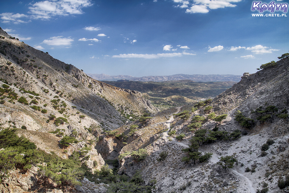
We would like to encourage you to choose Rouvas Gorge as one of your holiday goals. The trail led through this place is, in our opinion, one of the most interesting hiking tours in Crete. An additional advantage is that independent organization of such a trip is relatively uncomplicated and easy. Of course, if you have a rental car.
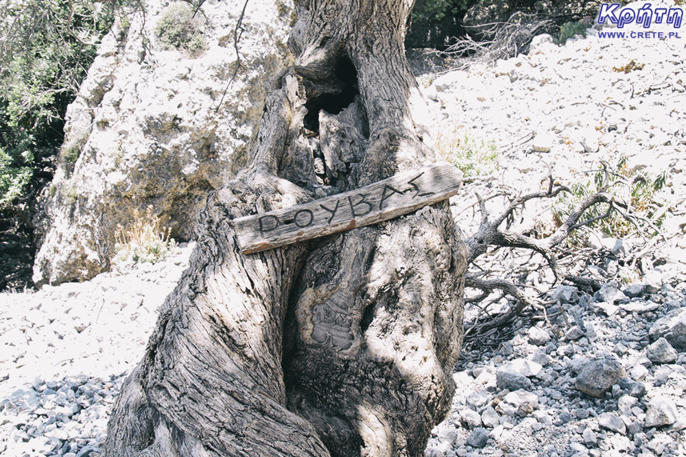
At the outset, it's worth mentioning that when you look for information about this place, you may come across some names under which it is described. On maps, this gorge will most often be seen as a gorge of St. Nicholas (Agios Nikolaos). This name is a direct reference to the patron of the local monastery located at the southern mouth of the ravine. Sometimes this place occurs under the name Gafaris or as the Zaros gorge. In the article, we will use the equally popular Rouvas name, which refers to the name of the local forest.
Although the trail itself is not particularly difficult or demanding, it is nevertheless worth taking care of suitable footwear. In many places the path is covered with loose stones, which in our opinion disqualifies you from entering here in trekking sandals. Approach or trial boots with an appropriate tread are the absolute minimum for a comfortable and safe passage of this ravine.
There are points on the trail with a fresh water intake, so there is no need to take too much inventory with you. A bottle with a capacity of up to 1.5 liters for two people should be sufficient. For our part, as always, we also encourage you to take fruit juice with you. It's worth having some sweets and other snacks with you, which will provide you with extra energy for your return journey. At the end of the ravine is a beautiful forest glade, which is a good place to rest and to eat a regenerative meal.
This time we recommend you leave your trekking poles at the hotel. Although there are places where you can use their help, however, they will not be needed or will be disturbed for the most part of the trail.

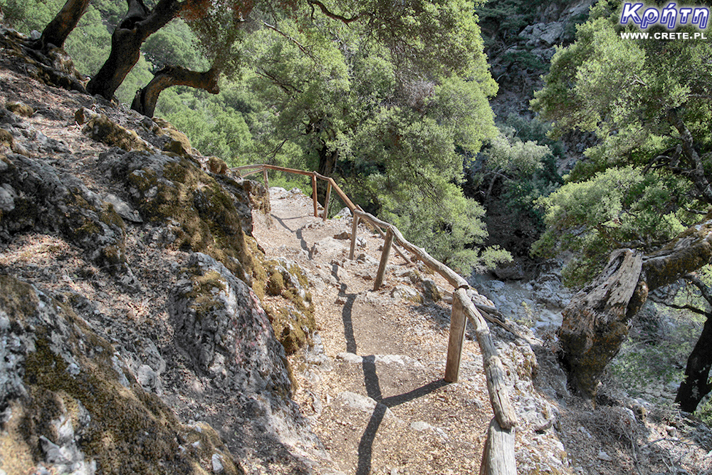
The trail is well marked and perfectly visible almost all along its length. In many places there are signposts and information boards on which, by means of simple pictograms, further rest places and points with a water intake are marked. Parts of tables are also marked with distances from a given place.
Although the length of this ravine is only 4 km, however, the total distance that you will cover during this trip is much larger and will oscillate around 14 km. The difference in height between the starting point and the final point in the Rouvas forest is about 520m. The proposed route has a route consistent with the section of the E4 route delimited here.
We recommend starting the trip by leaving the car in the car park located in the area of Lake Zaros. Well landscaped, the green area encourages you to take a moment to rest before you set out on the trail. So if you feel such a need after previous driving a car, we recommend taking the opportunity. In this place there is also a good restaurant, which, as part of the regeneration of forces, we suggest to visit, however, on the way back.
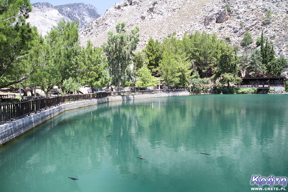
Finding yourselfon the southern shore of Lake Zaros, turn east towards a narrow curve. The trail hiding in the shade of the trees circles the lake and then goes north. Climbing gently uphill, you leave the Zaros region. The next stage of the trail is marked with a relatively flat path that traverses the northern slope of the Koudouni mountain. After about a kilometer you will reach the monastery of Agios Nikolaos. This is a very characteristic contemporary building, which due to its size can not be overlooked. Walking from the east and crossing the dry stony bottom of the stream you will enter the right trail leading through the Rouvas gorge.
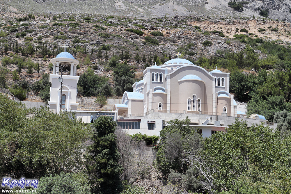
Leaving behind the buildings of Agios Nikolaos monastery, the trail climbs steeply uphill. Be careful, because a seemingly good path is covered with small stones here. It is easy to slip on them or worse, which unfortunately we had the opportunity to see with our own eyes.
Defeating the next few hundred meters of the trail, you will again cross its bottom, and then you will enter the opposite slope. In the distance you will see a characteristic steep rock cliff. Arriving at its foot, the trail turns almost 180 degrees and connects with the gravel road leading to the south. Walking about 150 meters, you should look for wooden signposts that will indicate the rest of the trail.
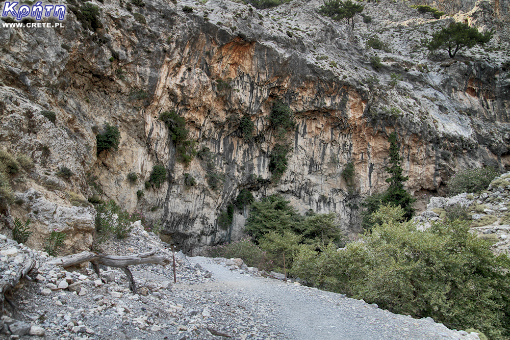
The right path is to the right of the road. Steadily climbing up the mountain slowly turns back to the northeast. Going above the cliff you passed earlier, you'll come to one of the amazing viewpoints on this trail. A bench hidden in the shadow of a tree seems to be almost suspended above the abyss. It is worth taking a moment of rest in this place, enjoying the beautiful panorama of Messara, located in the south, and the previously covered section of the gorge.
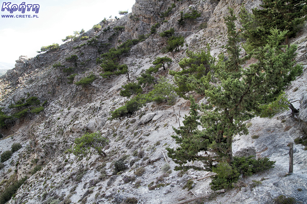
The next steep stage will take you to one of the most spectacular places of this gorge. Although the narrowing here is not as spectacular as the Iron Gate in Samaria, it also makes an impression. The interesting path leads to the sloping platform. The rock overhang in this place does not leave too much room for the head and forces you to make a deep slope. At the top of the breakneck section there is an entrance to the bridge. Going on it (on a windy day) you can expect a very strong wind here. The narrowing of the ravine causes that the power of each gust is multiplied.
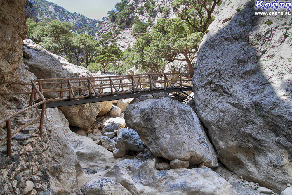
After going to the other side, the trail overcomes another interesting wooden bridge, and then climbs steeply on the opposite slope. At this stage, the nature of the ravine is clearly changed. The pine forest thickens to create a pleasant shadow in which the trail is hidden. In the air, you can feel the pine smell.
The next part of the road is a relatively comfortable path, which runs on a rocky ledge. The trail away from the bottom of the ravine gives you the opportunity to enjoy the amazing views. In the summer, at the bottom you can see a dry riverbed, which is covered with a yellow mineral sediment.
Even at the peak of the summer season, on the last stretch of the trail, you may come across flowing water. Most likely, however, it will be a rivulet, lazily flowing between stones. In several places, the trail crosses the bottom of the ravine going from one slope to the other.
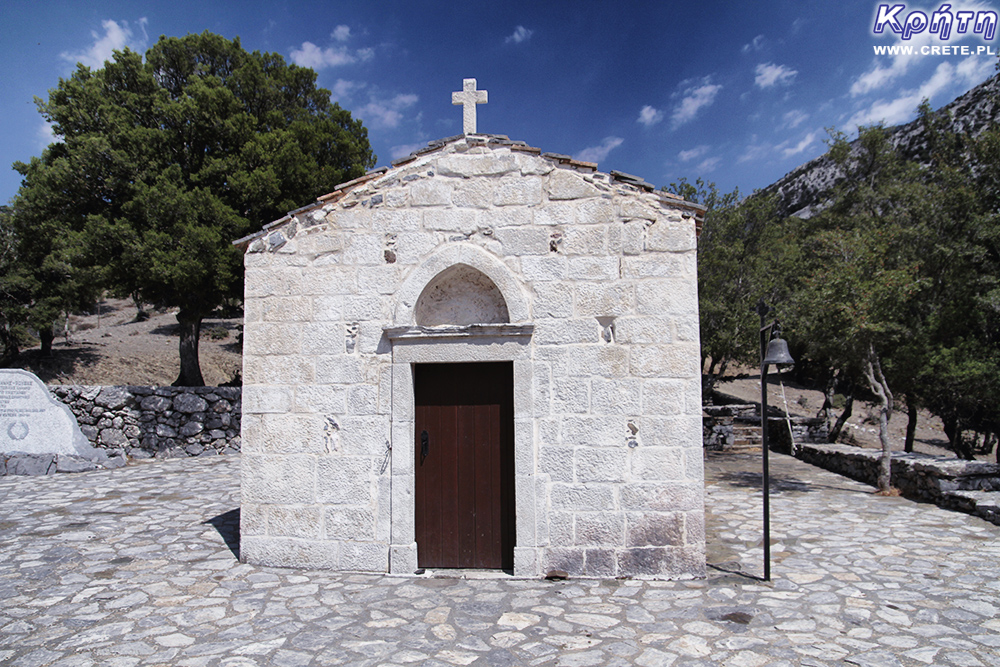
The end of the trail is surprising with the image of a vast glade, whose lush greenery does not match the typical landscape of Crete. In the shade of the spreading crowns of old trees, there are benches and tables where you can relax and also comfortably refresh yourself. On site you will also find fully functional toilets inalso equipped with washbasins. And although Rouvas is usually quite a peaceful place, it is sometimes loud, crowded and cheerful in this glade. Local Cretans willingly visit this place on the occasion of various types of holidays.
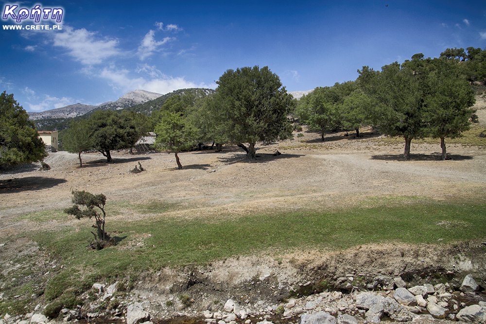
After the rest, there is nothing else you can do to return to the point where you left for this journey. Afternoon passage of the gorge in the opposite direction allows you to look at it in a different, much milder light. It is quite possible that you will be able to see many new details that have previously escaped your eyes.
Rouvas Gorge is one of the most interesting places in this part of Crete. And although in terms of spectacular views can not match Samaria, however, in our opinion it is no less interesting. People who like to walk long distances will probably also be happy that the total distance traveled in the proposed variant is about 14 kilometers.
The advantage of this place is also the large diversity of the area. The different parts of the ravine differ significantly. The interesting trail leads in a perfect way to the changing appearance of this gorge.
The gorge is located almost in the center of Crete. The relatively good and not very long commute can count both those who are vacationing near Rethymno and Heraklion . A trip to Rouvas Gorge can also be enjoyed by people who spend their leisure time in the Ierapetra area , but in this case it can take up to 2.5 hours to get there by car. A discipline of quite an early departure will be required.
↤ click the appropriate part of the island to change the bottom map
Knossos is one of the flagship monuments visited by tourists, it is also the most popular place where organized trips go.
Heraklion (Iraklion) is the largest city of Crete. With almost 140,000 inhabitants, it is the fourth largest city in Greece.
Dozens of craft workshops located in this small mountain village make Margarites one of the four main centers where traditional Cretan ceramics are made.
International airport. Nikos Kazantzakis in Heraklion is currently the largest airport in Crete.
Heraklion (Iraklion) is the largest city of Crete. With almost 140,000 inhabitants, it is the fourth largest Greek city.
The date of the foundation of Moni Arkadiou (Arkadi) is not exactly known. According to tradition, the name of this church refers to the name of the Emperor Arkadiusz, who supposedly was to be its founder.
The date of the foundation of Moni Arkadiou (Arkadi) is not exactly known. According to tradition, the name of this church refers to the name of the Emperor Arkadiusz, who supposedly was to be its founder.
Rethymnon with around 40,000 inhabitants are the third largest city of Crete. This place was populated already in the Minoan period. Historically, the city was an important commercial center.
Thrapsano is a small town inhabited by slightly over 2,500 people, the vast majority of which until recently maintained their activity as a potter.
Skinaria is a small beach located along a small bay, whose outlet on both sides ends with a rocky coast. It is still a little-known place overlooked by mass tourism
Skinaria is a small beach located along a small bay, whose outlet on both sides ends with a rocky coast. It is still a little-known place overlooked by mass tourism
According to Greek mythology, Zeus hid (and perhaps even gave birth) in the Ida cave. This myth is the greatest asset of this cave, which is not as interesting and beautiful as the Dikte cave.
Tripiti is a small beach covered with a mixture of gray sand, gravel and stones. Despite the fact that the beach is unorganized and has a semi-natural appearance, one small tavern works here.
Tripiti is a small beach covered with a mixture of gray sand, gravel and stones. Despite the fact that the beach is unorganized and has a semi-natural appearance, one small tavern works here.
Tripiti is a small beach covered with a mixture of gray sand, gravel and stones. Despite the fact that the beach is unorganized and has a semi-natural appearance, one small tavern works here.
Plakias is a perfect place for people who like to spend time hiking. In the area of the town and the surrounding area, there are several hiking trails that lead to interesting beaches.
Currently, the lower monastery is still not open to the public and is not used by the monks. The buildings of the upper monastery have undergone partial renovation and are the main seat of the Preveli monastery.
Currently, the lower monastery is still not open to the public and is not used by the monks. The buildings of the upper monastery have undergone partial renovation and are the main seat of the Preveli monastery.
Currently, the lower monastery is still not open to the public and is not used by the monks. The buildings of the upper monastery have undergone partial renovation and are the main seat of the Preveli monastery.
The Kourtaliotiko Gorge, also known as the Asomatos Gorge, is perhaps one of the most spectacular natural attractions available in the central part of Crete.
Agia Triada is a small Minoan archaeological site in the south of Crete, located near Timpaki, located on the western slope of the hill about 40 meters above sea level.
Około 60 kilometrów na południowy zachód od stolicy Krety - Heraklionu znajdują się ruiny drugiego co do wielkości starożytnego pałacu - Fajstos.
Currently, Melidoni Cave (originally called Gerontospilios) is associated mainly with the tragic events that took place here in 1824.
This fortress is a perfect example of Crete's multiculturalism. Located today in Greek hands, it was built by the Venetians, but is called a name taken from the Turkish language.
It is one of the most important and largest museums in Greece and one of the most important in Europe.
Tylissos is one of the few places in Crete that has kept its name since ancient times.
Plaża w Damnoni jest położona po sąsiedzku z Plakias - popularną turystyczną miejscowością
Agios Pavlos is a small town located on the southern coast of Crete near Saktouria.
Triopetra is located at the foot of the Siderotas mountain about 52 km south of Rethymno.
gia Galini (Αγία Γαλήνη) jest jednym z najpopularniejszych nadmorskich kurortów na południowym wybrzeżu Krety.
The observatory is located at the top of the Skinakas mountain at an altitude of 1750 m. The idea for its construction was born in 1984.
The Late-Romanesque cemetery in Armeni is located on the outskirts of this town, located less than 10 km south of the center of Rethymno.
The museum presents the dramatic history of Crete written over the last several hundred years.
The modern settlement known as Argyroupolis was built on the site of the ancient city of Lappa (also called Lambi)
Lentas is a good idea for those who want to get away from villages steeped in industrial tourism.
This ancient quarry, consisting of two parts by modern times, is called Λαβυρινθάκι and Λαβύρινθος.
If anyone of you is looking for a good restaurant near Matala and Kalamaki, then we would like to recommend estiório Chrisopigi.
Psiloritis (Timios Stavros - Holy Cross) is the top of the highest mountain of Crete, rising to 2456 m above sea level.
Rouvas Gorge is one of the most interesting places in this part of Crete. The interesting trail leads in a perfect way to the changing appearance of this gorge.
Matala is one of the most popular towns not only of the southern coast but also of the whole of Crete. In the 1960s and 1970s, this small fishing village was a mecca for hippies.
The Odigitrias Monastery is one of the most famous monasteries of southern Crete. Unfortunately, in terms of popularity, he is far from other Cretan monasteries.
Kali Limenes (meaning Dobre Porty or Piękny Przystanie) is a coastal town located in the Asterousia Mountains on the southern coast of Crete.
In addition to the famous grand palaces on the island in the Minoan period, a number of smaller residences were created. One of the most important examples is the Vathipetro discovered about 5 km north of Archanes, on the southeastern slope of Mount Juchtas in the central part of Crete.
When traveling around Crete, it is not difficult to pay attention to the fact that most of the beaches there are relatively small and short. For this reason, people who are used to our national Baltic standards, where the sandy coast stretches for kilometers, may experience a special disappointment. However, fortunately, nothing is lost, because Crete in its rich arsenal of various beaches can boast of those that allow for long walks along the coast. One of them, our favorite is the Kommos beach located in the south of the central part of the island.
Although there are countless caves in Crete, only a few can be visited. Sfendoni is the largest cave open to the public. content comes from: http://www.crete.pl www.CRETE.pl
The old Venetian port and the lighthouse are one of the most recognizable elements of Rethymno.
Samaria is one of the places we often devote a place to on our site. This gorge is not without exaggeration is considered one of the biggest attractions of the western part of Crete. Every year in high season it is visited by even over a thousand people a day. Its popularity was influenced not only by the natural beauty of this place, but also by the name of the longest gorge in Europe. Although there is already a guide on our site, in which we described in detail the trip from Paleochora to the Samaria Gorge, we decided to supplement it with an additional article. Below you will find detailed information on how to organize this trip yourself from some of the more important towns of central and western Crete.
The Kourtaliotiko gorge (Greek: Κουρταλιώτικο Φαράγγι), also known as the Asomatos gorge (Greek: Φαράγγι Ασώματου), is perhaps one of the most spectacular natural attractions available in the central part of Crete. The total length of this ravine is about 3 kilometers. Its majestic walls are separated by Sucha Góra (904 m high) and Kouroupis mountain (984 m above sea level). At the climax point, the steep walls of the gorge are over 600 meters high.
Going deep into the Richtis Gorge near Exo Mouliana, it's hard not to resist the impression that you enter a land completely different from the rest of Crete. The abundance of water and shade mean that even at the peak of the tourist season, this place is full of lush vegetation. So obvious rust colors dominate in other places of Crete, here they are completely absent, because their place replaces juicy greenery.
Komentarze
My przeszliśmy wąwóz Rouwas dwukrotnie - raz tak jak opisaliście - z żaros w górę i z powrotem, kolejny raz - dotarliśmy do lasu Rouvas z płaskowyżu Nida - była to jedna z ładniejszych tras górskich na Krecie jakie widzieliśmy - i po noclegu na w budynku należącym do tamtejszego zarządu lasów zejście do Zaros. Polecam.
Nas ten wąwóz zauroczył, niestety zdjęcia nie są w stanie oddać tych krajobrazów. Naszym zdaniem robi konkurencję oklepanej Samarii.
Gosia | crete.pl
Proponuję przy następnym pobycie na Nidzie odcinek do Ammoudary i z powrotem - nie jest trudny, prowadzi bitą drogą a krajobrazy wokół - super, nam się kojarzyły z księżycowym wąwozem z Sardynii. Odcinek z Ammoudary do Rouvas jest dużo bardziej wymagający - nie ma tam co prawda jakichś trudności technicznych, ale nie ma widocznej ścieżki i znakowanie pozostawia dużo do życzenia - stojąc przy jednym znaku nie widzimy kolejnego więc bez GPS nie bardzo wiadomo w którą stronę go szukać.
komentarz z
Piekny wawoz i bez tłoku
komentarz z
Wypełnij poniższy formularz aby dodać komentarz
lub kliknij w poniższy link aby skorzystać z możliwosci komentowania przez facebooka:
https://www.facebook.com/crete.poland/posts/10155243357932551