Serwis wymaga plików cookies do prawidłowego działania strony. Korzystanie z serwisu bez zmiany ustawień dla plików cookies oznacza, że będą one zapisywane w pamięci urządzenia. Ustawienia te można zmieniać w przeglądarce internetowej.
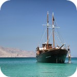
The best Polish website dedicated to the Greek island Crete and to a small extent of continental Greece. You will find useful information related to visiting Crete that goes beyond the offer of optional tours. On the website you will also find descriptions of the most interesting places that we visited by visiting this largest Greek island. The content complements the current news, photographs and recipes of Greek cuisine.
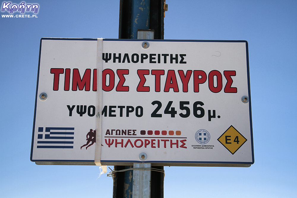
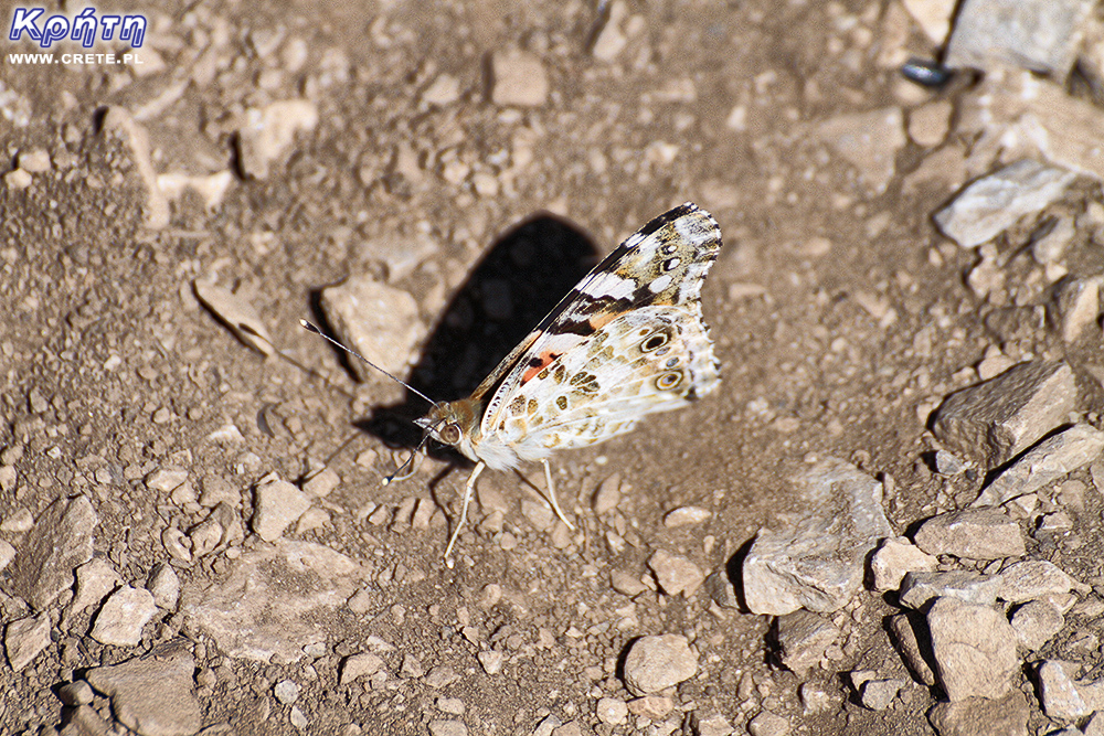
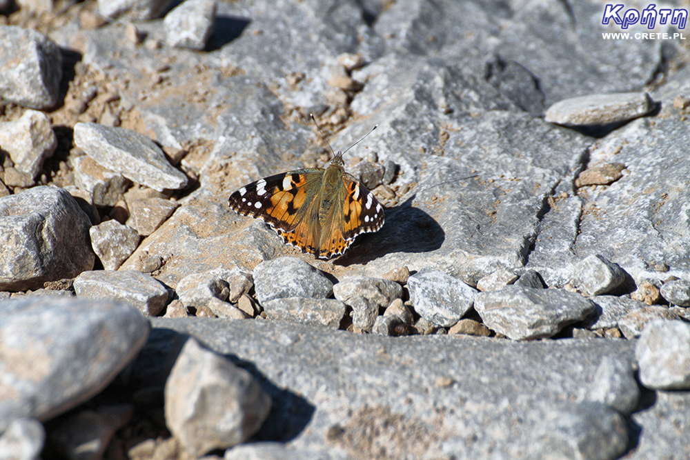
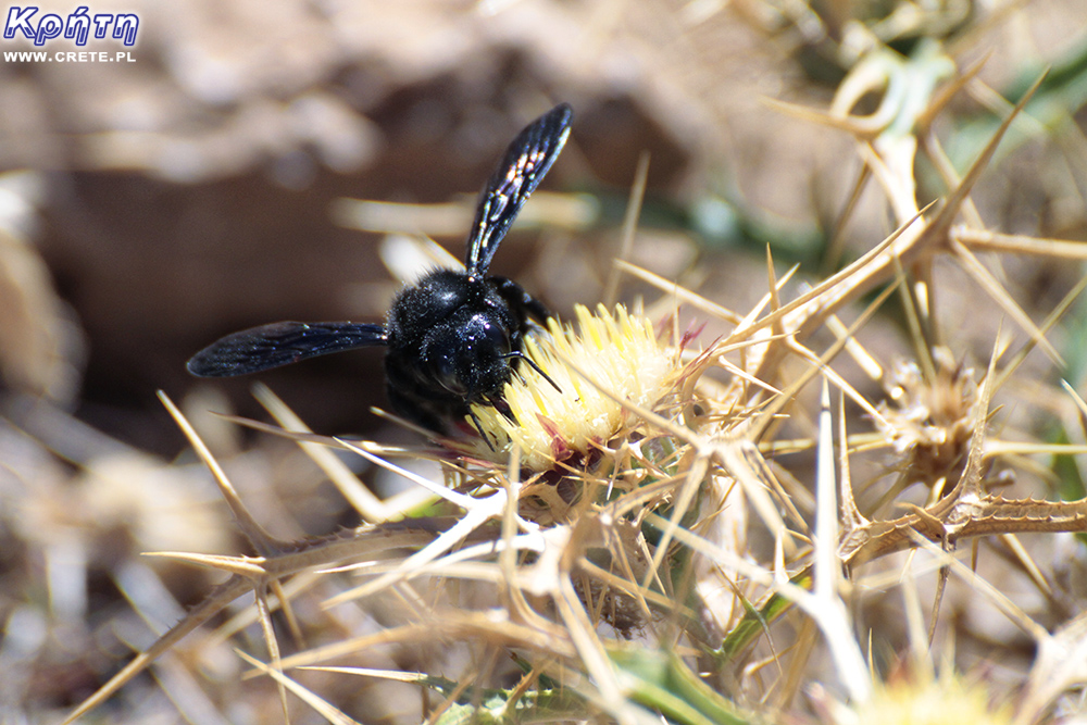
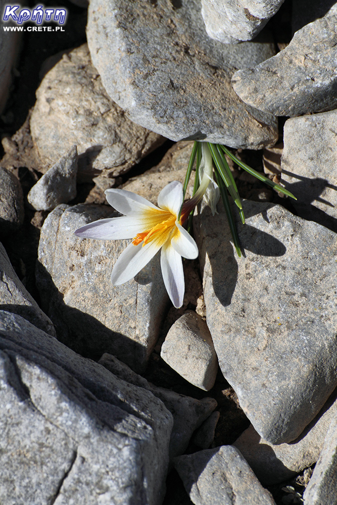
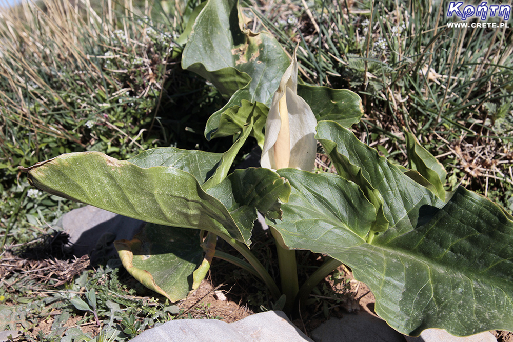
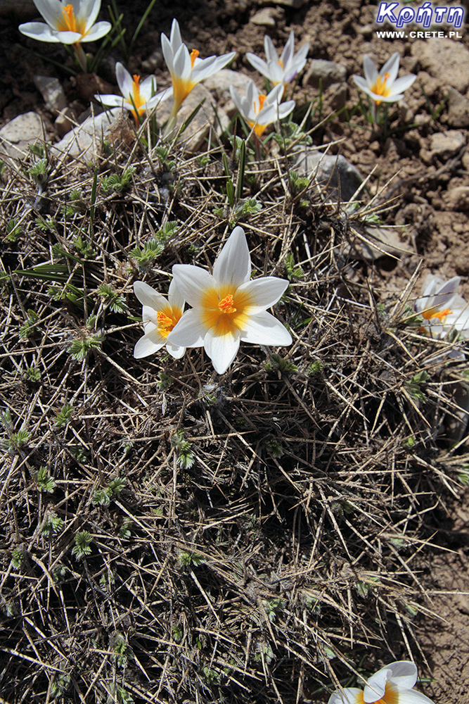
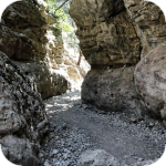
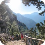
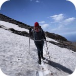
Crete is a perfect place for trekking enthusiasts. A multitude of hiking trails along the coast or through one of the many gorges even encourages this type of activity. While in Crete, you can also try to get to the top of one of the mountains there. Below you will find the "recipe" of the entrance from the Lakkos Migerou plateau to Psiloritis (Timios Stavros - Holy Cross), the top of the highest Crete mountain, 2456 m above sea level. This description will be useful for people who plan to come here in summer, late spring and early autumn. Pictures illustrating the article below come from spring and summer.
What to bring with you
Before you get on the trail, it is worth considering what to take with you on this trip. A few elements must certainly be included in the compulsory package that you should have with you. One of the most important are a good cream with a filter, a headgear and sunglasses. During entry to the Psiloritis, practically all the time will be exposed to sunlight. Low alpine vegetation means that only at the top you can count on a bit of shade at a small chapel.
Although the trail itself is relatively simple and does not require the use of specialized equipment, you can not forget about the right footwear after all. In his choice the most important is the characteristics of the sole, which should have an aggressive tread that provides good grip. In our opinion, the minimum permitting safe passage of this route is solid trial, trekking or trekking shoes. We advise against the use of trekking sandals. In many places the trail is covered with tiny loose stones, which very often have sharp edges.
Compulsory equipment also has to find the right amount of water. Remember that there is not one place on the trail where you can replenish your supplies. It's good if among the liquids you take you will also find juice or another drink that will help you top up the level of minerals. It is also worth taking small snacks with you, which will add you an extra energy kick. Unfortunately, it will be difficult to determine the amount of liquids, as well as the food that you have to take with you, because it is quite an individual feature also depends on the weather. Based on the endomondo calculations, we can only suggest that the application indicated the required hydration at the level of about 0.8l of water per one person. In our opinion, a 1.5 liter bottle of water per person is a safe minimum. This amount should be increased accordingly at high temperatures.
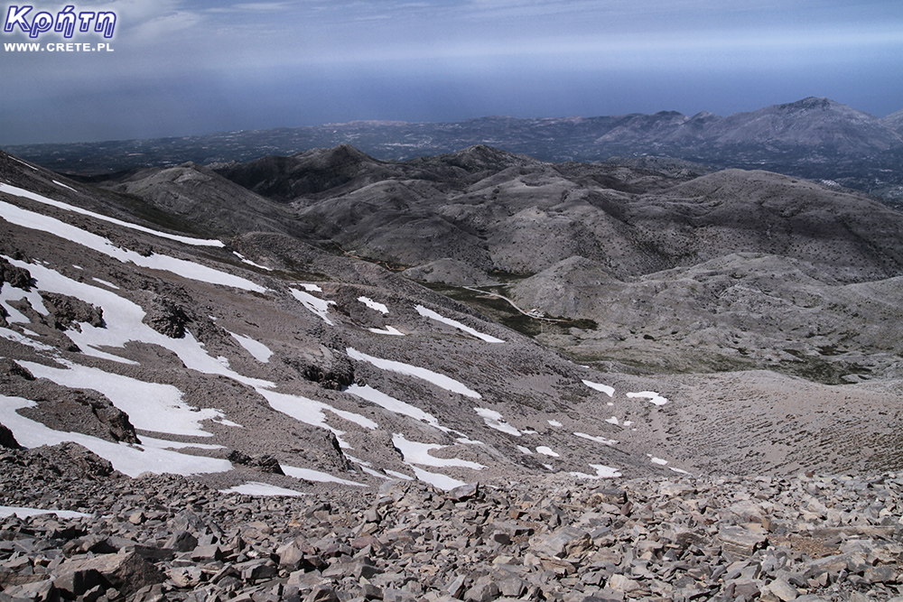
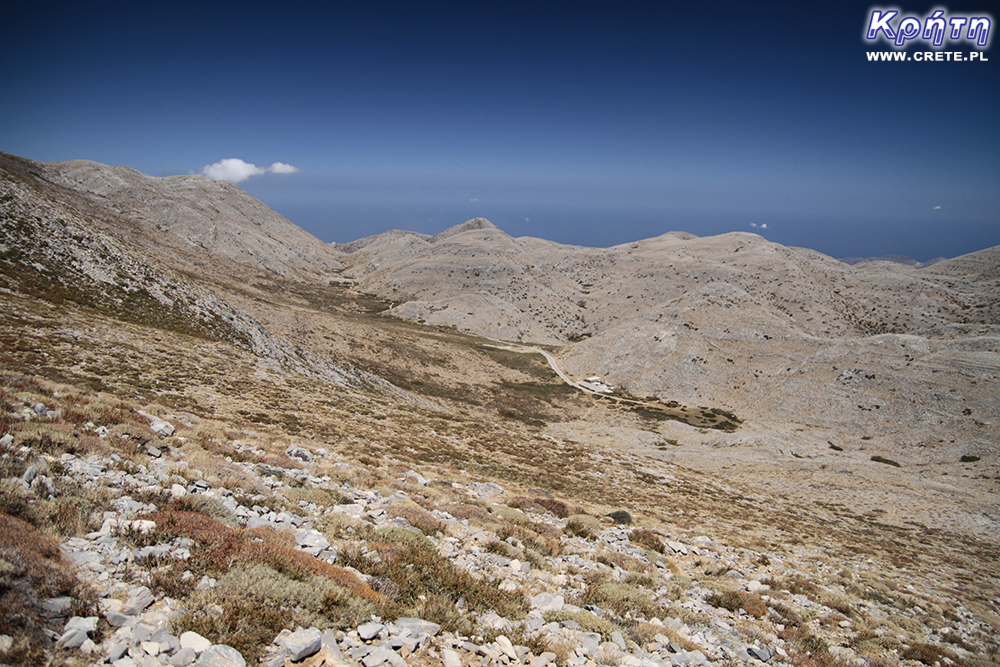
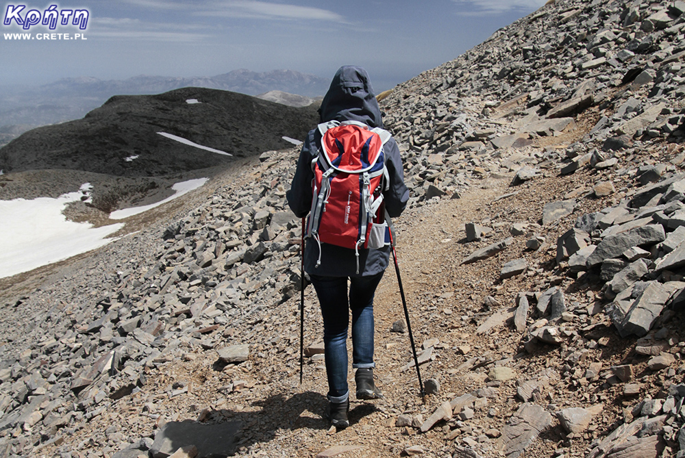
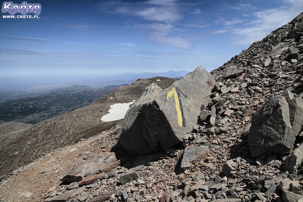
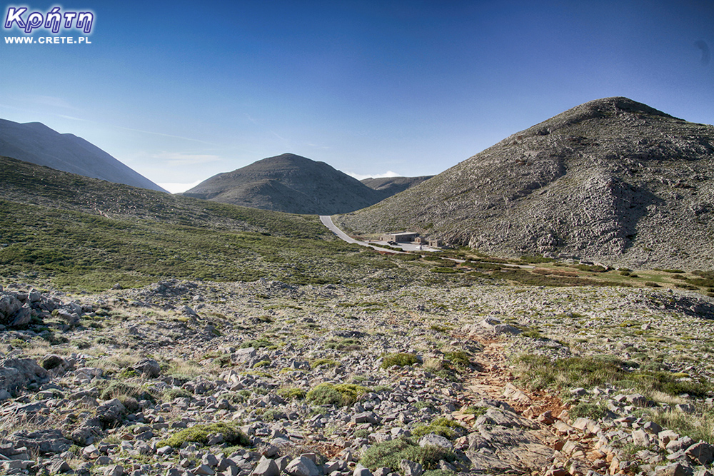
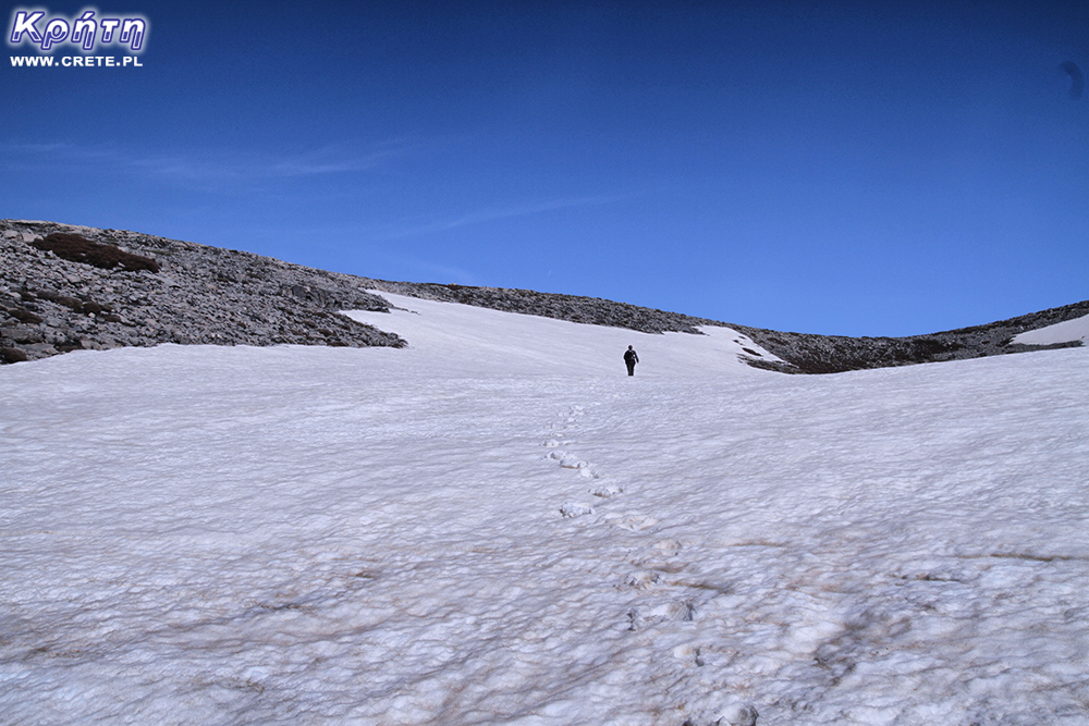
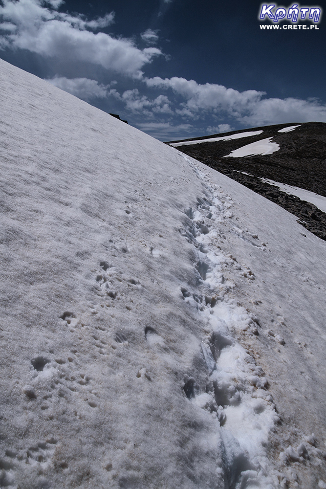
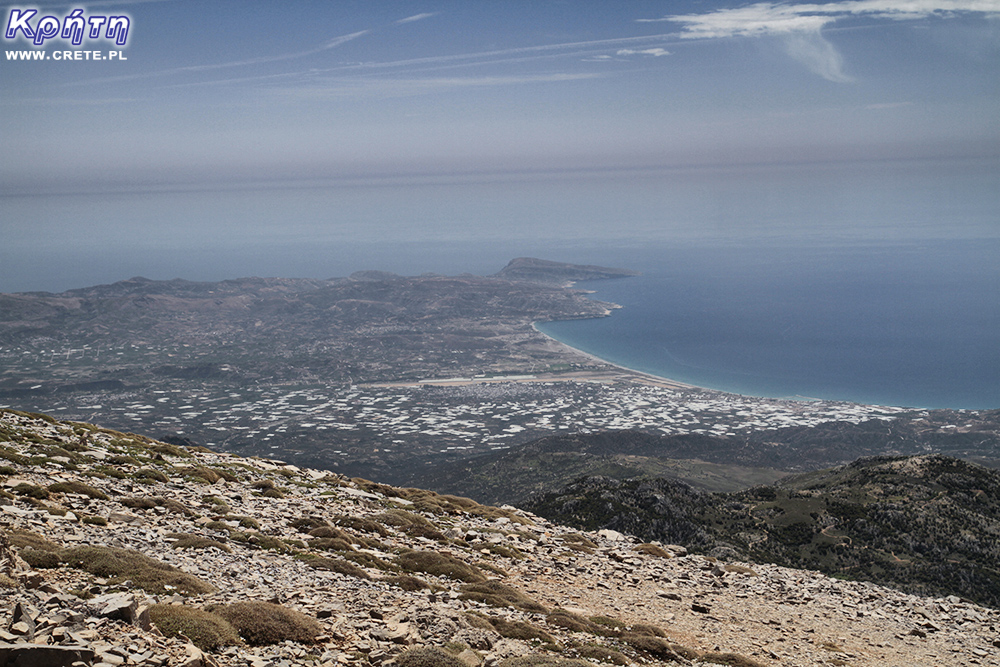
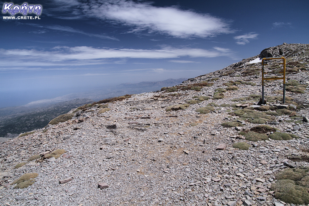
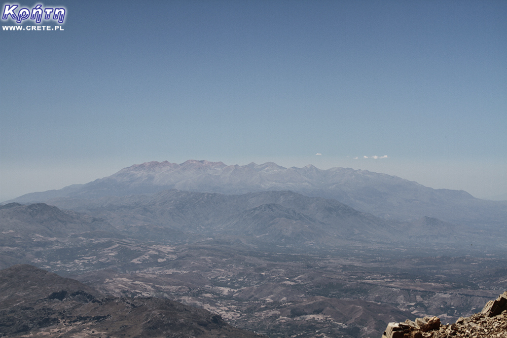
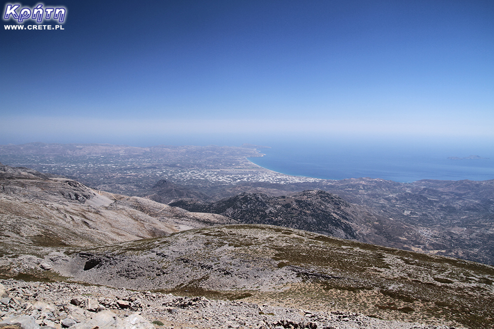
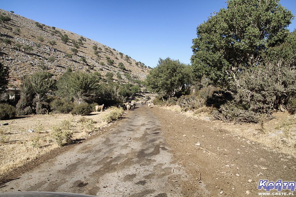
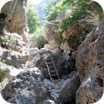
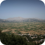
In the distance you can see the access road and Lakkos Migerou
During the approach, you should control the amount of your water supplies. It is worth determining the limit value at which you will make the decision to resign from further climbing. If you have depleted your stocks by more than half and will still be far from the top, in our opinion you should definitely give up.
A good backpack will also be necessary for the smooth passage of the trail. The best if it will be a dedicated trekking with the possibility of fastening at the waist. Remember that entering Psiloritis is a relatively tiring trip that will last at least a few hours. It is not worth taking the pleasure of this approach by condemning the torments of wearing an uncomfortable backpack.
It is a good idea to take trekking poles with you, which in our opinion do not constitute necessary equipment. They can, however, be helpful in those parts of the trail where the path is covered with loose stones. In these places it is relatively easy to lose "ground under your feet" and in these situations, poles are particularly useful, significantly reducing the risk of falling.
Such equipment for your own comfort should be supplemented with a small set of basic dressings. As we wrote earlier, in many places the trail is covered with sharp stones, which in contact with the skin may lead to minor abrasions ortreatments.
It is also worth mentioning a few words about the dress code. Even in the summer, the air temperature at the top can be clearly lower than that recorded on the Lakkos Migerou plateau. A long-sleeved blouse with a long sleeve may be useful. Cold can be particularly severe at times when Psiloritis is enveloped in clouds, which can happen even at the peak of the holiday season. By the way, it is worth mentioning that the weather here is very variable. The car is worth taking a slightly larger set of outfits, which you can freely compose adapting it to the conditions prevailing at the hostel. If you enjoy a cloudless sky, then it may not be necessary to take extra warmer things.
A good example of such a drastic change in weather can be what conditions we came across during one of our spring approaches. After arriving at the Lakkar Migerou plateau, we were welcomed by a low cloud base, high humidity and penetrating cold. We entered the trail dressed in a soft shell, fleece, additional blouses with long sleeves, scarves, as well as hats and gloves. And despite such a relatively thick dress for the onion, we must admit that it was not a costume that provided us with a special warmth. During the approach, however, a gentle wind appeared, which chased away the clouds. Within a few dozen minutes we walked in short sleeves bathed in the rays of the hot Cretan sun. Fleeces and jackets landed in backpacks.
For a change, literally two days later, we had the opposite situation. We set off from Lakkos Migerou, bathed in sunlight. Short sleeves were a sufficiently adequate dress. However, after passing through the first saddle and going out on the Agathias' traverse, we were caught by a strong, gusty wind, whose cold gusts quickly forced us to wear our jackets.
Before heading to the mountains and the trail
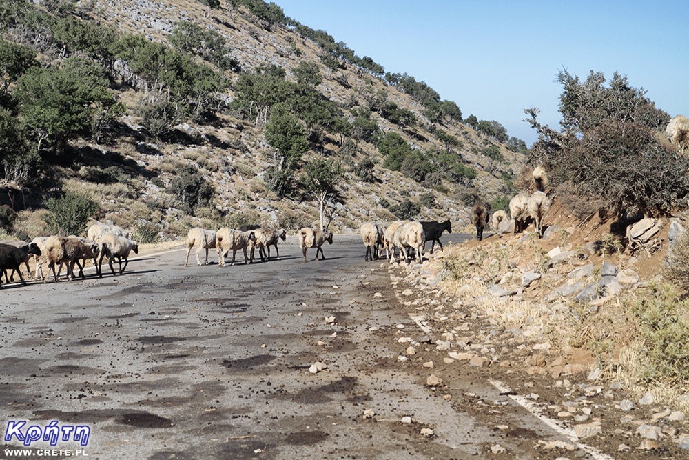
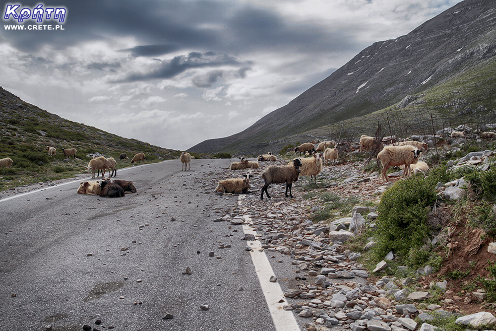
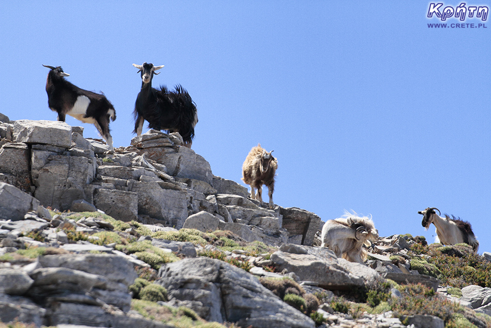
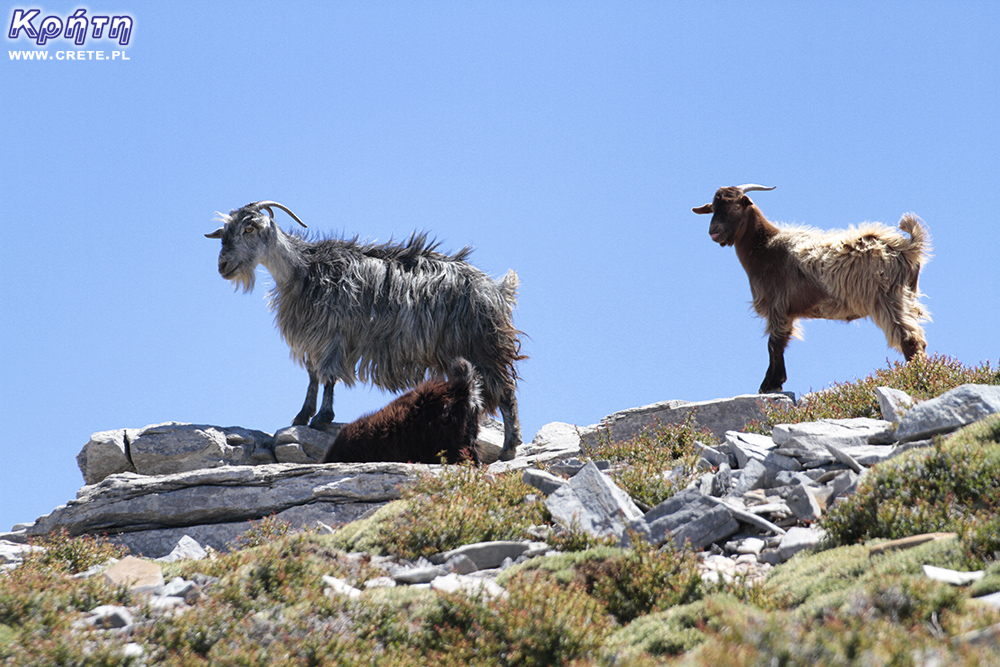
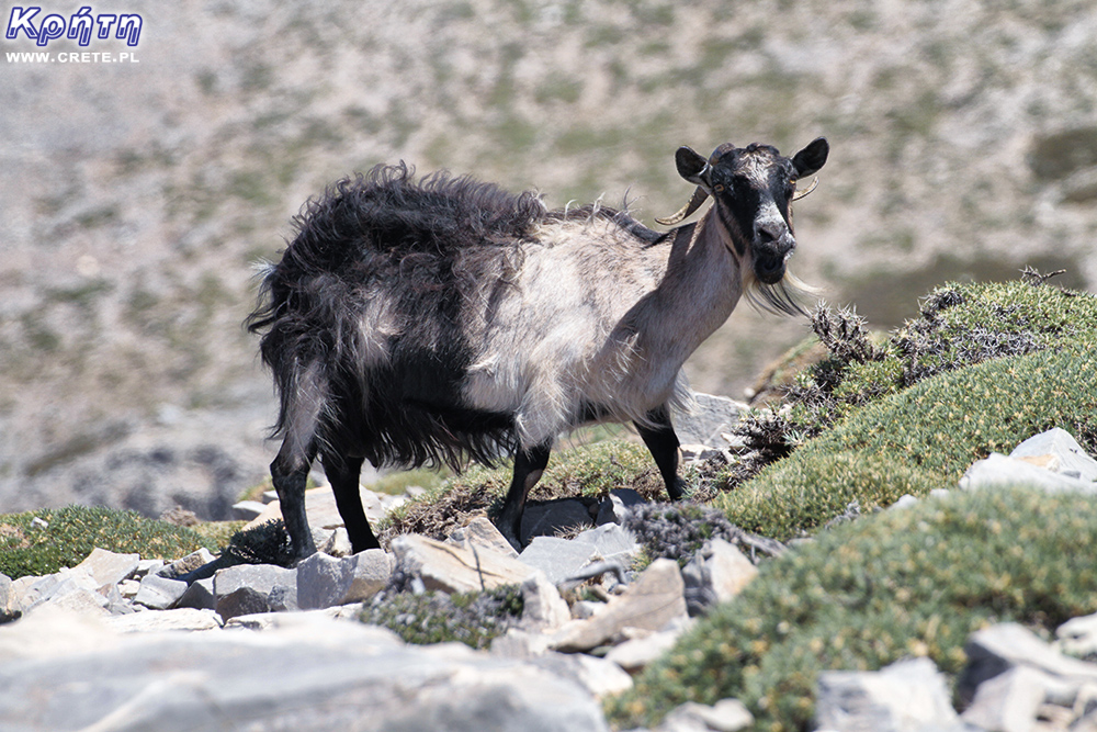
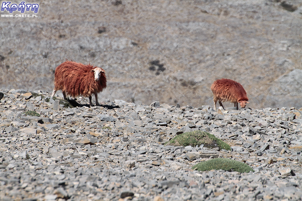
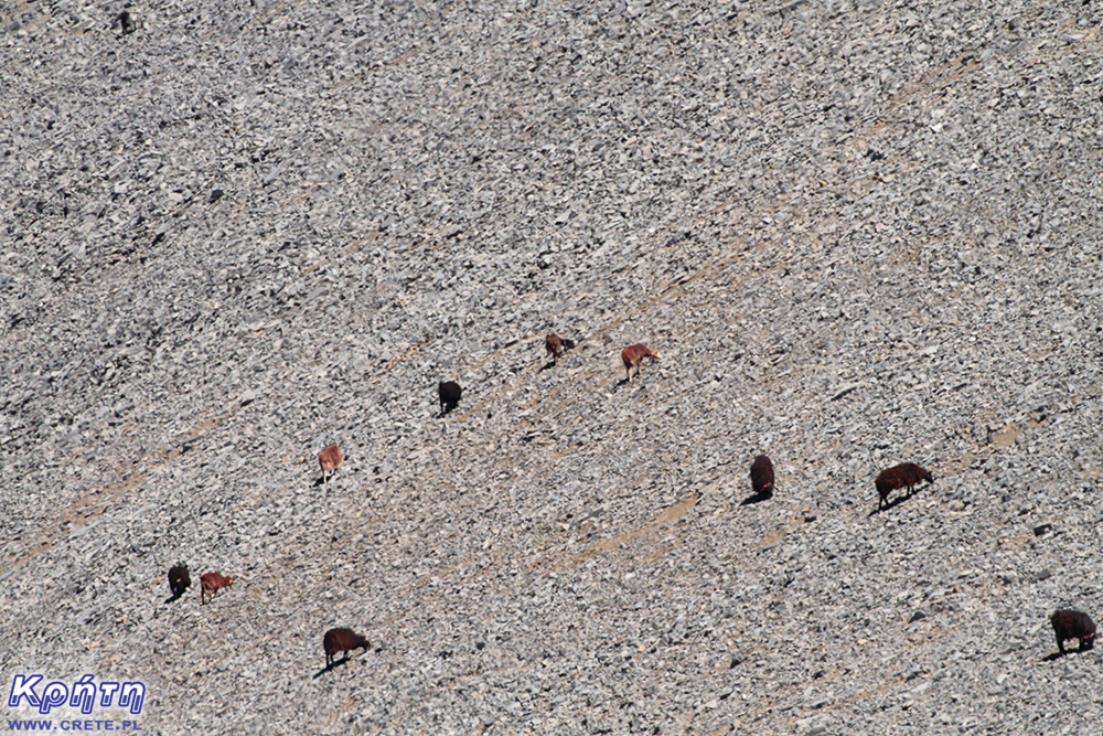
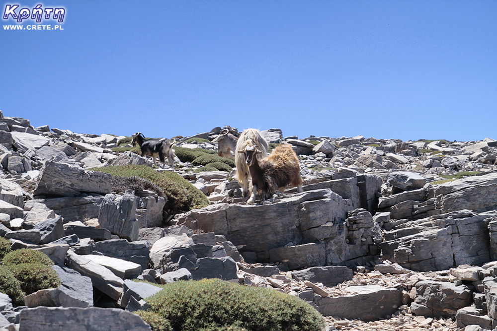
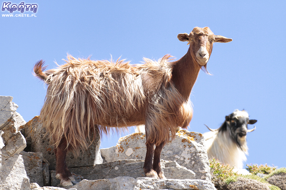
The region of the Psiloritis massif is a very secluded part of Crete. With a little bit of luck it can happen that you will not meet a single person here, and the only companions of your trip will be grazing goats and sheep. During the approach you can not count on the possibility of communication via a mobile phone (as of mid-2016). For this reason, we recommend that you inform the hotel employee about your plans before setting off to the Migerou Plateau, also providing an approximate time of return. In the event of any problems, this will facilitate the operation of the emergency services.
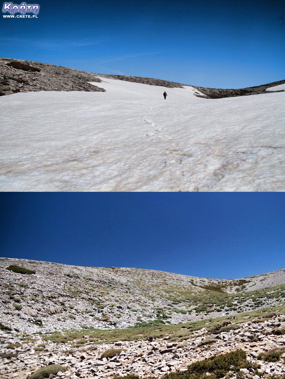
The same place in spring and summer
The two routes most popular among tourists planning trips to Psiloritis are those leading from Lakkos Migerou and from the Nida Plateau. The description below will apply to the first route, which in our opinion is definitely easier and requires less time to be spent. This description can be based on people who plan this trip during the late spring, autumn and summer. For tourists choosing here in winter and early spring, the description due to the snow cover may be of limited use or be completely useless. Remember that during this period, entering the Psiloritis outside of adapting your outfit to the temperature will be able to require additional mountain equipment.
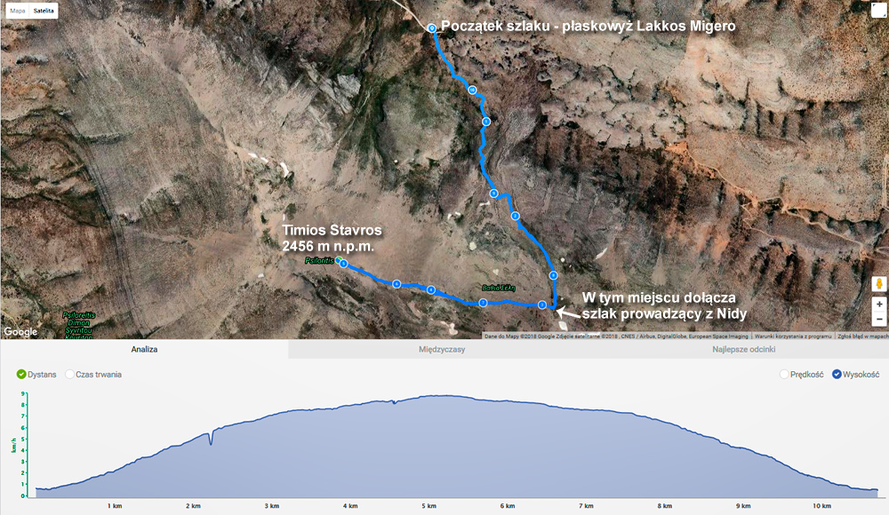
The course of the trail and its profile registered in Endomondo
Description of the route
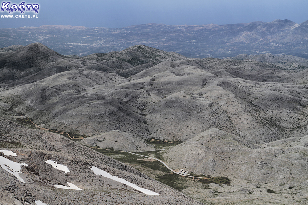
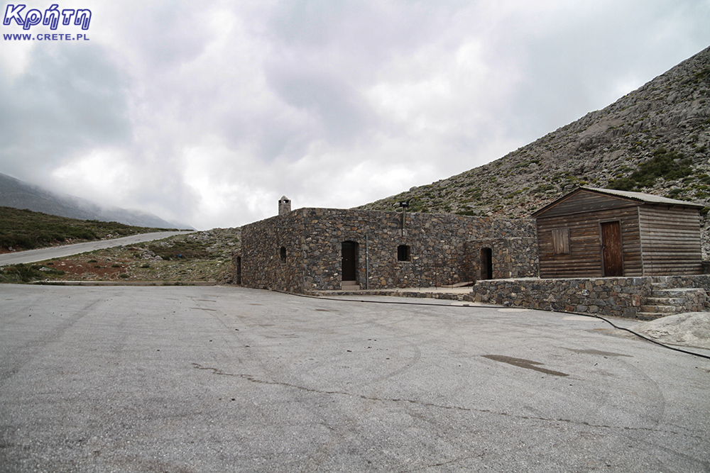
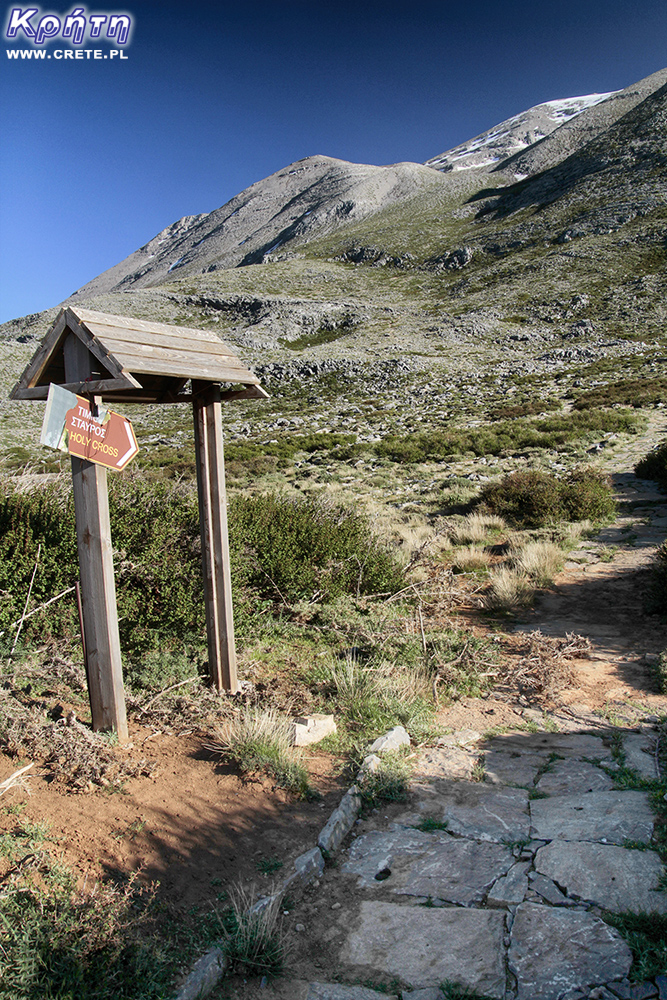
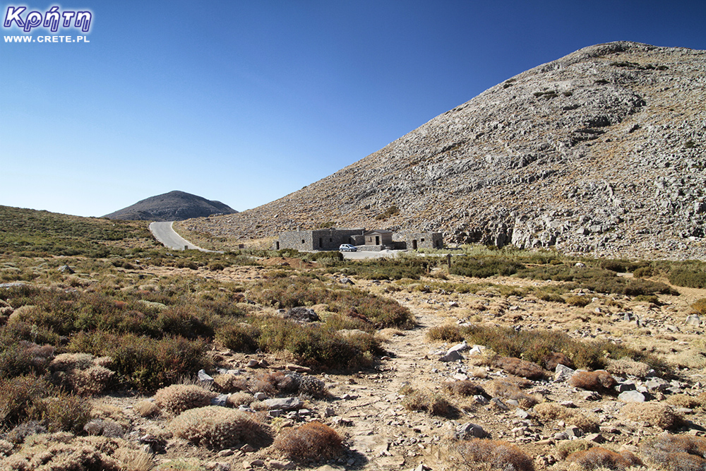
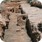
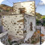
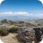
At the end of a winding road leading from the village of Livadia to Lakkos Migerou there is a car park and a small hostel consisting of three stone buildings. The facility, which is looked after by the Cultural Association of Livadia, you will find a toilet with running water, as well as a room with a small kitchenette, in which you can also arrange accommodation in the event of an emergency. However, if you plan to acquire Psiloritis in the summer, it is doubtful that you would need to use these additional "facilities". Do not expect to find here some great conditions or clean toilets. Remember, however, to respect this place and the effort put into its creation. Do not destroy anything or anythingif possible, do not leave rubbish.
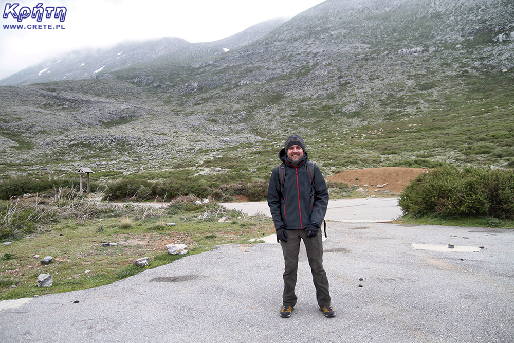
A shelter on the Lakkos Migerou Plateau
The total length of the route in both directions is about 10.5 kilometers, the transition time at a relatively quiet pace (without taking any breaks) fluctuates around 5 hours. The difference in height overcome during the climb is less than 900 meters.
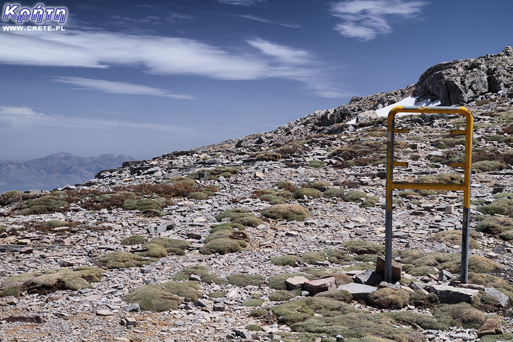
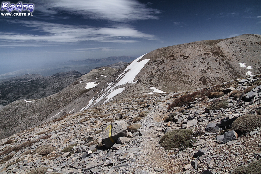
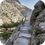
Practically for the most part of the route the trail is very visible. In spite of everything, in a few places you will come across signs that are made in various ways. The most official form of the designation is metal tubes, which on the top have attached the characteristic yellow and black badges defining the course of the E4 route.
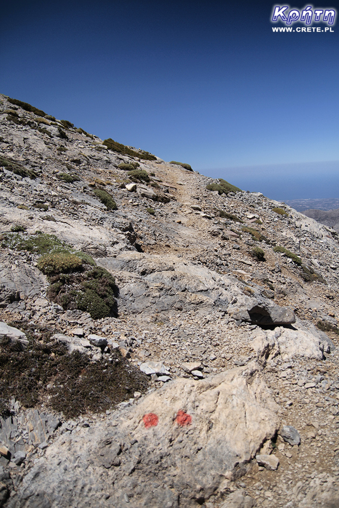
In some places the trail is also marked by arrows painted with red paint. In the upper part of the trail you can also come across a designation consisting of two red dots. Such signs are designated a parallel section of the route, which on the way back runs towards the Nida Plateau and the southern coast.
The beginning of the trail, located at an altitude of about 1550 m above sea level, is marked by an information board and a small signpost. From this place leads a relatively good path made of flat stone slabs. And although it is very comfortable, it is not worth getting used to it, because its quality deteriorates relatively quickly and the trail itself gets steeper.
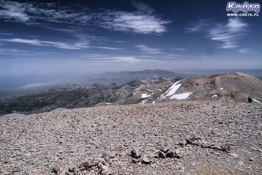
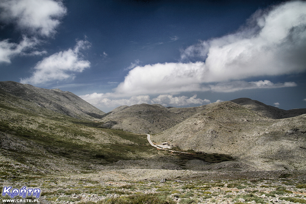
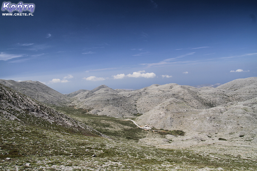
The shelter on the plateau will be visible through a very long part of the trail
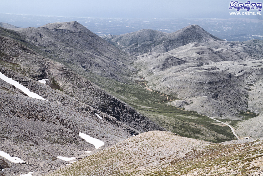
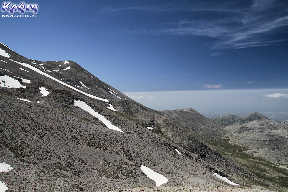
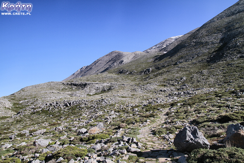
At this stage, the perception of the Psiloritis peak will still not be possible. Its top is on the right side of the trail and is covered by one of many surrounding hills. The path, which will become steeper, will lead you to the northern slope of Mount Aghatias.
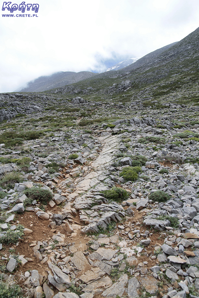
After passing about a kilometer at an altitude of 1750 m, you will come across the first flattening. This temporary rest after the first stage of the trail will make you all the more so that the next 750 meters of the trail is a relatively steep approach, over which you can overcome a height difference of about 250 m. By reaching this place you will be able to admire the beautiful panorama of the Migerou plateau and the surrounding hills , many of which will already be below your height.
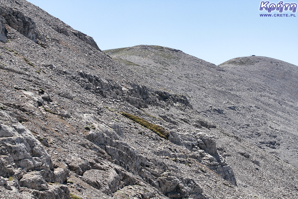
And again after a moment's rest your legs will have to face another steep approach. The nearest kilometer of the trail is in our opinion one of its more ungrateful stages. From here the trail is significantly deteriorated, stone slabs slowly disappear, giving way to loose stones and gravel.
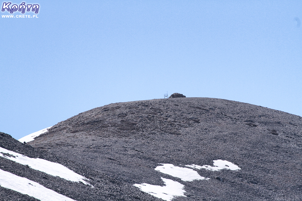
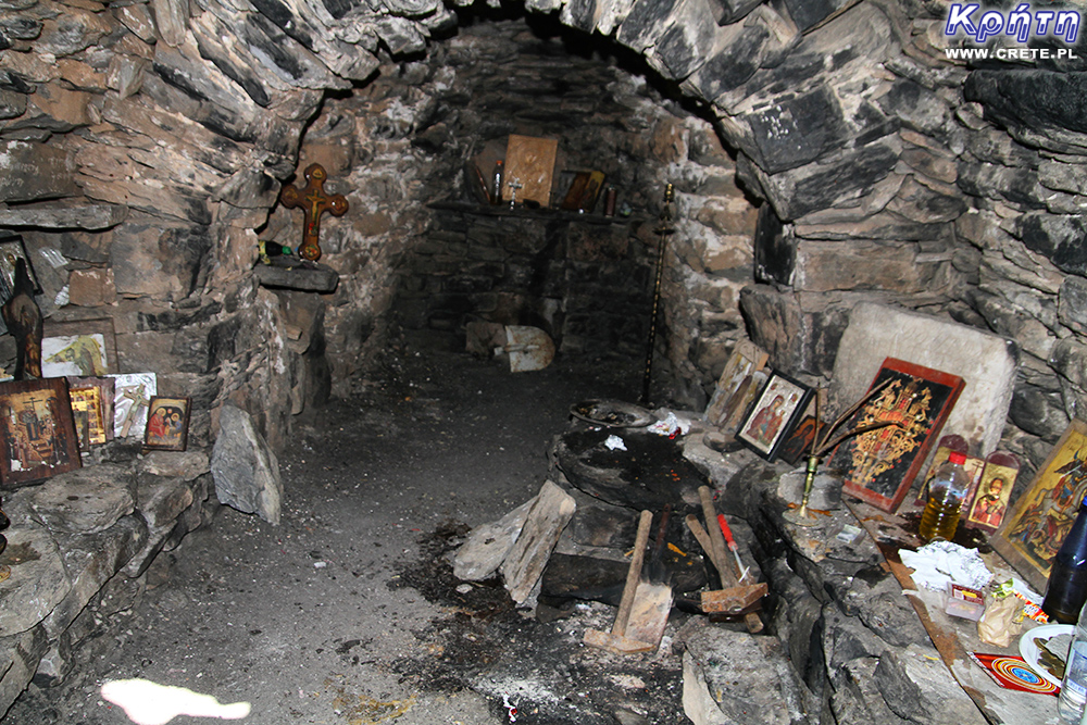
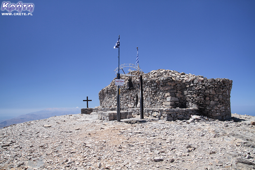
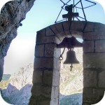
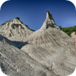
The characteristic chapel facilitates the identification of the highest peak of Crete
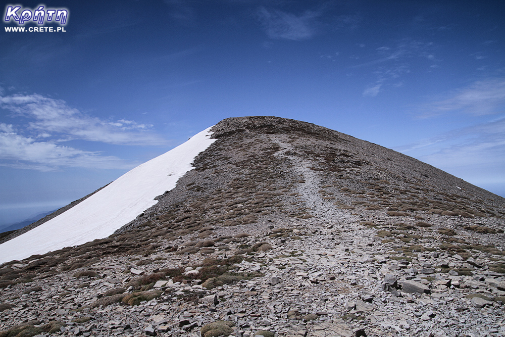
After passing 3.3 km you will reach a small saddle located at an altitude of about 2250 m. Its southern end is marked by a steep slope of the Aghatias mountain. In this place for the first time you will be able to spot the purpose of your trip, or the peak of Psiloritis. Looking west, you'll see the outline of a small stone chapel that marks the highest point of the mountain.
A bit above the saddle, the trail leading from Lakkos Migerou connects to the trail that can be reached on Psiloritis from the Nida Plateau. Coming from the saddle, we suggest heading a bit more to the southeast, where getting to join both routes is a bit milder and the ground is more stable. When entering the trail leading from Nida, turn right heading west.
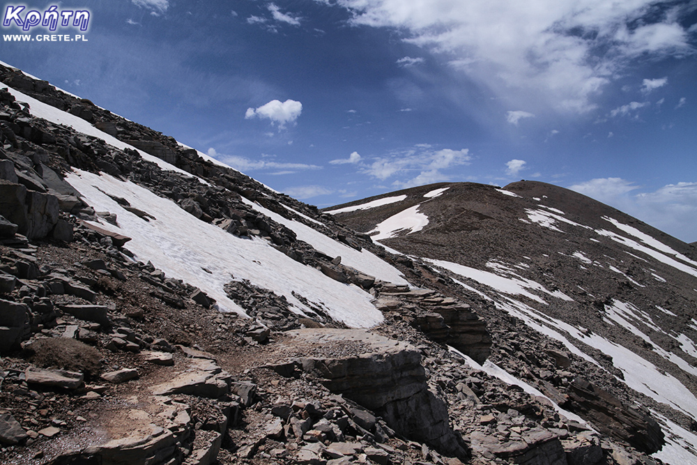
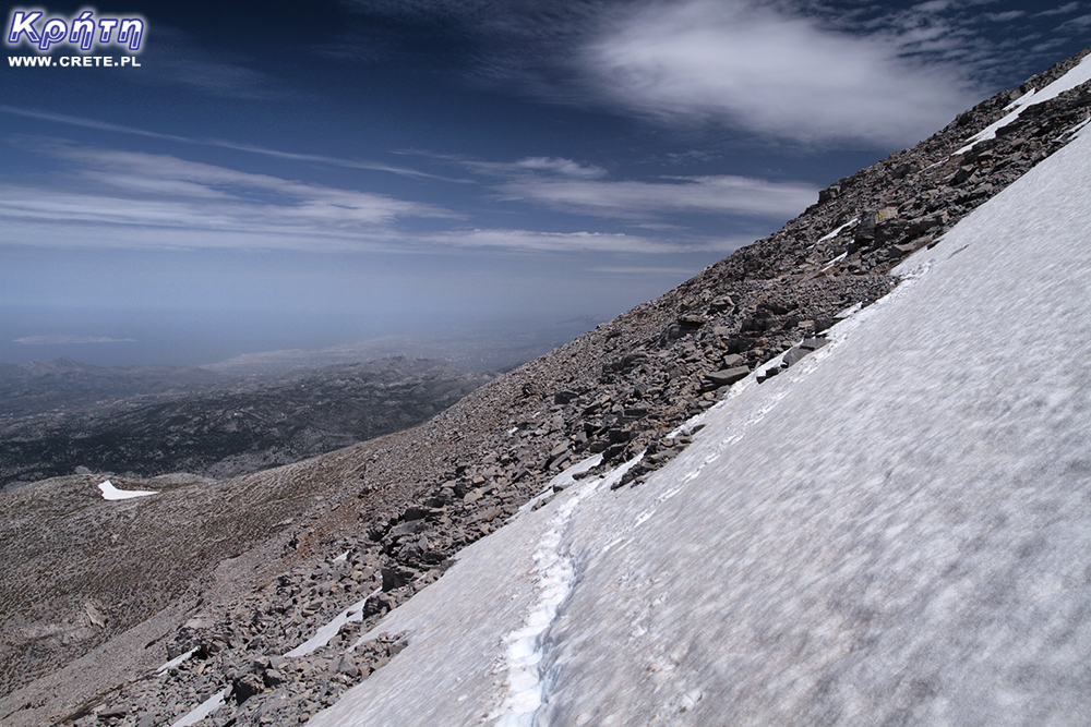
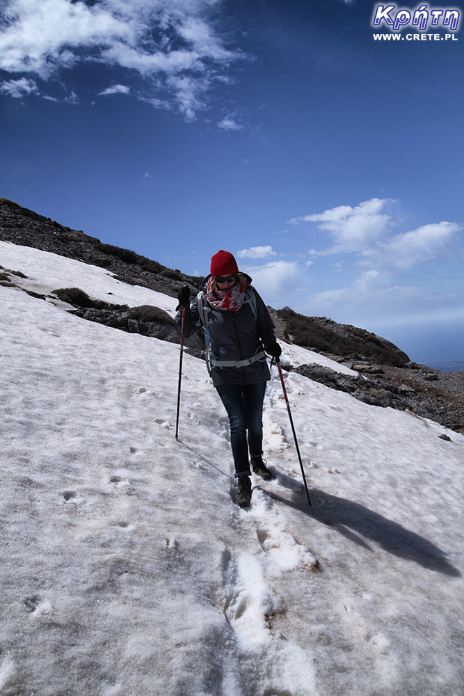
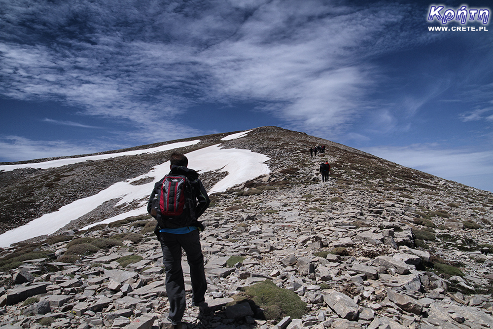
In front of you, the northern slope of the mountain Aghatias, which you will overcome by slowly rising traverse, should stretch out on your left. It is unquestionablenot one of the nicer episodes of this trekking. Remember, however, that although the clearly marked trail allows for a free march, you should be careful here. In several places the trail runs through a very steep slope consisting of rock rubble. Particular attention should be kept here if your trip falls on early spring. You can then come across snowy fields, whose outer surface is sometimes covered with a layer of ice. Entering them without the necessary additional equipment carries a lot of risk. In the summer, however, you will probably no longer see snow on Psiloritis (or maybe some small residue found in the hollows).
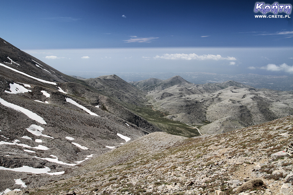
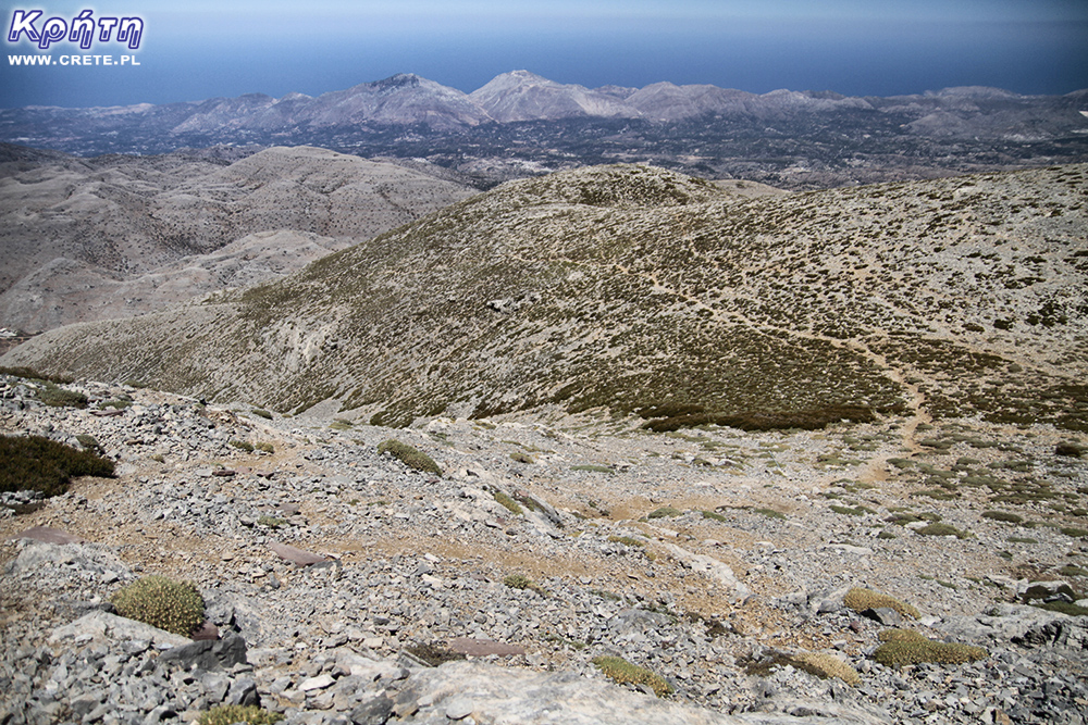
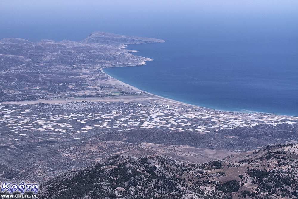
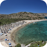
In the distance, visible rock in Matala and the beach between Tympaki, Kalamaki and Kommos
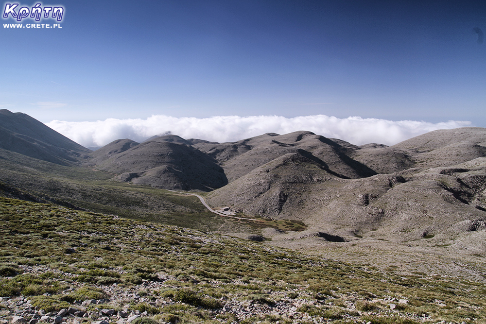
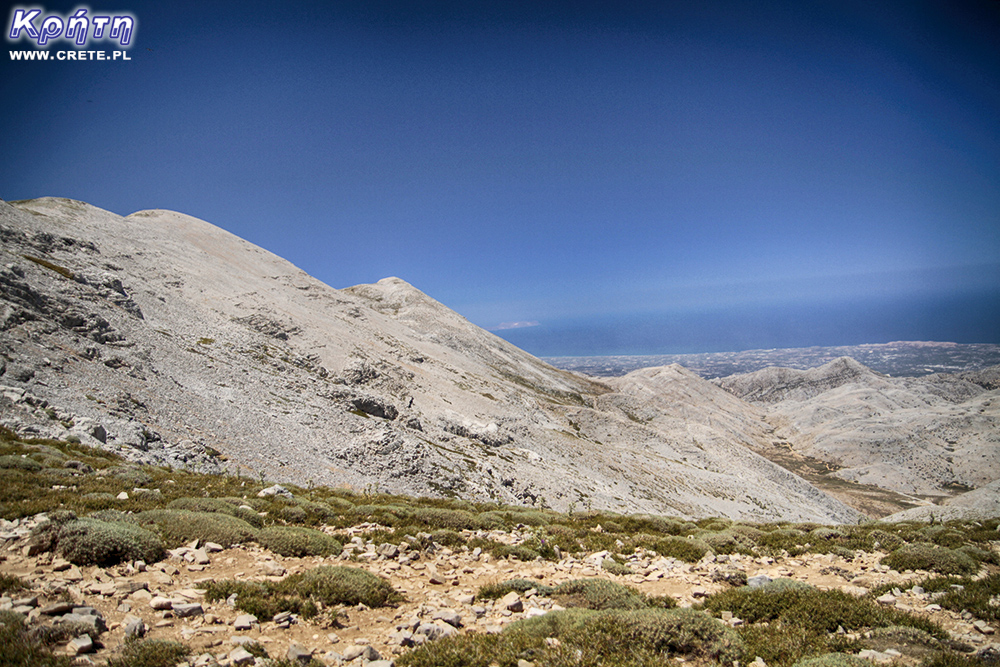
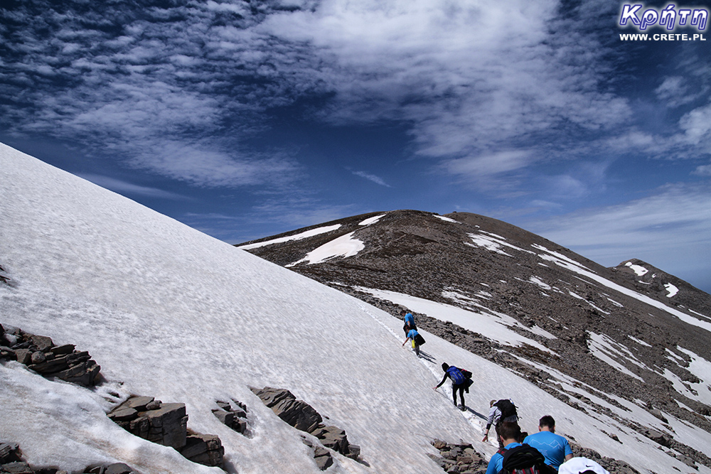
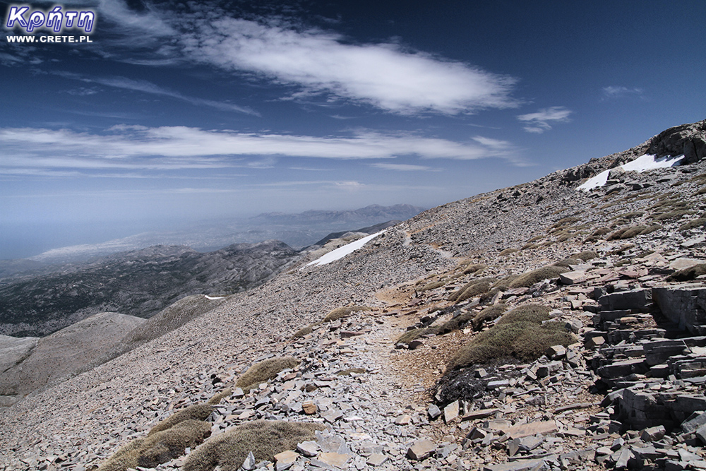
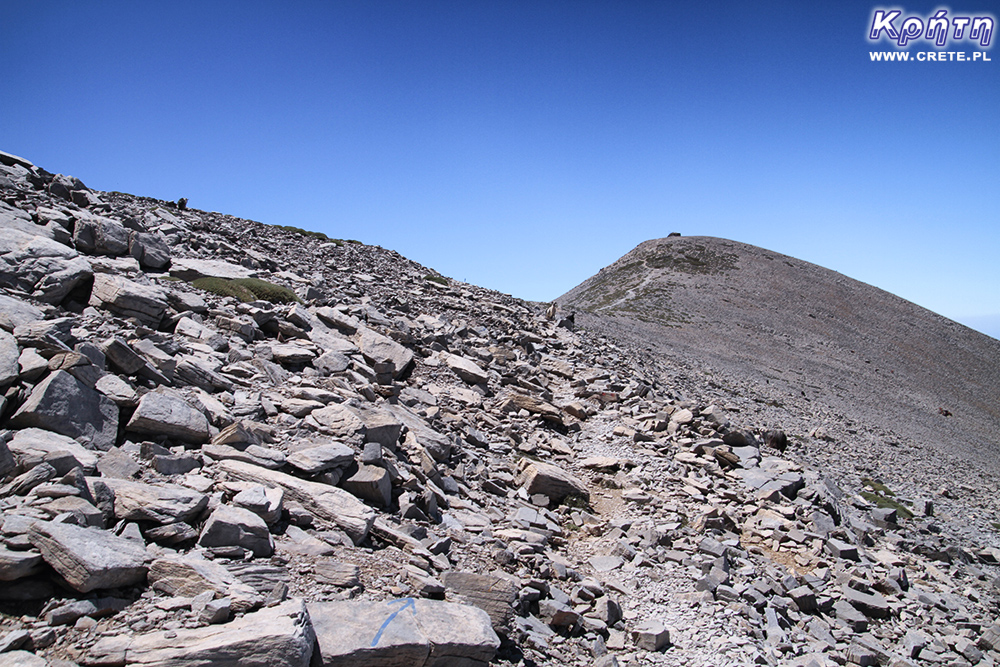
After passing the long traverse, you will reach the next saddle, which is located between the summit of the Aghatias hill and Psiloritis. In this place for the first time you will have the opportunity to enjoy the view of the south coast of Crete, which is located on the left side of the trail. Unfortunately, this view will not accompany you for a long time in your further journey. Leaving the saddle, the trail descends towards the northern traverse of the mountain slope and then splits into several paths. We recommend that you stick to the most comfortable of them. After defeating the next few hundred meters you will come to another flattening. In this place, the trail enters the intermediate peak of the slope. Before you again will be a panorama of the southern coast of Crete. The further part of the route is relatively steep and only just at the very top the slope slope is clearly relaxed.
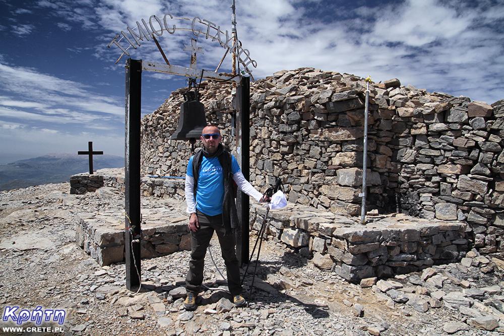
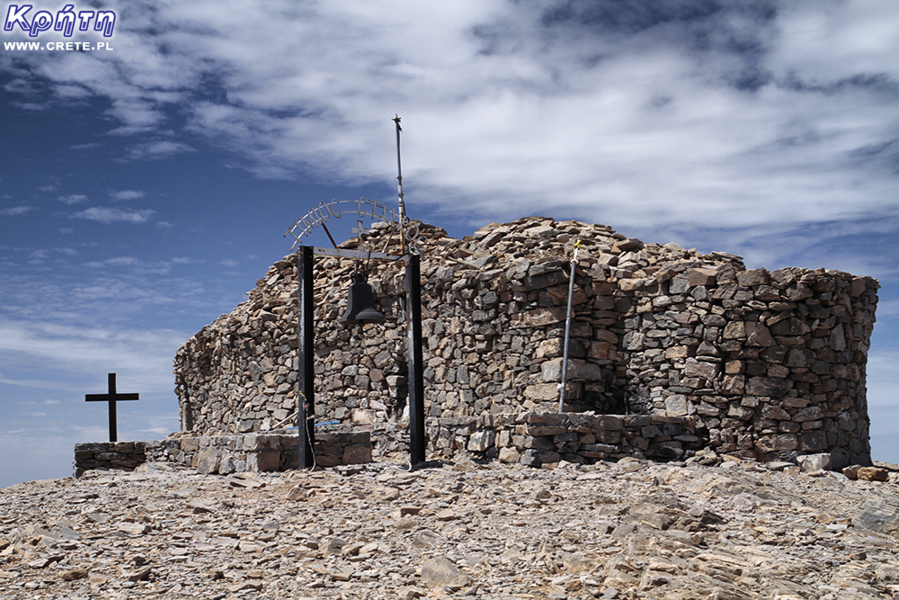
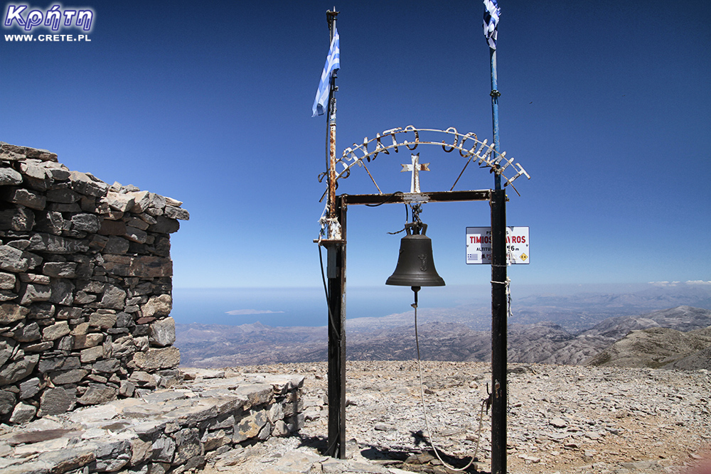
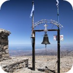
Defeating a bit over 5 km of a mountain trail you will stand on the highest mountain of Crete at an altitude of 2456 m above sea level. You can tell your success "to the whole world" (meaning, probably several nearby goats and sheep) by tapping the bell Timios Stavros :).
A distinctive chapel at the top
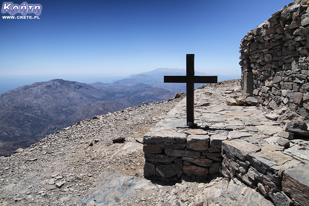
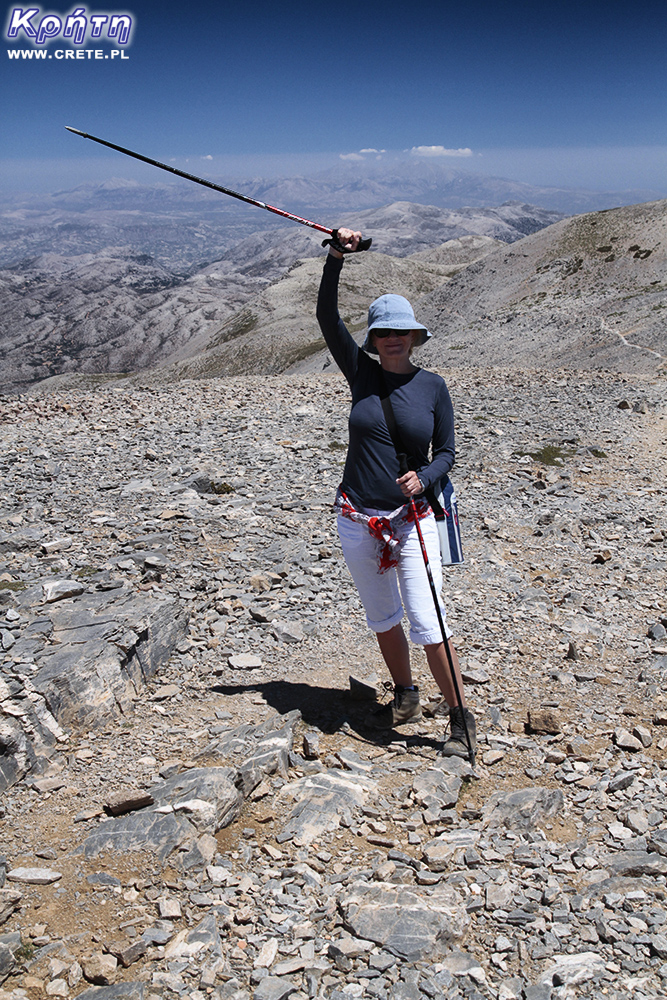
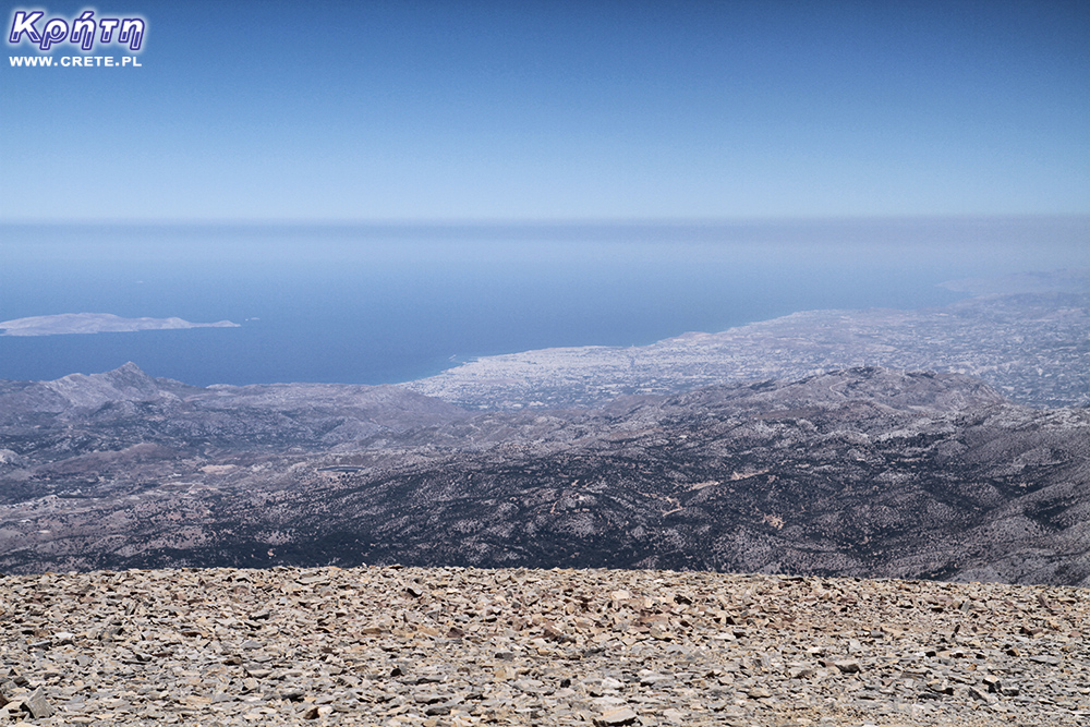
Being already at the top, it's worth taking a long rest. In good weather, you can admire a unique panorama here, which includes both the northern and southern coast. Looking to the northeast, you will be able to see the white buildings that make up Heraklion. From such a distant perspective it is easy to see how vast the city is. Looking west, you will have White Mountains in front of you (Lefka Ori). In the south you will see the vast fields of Messara, the Astrious mountains, and the coast around the town of Kalamaki, which is closed by the characteristic rocks of Matala. Your attention may also be caught by a small military airport located at the military base in Tympaki and a multitude of plastic tents.
The mountain range of Lefka Ori visible from the top
Going down and returning
The time devoted to descent can be even shorter by about ⅓ in relation to the approach. Remember, however, that it will depend on your pace as well as the condition of the trail. Before going down, it is worth improving the lacing of footwear so that the foot does not tend to slide on to the front of the shoe. In the lower parts, where the gravel path is intertwined with the remnants of the stone path, you have to watch out for loose rocks. Several times, especially during the summer trip to Psiloritis, we happened to unwind sluggishly on such loose small stones lying on larger slabs. Even if this is the case, trekking poles may be helpful when descending, which in emergency situations give additional support points.
After descending to the parking lot, remember to take a small regeneration break. The hostel in the small kitchenette has a sink with running water, which you can wash your hands and face. Although the road leading to Livadia is entirely covered with asphalt, driving along it requires attention. Remember also that due toFor a large number of sharp corners and steep descents, brake as often as possible. This is a simple technique of keeping the gearbox low (it can be even the first gear if necessary) so that the car with the gas running rolls off the hill with a constant speed. The main brakes are used only for braking. If you have never used this technique, it is worth to practice it on some safe elevation.
Is it worth it?
Entering Psiloritis at the peak of the holiday season is a relatively easy destination. Of course, you have to remember that the approach, even for reasons of the length of the trail and the difference in altitude, puts certain fitness requirements before the tourists. Sofa travelers and athletes should avoid this trail with a wide arch. However, if someone does not avoid physical activity and long walks, you can choose here. The more so because the entrance to Psiloritis is not very complicated in technical terms.
By entering this mountain you will be able to enjoy the unique landscapes of Crete. The vast panorama stretching from the top of the mountain allows you to view both the southern and the northern coast.
An additional advantage of this trip is that the summit of Psiloritis is still not very popular among tourists. Compared to attractions such as the Samaria Gorge, relatively few people find the time and willingness to enter this mountain. It is also worth noting that the route is respectful even to local Cretans. So, if you want to do something unique during your stay in Crete, then Psiloritis may be a good choice.
PS. If Crete, mountains and hiking are your passion, we encourage you to observe the profile of the kreta24.pl store, where cycles of group trips appear, which aim are interesting Cretan hiking trails.
west
central
east
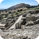
Interesting places on Crete
↤ click the appropriate part of the island to change the bottom map
W 2002 roku Falasarna zdobyła tytuł najlepszej plaży w Grecji. Wyróżnienie to nie jest bynajmniej przypadkowe, gdyż miejsce to jak na standardy Krety jest naprawdę unikalne.
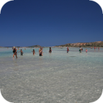
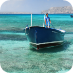
Elafonisi is a small island located at the end of the southwestern edge of Crete. A characteristic feature of Elafonisi is the shallow lagoon connecting it with Crete.
Elafonisi is a small island located at the end of the southwestern edge of Crete. A characteristic feature of Elafonisi is the shallow lagoon connecting it with Crete.
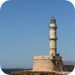
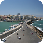
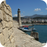
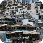
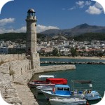
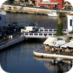
Chania (Χανιά) is the second largest (after Heraklion) city of Crete. The biggest advantage of Chania is the area of the Old Town and the beautiful Venetian Harbor.
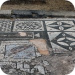
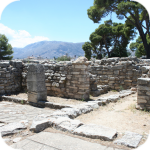
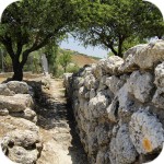
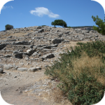
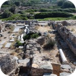
Aptera is a city whose history dates back to at least a thousand years before our era. In the peak period, about 20,000 lived in it. people, of which only 1/5 were free people.
Chania (Χανιά) is the second largest (after Heraklion) city of Crete. The biggest advantage of Chania is the area of the Old Town and the beautiful Venetian Harbor.
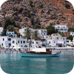
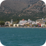
Omalos is a perfect starting point for exploring the Samaria Gorge. Located over 1,100 m above sea level extends over an area of 25 km2. Its size corresponds more or less to the size of the Lasithi Plateau.
Located 47 km from the city of Chania, it is the only freshwater lake in Crete. Its area is about 580 thousand. sqm. and the maximum depth is about 45 meters
Omalos is a perfect starting point for exploring the Samaria Gorge. Located over 1,100 m above sea level extends over an area of 25 km2. Its size corresponds more or less to the size of the Lasithi Plateau.
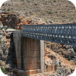
The steel crossing, which in the central part is separated from the ground by nearly 150 m, is at the leading position of the places where the longest bungee jumps are made.
Chania (Χανιά) is the second largest (after Heraklion) city of Crete. The biggest advantage of Chania is the area of the Old Town and the beautiful Venetian Harbor.
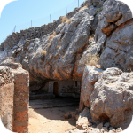
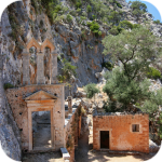
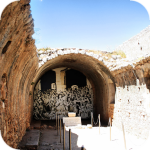
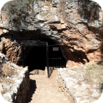
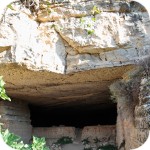
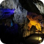
The cave is less than 1 km from Moni Gouvernetou Monastery. You will reach it using the pedestrian trail that has been marked out along the slope of the Avlaki Gorge.
Balos is one of Crete's flagship beaches if not all of Greece. We can assure you that the landscapes you see during your trip to Balos will remain with you for a very long time.
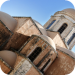
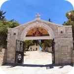
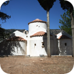
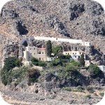
The Orthodox monastery of Agia Triada, located on the northern part of the Akrotiri peninsula, is one of the most beautiful and richest monasteries in Crete.
The Orthodox monastery of Agia Triada, located on the northern part of the Akrotiri peninsula, is one of the most beautiful and richest monasteries in Crete.
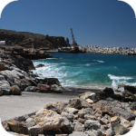
On the north-western coast of Crete, at the foot of the Gramovous peninsula, there are ruins of the ancient port of Korikos, later known as Falassarna.
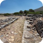
Polyrinia was one of the most important city-states of western Crete during the Hellenistic and Roman periods. It was built amphitheater on a steep hill, rising to a height of 481 meters above sea level
The island of Gramvousa, or in fact Imeri Gramvousa (Ήμερη Γραμβούσα), is an inseparable point of a trip that combines a stay in the Balos Lagoon with visiting the remains of a fortress located on the top of the island of Imeri Gramovousa.
There is a beach in Crete that literally makes some people shiver. This place is Seitan Limania which can be translated as Satan's Ports or Cursed Ports.
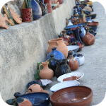
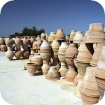
Dozens of craft workshops located in this small mountain village make Margarites one of the four main centers where traditional Cretan ceramics are made.
The date of the foundation of Moni Arkadiou (Arkadi) is not exactly known. According to tradition, the name of this church refers to the name of the Emperor Arkadiusz, who supposedly was to be its founder.
The date of the foundation of Moni Arkadiou (Arkadi) is not exactly known. According to tradition, the name of this church refers to the name of the Emperor Arkadiusz, who supposedly was to be its founder.
Rethymnon with around 40,000 inhabitants are the third largest city of Crete. This place was populated already in the Minoan period. Historically, the city was an important commercial center.
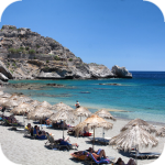
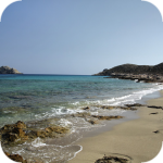
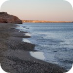
Skinaria is a small beach located along a small bay, whose outlet on both sides ends with a rocky coast. It is still a little-known place overlooked by mass tourism
Skinaria is a small beach located along a small bay, whose outlet on both sides ends with a rocky coast. It is still a little-known place overlooked by mass tourism
According to Greek mythology, Zeus hid (and perhaps even gave birth) in the Ida cave. This myth is the greatest asset of this cave, which is not as interesting and beautiful as the Dikte cave.
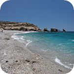
Tripiti is a small beach covered with a mixture of gray sand, gravel and stones. Despite the fact that the beach is unorganized and has a semi-natural appearance, one small tavern works here.
Tripiti is a small beach covered with a mixture of gray sand, gravel and stones. Despite the fact that the beach is unorganized and has a semi-natural appearance, one small tavern works here.
Tripiti is a small beach covered with a mixture of gray sand, gravel and stones. Despite the fact that the beach is unorganized and has a semi-natural appearance, one small tavern works here.
Plakias is a perfect place for people who like to spend time hiking. In the area of the town and the surrounding area, there are several hiking trails that lead to interesting beaches.
Currently, the lower monastery is still not open to the public and is not used by the monks. The buildings of the upper monastery have undergone partial renovation and are the main seat of the Preveli monastery.
Currently, the lower monastery is still not open to the public and is not used by the monks. The buildings of the upper monastery have undergone partial renovation and are the main seat of the Preveli monastery.
Currently, the lower monastery is still not open to the public and is not used by the monks. The buildings of the upper monastery have undergone partial renovation and are the main seat of the Preveli monastery.
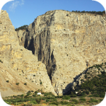
The Kourtaliotiko Gorge, also known as the Asomatos Gorge, is perhaps one of the most spectacular natural attractions available in the central part of Crete.
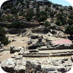
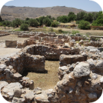
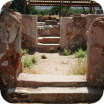
Agia Triada is a small Minoan archaeological site in the south of Crete, located near Timpaki, located on the western slope of the hill about 40 meters above sea level.
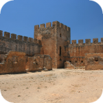
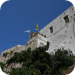
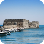
This fortress is a perfect example of Crete's multiculturalism. Located today in Greek hands, it was built by the Venetians, but is called a name taken from the Turkish language.
Rouvas Gorge is one of the most interesting places in this part of Crete. The interesting trail leads in a perfect way to the changing appearance of this gorge.
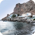
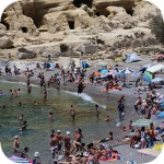
Matala is one of the most popular towns not only of the southern coast but also of the whole of Crete. In the 1960s and 1970s, this small fishing village was a mecca for hippies.
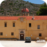
The Odigitrias Monastery is one of the most famous monasteries of southern Crete. Unfortunately, in terms of popularity, he is far from other Cretan monasteries.
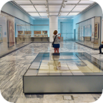
In addition to the famous grand palaces on the island in the Minoan period, a number of smaller residences were created. One of the most important examples is the Vathipetro discovered about 5 km north of Archanes, on the southeastern slope of Mount Juchtas in the central part of Crete.
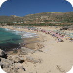
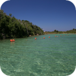
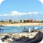
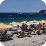
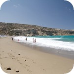
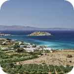
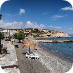
When traveling around Crete, it is not difficult to pay attention to the fact that most of the beaches there are relatively small and short. For this reason, people who are used to our national Baltic standards, where the sandy coast stretches for kilometers, may experience a special disappointment. However, fortunately, nothing is lost, because Crete in its rich arsenal of various beaches can boast of those that allow for long walks along the coast. One of them, our favorite is the Kommos beach located in the south of the central part of the island.
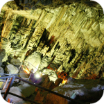
Although there are countless caves in Crete, only a few can be visited. Sfendoni is the largest cave open to the public. content comes from: http://www.crete.pl www.CRETE.pl
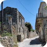
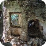
Only a few kilometers separate the bustling city of Rethymno from Mili, a village abandoned by its inhabitants. This place is also known as the village hidden in the gorge.
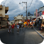
Information about one of the more known tourist cities of Crete, or about Malia. Description of attractions located in the city of Malia and a description of the specificity of this town.
The Lasithi Plateau is located about 70 kilometers from the capital of Crete - Heraklion. The average height at which the terrain of this plateau is located is 840 m above sea level.
One of the tourist attractions eagerly visited by people spending their holidays in Crete is the Dikte (Psychro) cave. The main factors that attract people to this cave are a rich and varied dripstone robe and a close connection with mythology.
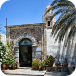
Among the olive groves in the place called Logari, which is less than a kilometer from the village of Kritsa, there is a small Byzantine church of Panagia Kera from the 13th-14th centuries.
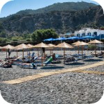
Stalida is located directly along the coast and is one of the most famous tourist destinations in Crete, which definitely comes alive with the advent of the tourist season
Most people crossing the route between Agios Nikolaos and Ierapetra will definitely notice the large crack which is marked by the mountain located east of this road. This majestic geological creation called Ha was probably created as a result of an earthquake.
Xerokambos is a small settlement in which you will find literally several taverns, and most of the buildings are single-storey and one-story houses. The big advantage of this beach is a gentle sandy descent to the sea.
Agios Nikolaos (Άγιος Νικόλαος) is a small town with less than 20,000 inhabitants. permanent residents (according to statistical data from 2001). This city is the capital of the Lasithi nomos.
Although Elounda seems to be a sleepy fishing town to this day, however, appearances should not fool you, because this town and its surroundings can boast of probably the largest number of the best hotels.
Although Elounda seems to be a sleepy fishing town to this day, however, appearances should not fool you, because this town and its surroundings can boast of probably the largest number of the best hotels.
Stalida is located directly along the coast and is one of the most famous tourist destinations in Crete, which definitely comes alive with the advent of the tourist season
Zakros is the fourth-largest Minoan palace in Crete in importance and size. This latest found, built on the east coast of the island is located in the village of Káto Zákros.
Zakros is the fourth-largest Minoan palace in Crete in importance and size. This latest found, built on the east coast of the island is located in the village of Káto Zákros.
The first palace was built around 1900 BC. in the place where there was a quite impressive settlement whose remains were later transformed into the central part of the city.
The ruins of the ancient city of Itanos are located at the eastern tip of Crete, less than 3 kilometers north of the famous palm beach of Vai. Although there are also nice beaches at Itanos, unlike its well-known neighbor, this place does not attract crowds. There are either accidental stray tourists or excavation enthusiasts here.
Less than 10,000 population of Sitia makes the city the smallest in Crete. Some even go a step further and say perversely that it is rather the largest village of Crete.
Napoleon's house is one of the few typically tourist attractions in Ierapetra. About what could have happened here in the summer of 1798 and possibly how much in this legend is the truth we write in the article on the page below.
Moni Kapsa Monastery is one of the most interesting monasteries in Crete. Its massive buildings were erected on rocky, gray slopes surrounding the nearby Pervolakia Gorge.
Super poradnik, warto przeczytać i odpowiednio się przygotować byłem we wrześniu temperatury ok 30° 2l wody i było mało
1
CRETE - Kreta
2018-02-26 07:43:19
komentarz z
Od której strony szedłeś? Z Nidy?
1
Krzysztof Rodak
2018-02-27 21:50:39
komentarz z
Kurcze szukałem na mapach googla ale znaleźć nie mogę ale pamiętam że jak wróciliśmy do auta to wypiłem piwko w restauracji zaraz przy początku szlaku
CRETE - Kreta
2018-02-28 07:28:34
komentarz z
To pewnie Nida. Przy Lakkos Migerou nie ma żadnej tawerny. Na Nidzie jest to taki niedokończony ośrodek turystyczny.
gość PiotrWie
2018-02-26 19:14:53
Ja chciałbym dodać, że czas przejścia 5 godzin w obie strony jest dość optymistyczny - na mapie Anavasi jest 3 h w górę i 2,5 w dół - i jest to czas samego przejścia, nie uwzględniający odpoczynków czy robienia zdjęć. W praktyce wychodzi przynajmniej 6 godzin. Jeśli chcemy iść spokojnie i móc posiedzieć na górze z godzinę to trzeba wyjść najpóźniej przed 10:00, a bezpieczniej wcześniej. Dojazd z Rethymnonu to co najmniej 1,5 godziny - tak więc mieszkając gdzieś dalej warto jednak rozpatrzyć wariant z przyjazdem wieczorem, noclegiem w schronisku i wyjściem rano. Wariant z wyjściem z płaskowyżu Nida - tym bardziej ( tam jest 4 godziny w górę i 3 w dół.) Od południa wychodząc z Fourfuras jest ok 8 godzin, od schroniska - połowę tego ( ale by tam dojechać trzeba dysponować samochodem w dużym prześwitem - czyli przynajmniej Suzuki Jimny). Oczywiście wiele zależy od indywidualnych umiejętności - my pierwszy raz schodząc z góry do Lakkos Mygreou spotkaliśmy dwie dziewczyny ruszające do góry - była godzina 17, myśleliśmy że chcą zobaczyć początek szlaku i podejść na drugi dzień - tymczasem ok 20 zbiegły z góry i zaczęły się nas dopytywać na jakim poziome jest parking - bo wiedzą ile jest na szczycie ale nie wiedzą ile podeszły. Jak sie ich spytaliśmy czy był widok z góry powiedziały że nie wiedzą bo nie miały czasu, a pytane o kaplicę zrobiły wielkie oczy - to tam coś było? Tak więc osobiście nie polecam biegania "by zaliczyć" - o wiele lepiej jest po grecku - siga, siga.
Piotrek | www.crete.pl
2018-02-26 19:43:21
Czas
Jest dokładnie tak jak napisałeś w komentarzu. Podany w opisie czas 5 godzin uwzględnia samo przejście szlaku. Do tego trzeba doliczyć jeszcze trwanie dłuższych przerw no i oczywiście wypoczynek/podziwianie widoków na szczycie. Sama ostatnia czynność może zająć dobrych kilkadziesiąt minut. Tym bardziej, że przy sprzyjającej pogodzie rozległość panoramy może być oszałamiająca.
Dojazd na początek szlaku to zupełnie inna para kaloszy, którą prawdopodobnie opiszę oddzielnie. Faktycznie na Lakkos Migerou warto być zdecydowanie jak najwcześniej. Drogę łączącą to miejsce z cywilizacją, czyli wioską Liviadia, ciężko nazwać autostradą. Jest stroma i dodatkowo często pokryta skalnym rumoszem. Zdecydowanie nie polecam jazdy na tym odcinku po zmroku.
No i na koniec. Ten szlak, podobnie jak większość szlaków na Krecie, to miejsca które trzeba poczuć. Spiesząc się tak jak opisana przez Ciebie dwójka dziewczyn traci się dużą część z atutów tego typu wycieczek. Umykają krajobrazy, detale ukryta na szlaku. A jak widać w Twoim komentarzu umknąć może nawet sam cel wycieczki, czyli szczyt. Ech ... i gdzie ci ludzie tak się śpieszą?
gość PiotrWie
2018-02-26 20:54:38
A dla tych, którzy chcą poczuć atmosferę tego pasma " całościowo" polecam wersję hard - wyjście z Furfuras, nocleg na szczycie i zejście na Nidę - ale trzeba mieć ze sobą lepszy śpiwór - my spaliśmy w naszych standardowych 650-gramkach które sprawdzają się super na Krecie tak do 1500 - 1600 metrów wysokości i zmarzliśmy jak nieszczęście - ale i tak było warto.
Gosia | crete.pl
2018-02-26 21:44:29
Może nie były na Timios Stavros tylko na sąsiednim szczycie?
gość PiotrWie
2018-02-27 10:02:32
Były na Timios Stavros - z rozmowy wynikało że "odbiły się" od dzwonnicy z flagami i zbiegły w dół bez rozglądania się na górze. Może po prostu trenowały do jakiegoś biegu rzeźnika i było im obojętne gdzie są - ważniejsze ile przebiegły i w jakim czasie.
gość woolas
2018-06-11 15:19:15
z Heraklionu...
Kochani, jak w temacie jak najlepiej i najszybciej dotrzeć pod szlak właśnie z Heraklionu? Na GoogleMaps ciężko się rozeznać w temacie postanowiłem skorzystać z Waszego doświadczenia...Dodam, że chciałbym wynająć auto bo autobusami to raczej odpada...pozdrawiam ;)
Piotrek | www.crete.pl
2018-06-11 15:29:37
Prosta droga
Generalnie z Heraklionu prosta droga. Oczywiście jak na standardy Krety ;). O dojeździe autobusem jak najbardziej zapomnij. Natomiast samochodem musisz kierować się na drogę łączącą następujące miejscowości Tylissos > Gonies > Anogia > Zoniana > Livadia > Płaskowyż Lakkos Migerou. Odległość z Heraklionu to około 60km, ale myślę, że trzeba liczyć przynajmniej 1,5-2 godziny jazdy po górskich drogach. Poniżej podsyłam Ci link do mapki, myślę, że to powinno Ci ułatwić orientację: https://www.google.pl/maps/
gość PiotrWie
2018-06-11 20:57:59
Wpisuję to tu bo nie bardzo wiem gdzie - jak macie lepszą koncepcję to przenieście. W tym roku w końcu udało nam się wejść na Pachnes - było to kolejne podejście bo chcieliśmy wejść " elegancko" - z dojściem z pewnej odległości - szliśmy trzy i pól dnia. Ale nie o tym chcę pisać - chcę opisać jak po prostu wejść na Pachnes - bo z zachodniej Krety Psiloritis jest daleko - a Pachnes jest tylko 6 metrów niższy. Jeśli chce podejść grupa do 4 osób to najbardziej rozsądne jest wynajęcie na 1 dzień Suzuki Jimny dojazd do Anopoli skąd ok godziny drogą polną w kierunku góry - ale miejscami z takimi kamieniami że podjazd np Pandą jest niemożliwy - do parkingu na końcu drogi - jest to prawie na 1900 m.npm. Stąd wyruszamy pieszo - niesałą godzinę do Rousiess, skąd do 1,5 godziny na szczyt. Szlak względnie łatwy, obecnie jak na warunki kreteńskie wyjątkowo dobrze oznakowany. Powrót - ok 2 godz. W sumie - mniej niż z Lakkos Mygreou na Psiloritis.
Przy wiekszej grupie - tak do 8 osób - można rozważyć transport z Anopoli na parking pick -upem który oferuje tawerna w Anopoli - koszt usługi polegającej na wywiezieniu rano i zwiezieniu wieczorem to 140 euro niezależnie od ilości osób, godziny wyjazdu i powrotu do uzgodnienia. Gdyby ktoś był zainteresowany - mam wizytówkę z telefonem tawerny.
gość woolas
2018-06-12 09:51:56
Dzięki Piotrek!
Super, serdeczne dzięki za informację na pewno się przyda, sprawdzimy czy ta góra może konkurować na atrakcyjność z którąś z naszych (i nie tylko naszych) w Tatrach ;)
Piotrek | www.crete.pl
2018-06-12 12:44:11
Pachnes
Piotr dzięki za cenne informacje na temat Pachnes. Myślę, że na razie Twój wpis zostawimy w tym miejscu. W miarę możliwości ewentualnie prosilibyśmy Ciebie tylko o podesłanie (może na maila [email protected]) skanu lub zdjęcia wizytówki tawerny z Anopoli oferującej dojazd do tego parkingu. Jeśli w przyszłości będziemy w rejonie Chora Sfakion to na pewno pomyślimy o tym, aby wejść na szczyt Pachnes. Nie jesteśmy jakimiś szczególnymi górskimi łazikami, ale z Twojego opisu wynika, że ta góra jest w naszym zasięgu :).
gość PiotrWie
2018-06-13 11:27:22
Ocenianie atrakcyjności gór Krety na podstawie wejścia na Psiloritis z Lakkos Mygreou to trochę tak jakbyś atrakcyjność Tatr oceniał na podstawie wycieczki na Giewont z Zakopanego. Żeby ocenić ich atrakcyjność trzeba pokusić się o jakieś dłuższe przejście - jak Psiloritis to z Fourfouras przez szczyt na Nidę i dalej do Zaros - w wersji szybkiej 2,5 dnia, my siga,siga szliśmy cztery i pół. Góry przede wszystkim są puste, surowe, z dużymi różnicami wysokości - Pachnes jest 7 km od brzegu morza, to prawie jakby Rysy były w Gdańsku - my podczas tegorocznego przejścia przez Góry Białe w pierwszym dniu spotkaliśmy jednego człowieka, w drugim nikogo, w trzecim grupkę trzech austryjaków a w czwartym byliśmy w bardzo uczęszczanej okolicy - spotkaliśmy tak ze 30 osób.
Piotrek | www.crete.pl
2018-06-13 15:31:24
Ja tam nie wiem, nie znam się ;)
Fakt ta pustka w górach Krety daje naprawdę niesamowite wrażenie. Tak jak pisałeś ilość ludzi spotykanych na szlaku bywa znikoma. W czasie naszego ostatniego letniego wejścia na Psiloritis nie spotkaliśmy tu nikogo. Pokonując trawers Agathiasa na przedłużeniu szlaku w kierunku Nidy z daleka majaczyła nam postać pasterza. A przecież szlak na Psiloritis nie jest wcale tak mało popularny. Oczywiście można trafić na taki dzień, że będzie tu sporo osób, ale jest to raczej wyjątek a nie reguła. Chociaż kto wie, może po publikacji naszego "poradnika" więcej osób zdecyduje się na to aby wejść na Psiloritis. Tym bardziej, że nie jest to wejście wymagające jakichkolwiek technik wspinaczkowych.
Ogólnie ta pustka w górach na Krecie jest o tyle fajna, że jest wielowymiarowa. Poza niezliczoną ilością kamieni tworzących gołoborza jest niewiele innych bodźców które mogą zwrócić uwagę. Cisza i spokój powoduje, że można wyłapać takie smaczki jak świst powietrza przecinanego przez skrzydła jaskółek latających wokół góry. Cień drapieżnych ptaków przemykających bezszelestnie ponad naszymi głowami. Ogólnie jeśli ktoś już wejdzie na szczyt to polecam spędzić tam dłuższą chwilę. Panorama rozciągająca się z tego miejsca jest niesamowita. Widać stąd spory kawałek wyspy.
Co do samej oceny gór to osobiście nawet się na to nie silę. Tym bardziej nie chcę ich porównywać do polskich gór z którymi miałem zdecydowanie za mały kontakt. Trzeba znać swoje miejsce w szeregu ;). Mam nadzieję, że woolas będzie zadowolony z kontaktu z tą kreteńska innością.
Piotrek | www.crete.pl
2018-06-15 09:40:16
Dojazd do Pachnes
Tawerna o której wspominał Piotwie oferująca dojazd do górskiego Parkingu na Pachnes to: http://www.anopolirooms.gr/en/. Z tego co wypatrzyliśmy na tej stronie to właściciele oferują również możliwość wykupienia noclegu (30€ za pokój dwuosobowy). Miejsce wygląda całkiem sympatycznie więc na pewno warto je zapamiętać.
gość Piotr
2018-08-28 05:20:30
Psiloritis z dziećmi
Miałem zamiar wejść na Psilortsis z dziećmi. Żona jednak się wystraszyla że nie dadzą rady więc pojechałem sam. Moim zdaniem Psilortsis to łatwa góra na którą jest w stanie wejść sześciolatka. Przewyzszenie jest zblizone do Babiej Góry ale szlak na Psilortsis jest dużo krótszy i zdecydowanie łatwiejszy. Ale po kolei.
1. Droga. Na zakręcie w Livadii obok pomnika zjechać trzeba z głównej drogi która asfaltem prowadzi do schroniska na płaskowyżu Lakkos Migerou (jadąc z Retimo będzie na wprost przy pomniku. Asfalt równy, droga kręta ale każde auto da sobie radę. Z Livadii ok. 25 minut.
2. Temperatura. 25 sierpnia 2018. Livadia 30stopni, płaskowyż Lakkos Migerou 21 stopni, szczyt ok. 15 stopni. Ja tak miałem ale myślę, że inni podobnie, czyli spadek o ok. 15 stopni.
3. Szlak. Bardzo dobry stan, do przełęczy na której łączy się ze szlakiem idącym z Nidy raczej słabo oznaczony ale wierzcie, że nie ma takiej potrzeby gdyż ścieżka jest ułożona z kamieni tworzących coś na wzór schodów. Od przełęczy oznaczony rewelacyjnie, czasem znaki (dwie czerwone kropki) co 10 metrów. Góra widoczna przez dużą część drogi dzięki kapliczce.
4. Czas przejścia. Ja bez dzieci obróciłem w równe pięć godzin, z tego godzina siedzenia na szczycie, kilka pieciominutowych odpoczynków po drodze i masa robionych zdjęć. Realnie oceniam drogę dla mnie na max 3.5h czystego marszu dla osoby dorosłej. Wierzycie mi że nie chodzę po górach na co dzień, nie uprawiam żadnego sportu, a nawet mam mało ruchu. Po prostu jestem tylko zacięty by iść. Z dziećmi które lubią odpoczywać często wycieczka będzie na pewno dłuższa, ale maks to 8 godzin. Moje 10 i 11 latka w 6.5 spokojnie dałyby radę.
5. Godzina wyjścia. Nie polecam zbyt wcześnie bo chłodno może być. Zjedzcie śniadanie i w drogę. Wtedy o 11 ruszcie na szlak. Na koniec wakacji jasno jest do 20.30. Nawet jak będziecie wracać o szarówce to szlak jest prosty i latarka z telefonu wydłuży nam wędrówkę do 21.30.
6. Obuwie. Ja szedłem w sandałach turystycznych ale dzieciom odradzam. Najlepiej obuwie trekkingowe. Dobra podeszwa.
7. Odzież. Koniecznie długi rękaw. Najlepiej kurtka wiatro i wodoszczelna w plecaku. Może silnie wiać. Jak ja byłem średnio wiało od przełęczy.
8. Zasięg telefonu. W początkowej fazie słaby, im bliżej szczytu tym lepszy
9. Powrót. Mi zajął półtorej godziny. Jeśli się obawiacie że nie zdążycie wrócić za jasna wyznaczcie sobie godzinę powrotu uwzględniając na powrót tyle samo czasu ile zajęło wam wchodzenie
10. NAJWAŻNIEJSZE. Pamiętajcie że to są góry i wszystko może się zmienić momentalnie. Zachowajcie zdrowy rozsądek. Przed wyjściem na Psilortsis lepiej znać skale możliwości swojego dziecka i sprawdzić ją w łatwiejszym terenie.
Podsumowując Psilortsis z dziećmi tak, ale zachowajcie zdrowy rozsądek.
Ps. Pozdrowienia dla rodzinki z Kostrzyna spotykanych na szczycie.
gość Masza
2019-02-02 19:36:47
Dojazd do Lakkos Migerou?
Wybieramy się na Kretę na początku czerwca i mamy zamiar wejść na Psilortsis. Nie mamy ambicji na jakiś dłuższy szlak i na podstawie wpisów na tej stronie zdecydowaliśmy się na dojazd autem do schroniska na płaskowyżu Lakkos Migerou i wyruszenie z tego punktu. Podpowiedzcie proszę czy auto w typie Sparka poradzi sobie z dojazdem czy raczej trzeba wynająć auto terenowe?
Z góry dziękuję za wskazówki!
Gosia | crete.pl
2019-02-03 10:59:51
odp. Dojazd do Lakkos Migerou?
Tak da radę dojechać. Aż do schroniska prowadzi asfaltowa droga., miejscami bywa nieco stromo.
Gosia | www.crete.pl
gość Krzysztof Stańczyk
2019-07-25 21:08:42
dobry opis
Bardzo dobry opis, nic dodać nic ująć. Polecam wejście. Polecam Waszą stronę. W dzisiejszy pogodny dzień było łącznie ze mną 9 turystów.
gość agata
2023-02-07 13:37:50
do znawców tematu
Czy pierwsza połowa kwietnia to za wcześnie na zrobienie tego treku?
Mam na myśli warunki pogodowe, śnie etc.
Będę wdzięczna za wszystkie wskazówki
Gosia | crete.pl
2023-02-07 18:37:56
Niestety nie ma jednoznacznej odpowiedzi. Wszystko zależy od tego ile śniegu w górach będzie w tym czasie. A teraz od kilku dni ostro sypie zwłaszcza w górach. Jeśli chciałabyś wchodzić od strony Lakkos Migerou lub Nidy to zlodowaciały śnieg zalegający na północnym zboczu Agathiasa może uniemożliwić dojście do Psiloritis.
Generalnie wiosna jest bardzo zmienna. Jednego dnia może być zimno, bez porządnej kurtki i spodni nie wejdziesz, na drugi dzień może być lampa taka, że słońce ostro grzeje i można wejść w zwykłej bluzie.
gość PiotrWie
2023-02-07 20:45:24
Jedynym przejściem realnym na Krecie w pierwszej połowie kwietnia jest nadmorska wersja E4 - od Imbros przez Chora Sfakion, Aghia Roumeli, Soughię,Paleochorę do Elafonisi. Jak jest mało śniegu to na Psiloritis da się wejść tak od połowy maja a jak dużo to od czerwca.
gość agata
2023-03-05 08:52:25
Re: do znawców tematu
Bardzo dziękuję za wszystkie wypowiedzi
gość Fidelisu
2023-03-26 22:04:56
Trek kwietniowy na Psiloritis
Witam. Czy obecna pogoda na najwyższym szczycie Krety umożliwia względnie bezpieczne i suche przejście szlaku na początku kwietnia? Dzięki z góry za odp.
Wypełnij poniższy formularz aby dodać komentarz
lub kliknij w poniższy link aby skorzystać z możliwosci komentowania przez facebooka: https://www.facebook.com/crete.poland/posts/10155206324647551
In Crete, in addition to beautiful beaches and ancient monuments, there are many gorges and mountain trails that attract people who prefer active rest and hiking.
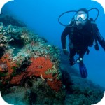
If you are provided with a mask and tube, even during ordinary swimming by the beach, you can watch the varied sea bottom and its inhabitants. However, if you simply do not have the usual snorkeling and would like to try your hand at more advanced diving, we can recommend you the Oceanis Dive Center in Kolymbari, which is regularly used by participants of trips organized by kreta24.pl.
gość PiotrWie Jeździliśmy na Kretę od 2008r, bywały lata że byliśmy w kilku kawałkach w sumie czterdzieści kilka dni ( samoloty z Wrocławia latały w piątek wieczorem tak że można było polecieć po pracy, powrotem był w poniedziałek w nocy więc za 11 dni urlopu można było być 17 dni, jak się zaplanowało z jakimś świętem to można było być 2 x 17 dni i raz 10 dni) i z roku na rok było coraz więcej ludzi - nie tylko na plażach ale ... (...)
Czy wyspa jest w stanie pomieścić 15 mln turystów, zapewne tak. Pytanie moje: skąd będzie woda?! Jak już brakuje, tama na Aposelemis sucha, gdzie ścieki popłyną, gdzie będą składowane śmieci??? Smutne, że wyspa zamienia się na globalną destynację.. rozumiem, że pieniądze są ważne ale żeby dewastować naturalne tereny np.triopetra, plakias etc... przykro
Można próbować zrozumieć ludzi, którzy z tego żyją. Można też puścić ludzi na żywioł i nie zajmować się takimi głupotami, jak ofiary śmiertelne. Samaria nie jest szlakiem w 100% bezpiecznym (który szlak jest), to głęboki wąwóz, narażony na erozyjne osunięcia skał. Poza ty, to jest region aktywny sejsmicznie i dość kapryśny pogodowo.
Myślę, że tu nie ma miejsca na ustępstwa. (...)
gość PiotrWie Dziś po raz pierwszy ( a jeździmy dużo od 2008 roku i dużo chodzimy po szlakach) widzieliśmy w Grecji ekipę przygotowującą szlak do sezonu. Nie była to co prawda zbyt duża ekipa - dwie osoby z motyką, sekatorem i niewielką piłą ręczną - ale zawsze coś - na wyspach Kanaryjskich ekipa to pierwszy z kosą spalinową a zanim kilka osób zmiatających resztki na bok. (...)


Komentarze
komentarz z
https://www.facebook.com/wandernampsiloritis/?ref=bookmarks
komentarz z
Super poradnik, warto przeczytać i odpowiednio się przygotować byłem we wrześniu temperatury ok 30° 2l wody i było mało
komentarz z
Od której strony szedłeś? Z Nidy?
komentarz z
Kurcze szukałem na mapach googla ale znaleźć nie mogę ale pamiętam że jak wróciliśmy do auta to wypiłem piwko w restauracji zaraz przy początku szlaku
komentarz z
To pewnie Nida. Przy Lakkos Migerou nie ma żadnej tawerny. Na Nidzie jest to taki niedokończony ośrodek turystyczny.
Ja chciałbym dodać, że czas przejścia 5 godzin w obie strony jest dość optymistyczny - na mapie Anavasi jest 3 h w górę i 2,5 w dół - i jest to czas samego przejścia, nie uwzględniający odpoczynków czy robienia zdjęć. W praktyce wychodzi przynajmniej 6 godzin. Jeśli chcemy iść spokojnie i móc posiedzieć na górze z godzinę to trzeba wyjść najpóźniej przed 10:00, a bezpieczniej wcześniej. Dojazd z Rethymnonu to co najmniej 1,5 godziny - tak więc mieszkając gdzieś dalej warto jednak rozpatrzyć wariant z przyjazdem wieczorem, noclegiem w schronisku i wyjściem rano. Wariant z wyjściem z płaskowyżu Nida - tym bardziej ( tam jest 4 godziny w górę i 3 w dół.) Od południa wychodząc z Fourfuras jest ok 8 godzin, od schroniska - połowę tego ( ale by tam dojechać trzeba dysponować samochodem w dużym prześwitem - czyli przynajmniej Suzuki Jimny). Oczywiście wiele zależy od indywidualnych umiejętności - my pierwszy raz schodząc z góry do Lakkos Mygreou spotkaliśmy dwie dziewczyny ruszające do góry - była godzina 17, myśleliśmy że chcą zobaczyć początek szlaku i podejść na drugi dzień - tymczasem ok 20 zbiegły z góry i zaczęły się nas dopytywać na jakim poziome jest parking - bo wiedzą ile jest na szczycie ale nie wiedzą ile podeszły. Jak sie ich spytaliśmy czy był widok z góry powiedziały że nie wiedzą bo nie miały czasu, a pytane o kaplicę zrobiły wielkie oczy - to tam coś było? Tak więc osobiście nie polecam biegania "by zaliczyć" - o wiele lepiej jest po grecku - siga, siga.
Czas
Jest dokładnie tak jak napisałeś w komentarzu. Podany w opisie czas 5 godzin uwzględnia samo przejście szlaku. Do tego trzeba doliczyć jeszcze trwanie dłuższych przerw no i oczywiście wypoczynek/podziwianie widoków na szczycie. Sama ostatnia czynność może zająć dobrych kilkadziesiąt minut. Tym bardziej, że przy sprzyjającej pogodzie rozległość panoramy może być oszałamiająca.
Dojazd na początek szlaku to zupełnie inna para kaloszy, którą prawdopodobnie opiszę oddzielnie. Faktycznie na Lakkos Migerou warto być zdecydowanie jak najwcześniej. Drogę łączącą to miejsce z cywilizacją, czyli wioską Liviadia, ciężko nazwać autostradą. Jest stroma i dodatkowo często pokryta skalnym rumoszem. Zdecydowanie nie polecam jazdy na tym odcinku po zmroku.
No i na koniec. Ten szlak, podobnie jak większość szlaków na Krecie, to miejsca które trzeba poczuć. Spiesząc się tak jak opisana przez Ciebie dwójka dziewczyn traci się dużą część z atutów tego typu wycieczek. Umykają krajobrazy, detale ukryta na szlaku. A jak widać w Twoim komentarzu umknąć może nawet sam cel wycieczki, czyli szczyt. Ech ... i gdzie ci ludzie tak się śpieszą?
A dla tych, którzy chcą poczuć atmosferę tego pasma " całościowo" polecam wersję hard - wyjście z Furfuras, nocleg na szczycie i zejście na Nidę - ale trzeba mieć ze sobą lepszy śpiwór - my spaliśmy w naszych standardowych 650-gramkach które sprawdzają się super na Krecie tak do 1500 - 1600 metrów wysokości i zmarzliśmy jak nieszczęście - ale i tak było warto.
Może nie były na Timios Stavros tylko na sąsiednim szczycie?
Były na Timios Stavros - z rozmowy wynikało że "odbiły się" od dzwonnicy z flagami i zbiegły w dół bez rozglądania się na górze. Może po prostu trenowały do jakiegoś biegu rzeźnika i było im obojętne gdzie są - ważniejsze ile przebiegły i w jakim czasie.
z Heraklionu...
Kochani, jak w temacie jak najlepiej i najszybciej dotrzeć pod szlak właśnie z Heraklionu? Na GoogleMaps ciężko się rozeznać w temacie postanowiłem skorzystać z Waszego doświadczenia...Dodam, że chciałbym wynająć auto bo autobusami to raczej odpada...pozdrawiam ;)
Prosta droga
Generalnie z Heraklionu prosta droga. Oczywiście jak na standardy Krety ;).
O dojeździe autobusem jak najbardziej zapomnij. Natomiast samochodem musisz kierować się na drogę łączącą następujące miejscowości Tylissos > Gonies > Anogia > Zoniana > Livadia > Płaskowyż Lakkos Migerou. Odległość z Heraklionu to około 60km, ale myślę, że trzeba liczyć przynajmniej 1,5-2 godziny jazdy po górskich drogach. Poniżej podsyłam Ci link do mapki, myślę, że to powinno Ci ułatwić orientację:
https://www.google.pl/maps/
Wpisuję to tu bo nie bardzo wiem gdzie - jak macie lepszą koncepcję to przenieście. W tym roku w końcu udało nam się wejść na Pachnes - było to kolejne podejście bo chcieliśmy wejść " elegancko" - z dojściem z pewnej odległości - szliśmy trzy i pól dnia. Ale nie o tym chcę pisać - chcę opisać jak po prostu wejść na Pachnes - bo z zachodniej Krety Psiloritis jest daleko - a Pachnes jest tylko 6 metrów niższy. Jeśli chce podejść grupa do 4 osób to najbardziej rozsądne jest wynajęcie na 1 dzień Suzuki Jimny dojazd do Anopoli skąd ok godziny drogą polną w kierunku góry - ale miejscami z takimi kamieniami że podjazd np Pandą jest niemożliwy - do parkingu na końcu drogi - jest to prawie na 1900 m.npm. Stąd wyruszamy pieszo - niesałą godzinę do Rousiess, skąd do 1,5 godziny na szczyt. Szlak względnie łatwy, obecnie jak na warunki kreteńskie wyjątkowo dobrze oznakowany. Powrót - ok 2 godz. W sumie - mniej niż z Lakkos Mygreou na Psiloritis.
Przy wiekszej grupie - tak do 8 osób - można rozważyć transport z Anopoli na parking pick -upem który oferuje tawerna w Anopoli - koszt usługi polegającej na wywiezieniu rano i zwiezieniu wieczorem to 140 euro niezależnie od ilości osób, godziny wyjazdu i powrotu do uzgodnienia. Gdyby ktoś był zainteresowany - mam wizytówkę z telefonem tawerny.
Dzięki Piotrek!
Super, serdeczne dzięki za informację na pewno się przyda, sprawdzimy czy ta góra może konkurować na atrakcyjność z którąś z naszych (i nie tylko naszych) w Tatrach ;)
Pachnes
Piotr dzięki za cenne informacje na temat Pachnes. Myślę, że na razie Twój wpis zostawimy w tym miejscu. W miarę możliwości ewentualnie prosilibyśmy Ciebie tylko o podesłanie (może na maila [email protected]) skanu lub zdjęcia wizytówki tawerny z Anopoli oferującej dojazd do tego parkingu.
Jeśli w przyszłości będziemy w rejonie Chora Sfakion to na pewno pomyślimy o tym, aby wejść na szczyt Pachnes. Nie jesteśmy jakimiś szczególnymi górskimi łazikami, ale z Twojego opisu wynika, że ta góra jest w naszym zasięgu :).
Ocenianie atrakcyjności gór Krety na podstawie wejścia na Psiloritis z Lakkos Mygreou to trochę tak jakbyś atrakcyjność Tatr oceniał na podstawie wycieczki na Giewont z Zakopanego. Żeby ocenić ich atrakcyjność trzeba pokusić się o jakieś dłuższe przejście - jak Psiloritis to z Fourfouras przez szczyt na Nidę i dalej do Zaros - w wersji szybkiej 2,5 dnia, my siga,siga szliśmy cztery i pół. Góry przede wszystkim są puste, surowe, z dużymi różnicami wysokości - Pachnes jest 7 km od brzegu morza, to prawie jakby Rysy były w Gdańsku - my podczas tegorocznego przejścia przez Góry Białe w pierwszym dniu spotkaliśmy jednego człowieka, w drugim nikogo, w trzecim grupkę trzech austryjaków a w czwartym byliśmy w bardzo uczęszczanej okolicy - spotkaliśmy tak ze 30 osób.
Ja tam nie wiem, nie znam się ;)
Fakt ta pustka w górach Krety daje naprawdę niesamowite wrażenie. Tak jak pisałeś ilość ludzi spotykanych na szlaku bywa znikoma. W czasie naszego ostatniego letniego wejścia na Psiloritis nie spotkaliśmy tu nikogo. Pokonując trawers Agathiasa na przedłużeniu szlaku w kierunku Nidy z daleka majaczyła nam postać pasterza. A przecież szlak na Psiloritis nie jest wcale tak mało popularny. Oczywiście można trafić na taki dzień, że będzie tu sporo osób, ale jest to raczej wyjątek a nie reguła. Chociaż kto wie, może po publikacji naszego "poradnika" więcej osób zdecyduje się na to aby wejść na Psiloritis. Tym bardziej, że nie jest to wejście wymagające jakichkolwiek technik wspinaczkowych.
Ogólnie ta pustka w górach na Krecie jest o tyle fajna, że jest wielowymiarowa. Poza niezliczoną ilością kamieni tworzących gołoborza jest niewiele innych bodźców które mogą zwrócić uwagę. Cisza i spokój powoduje, że można wyłapać takie smaczki jak świst powietrza przecinanego przez skrzydła jaskółek latających wokół góry. Cień drapieżnych ptaków przemykających bezszelestnie ponad naszymi głowami. Ogólnie jeśli ktoś już wejdzie na szczyt to polecam spędzić tam dłuższą chwilę. Panorama rozciągająca się z tego miejsca jest niesamowita. Widać stąd spory kawałek wyspy.
Co do samej oceny gór to osobiście nawet się na to nie silę. Tym bardziej nie chcę ich porównywać do polskich gór z którymi miałem zdecydowanie za mały kontakt. Trzeba znać swoje miejsce w szeregu ;). Mam nadzieję, że woolas będzie zadowolony z kontaktu z tą kreteńska innością.
Dojazd do Pachnes
Tawerna o której wspominał Piotwie oferująca dojazd do górskiego Parkingu na Pachnes to: http://www.anopolirooms.gr/en/. Z tego co wypatrzyliśmy na tej stronie to właściciele oferują również możliwość wykupienia noclegu (30€ za pokój dwuosobowy). Miejsce wygląda całkiem sympatycznie więc na pewno warto je zapamiętać.
Psiloritis z dziećmi
Miałem zamiar wejść na Psilortsis z dziećmi. Żona jednak się wystraszyla że nie dadzą rady więc pojechałem sam. Moim zdaniem Psilortsis to łatwa góra na którą jest w stanie wejść sześciolatka. Przewyzszenie jest zblizone do Babiej Góry ale szlak na Psilortsis jest dużo krótszy i zdecydowanie łatwiejszy. Ale po kolei.
1. Droga. Na zakręcie w Livadii obok pomnika zjechać trzeba z głównej drogi która asfaltem prowadzi do schroniska na płaskowyżu Lakkos Migerou (jadąc z Retimo będzie na wprost przy pomniku. Asfalt równy, droga kręta ale każde auto da sobie radę. Z Livadii ok. 25 minut.
2. Temperatura. 25 sierpnia 2018. Livadia 30stopni, płaskowyż Lakkos Migerou 21 stopni, szczyt ok. 15 stopni. Ja tak miałem ale myślę, że inni podobnie, czyli spadek o ok. 15 stopni.
3. Szlak. Bardzo dobry stan, do przełęczy na której łączy się ze szlakiem idącym z Nidy raczej słabo oznaczony ale wierzcie, że nie ma takiej potrzeby gdyż ścieżka jest ułożona z kamieni tworzących coś na wzór schodów. Od przełęczy oznaczony rewelacyjnie, czasem znaki (dwie czerwone kropki) co 10 metrów. Góra widoczna przez dużą część drogi dzięki kapliczce.
4. Czas przejścia. Ja bez dzieci obróciłem w równe pięć godzin, z tego godzina siedzenia na szczycie, kilka pieciominutowych odpoczynków po drodze i masa robionych zdjęć. Realnie oceniam drogę dla mnie na max 3.5h czystego marszu dla osoby dorosłej. Wierzycie mi że nie chodzę po górach na co dzień, nie uprawiam żadnego sportu, a nawet mam mało ruchu. Po prostu jestem tylko zacięty by iść. Z dziećmi które lubią odpoczywać często wycieczka będzie na pewno dłuższa, ale maks to 8 godzin. Moje 10 i 11 latka w 6.5 spokojnie dałyby radę.
5. Godzina wyjścia. Nie polecam zbyt wcześnie bo chłodno może być. Zjedzcie śniadanie i w drogę. Wtedy o 11 ruszcie na szlak. Na koniec wakacji jasno jest do 20.30. Nawet jak będziecie wracać o szarówce to szlak jest prosty i latarka z telefonu wydłuży nam wędrówkę do 21.30.
6. Obuwie. Ja szedłem w sandałach turystycznych ale dzieciom odradzam. Najlepiej obuwie trekkingowe. Dobra podeszwa.
7. Odzież. Koniecznie długi rękaw. Najlepiej kurtka wiatro i wodoszczelna w plecaku. Może silnie wiać. Jak ja byłem średnio wiało od przełęczy.
8. Zasięg telefonu. W początkowej fazie słaby, im bliżej szczytu tym lepszy
9. Powrót. Mi zajął półtorej godziny. Jeśli się obawiacie że nie zdążycie wrócić za jasna wyznaczcie sobie godzinę powrotu uwzględniając na powrót tyle samo czasu ile zajęło wam wchodzenie
10. NAJWAŻNIEJSZE. Pamiętajcie że to są góry i wszystko może się zmienić momentalnie. Zachowajcie zdrowy rozsądek. Przed wyjściem na Psilortsis lepiej znać skale możliwości swojego dziecka i sprawdzić ją w łatwiejszym terenie.
Podsumowując Psilortsis z dziećmi tak, ale zachowajcie zdrowy rozsądek.
Ps. Pozdrowienia dla rodzinki z Kostrzyna spotykanych na szczycie.
Dojazd do Lakkos Migerou?
Wybieramy się na Kretę na początku czerwca i mamy zamiar wejść na Psilortsis. Nie mamy ambicji na jakiś dłuższy szlak i na podstawie wpisów na tej stronie zdecydowaliśmy się na dojazd autem do schroniska na płaskowyżu Lakkos Migerou i wyruszenie z tego punktu. Podpowiedzcie proszę czy auto w typie Sparka poradzi sobie z dojazdem czy raczej trzeba wynająć auto terenowe?
Z góry dziękuję za wskazówki!
odp. Dojazd do Lakkos Migerou?
Tak da radę dojechać. Aż do schroniska prowadzi asfaltowa droga., miejscami bywa nieco stromo.
Gosia | www.crete.pl
dobry opis
Bardzo dobry opis, nic dodać nic ująć. Polecam wejście. Polecam Waszą stronę. W dzisiejszy pogodny dzień było łącznie ze mną 9 turystów.
do znawców tematu
Czy pierwsza połowa kwietnia to za wcześnie na zrobienie tego treku?
Mam na myśli warunki pogodowe, śnie etc.
Będę wdzięczna za wszystkie wskazówki
Niestety nie ma jednoznacznej odpowiedzi. Wszystko zależy od tego ile śniegu w górach będzie w tym czasie. A teraz od kilku dni ostro sypie zwłaszcza w górach. Jeśli chciałabyś wchodzić od strony Lakkos Migerou lub Nidy to zlodowaciały śnieg zalegający na północnym zboczu Agathiasa może uniemożliwić dojście do Psiloritis.
Generalnie wiosna jest bardzo zmienna. Jednego dnia może być zimno, bez porządnej kurtki i spodni nie wejdziesz, na drugi dzień może być lampa taka, że słońce ostro grzeje i można wejść w zwykłej bluzie.
Jedynym przejściem realnym na Krecie w pierwszej połowie kwietnia jest nadmorska wersja E4 - od Imbros przez Chora Sfakion, Aghia Roumeli, Soughię,Paleochorę do Elafonisi. Jak jest mało śniegu to na Psiloritis da się wejść tak od połowy maja a jak dużo to od czerwca.
Re: do znawców tematu
Bardzo dziękuję za wszystkie wypowiedzi
Trek kwietniowy na Psiloritis
Witam. Czy obecna pogoda na najwyższym szczycie Krety umożliwia względnie bezpieczne i suche przejście szlaku na początku kwietnia? Dzięki z góry za odp.
Wypełnij poniższy formularz aby dodać komentarz
lub kliknij w poniższy link aby skorzystać z możliwosci komentowania przez facebooka:
https://www.facebook.com/crete.poland/posts/10155206324647551