Serwis wymaga plików cookies do prawidłowego działania strony. Korzystanie z serwisu bez zmiany ustawień dla plików cookies oznacza, że będą one zapisywane w pamięci urządzenia. Ustawienia te można zmieniać w przeglądarce internetowej.
The best Polish website dedicated to the Greek island Crete and to a small extent of continental Greece. You will find useful information related to visiting Crete that goes beyond the offer of optional tours. On the website you will also find descriptions of the most interesting places that we visited by visiting this largest Greek island. The content complements the current news, photographs and recipes of Greek cuisine.
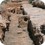
We do not know how it happened that in our described places, which are worth seeing in Crete, so far there is no description of the Gramvousa fortress. So we are catching up and publishing a historical outline and some other information.
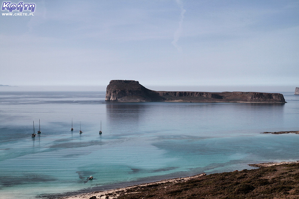
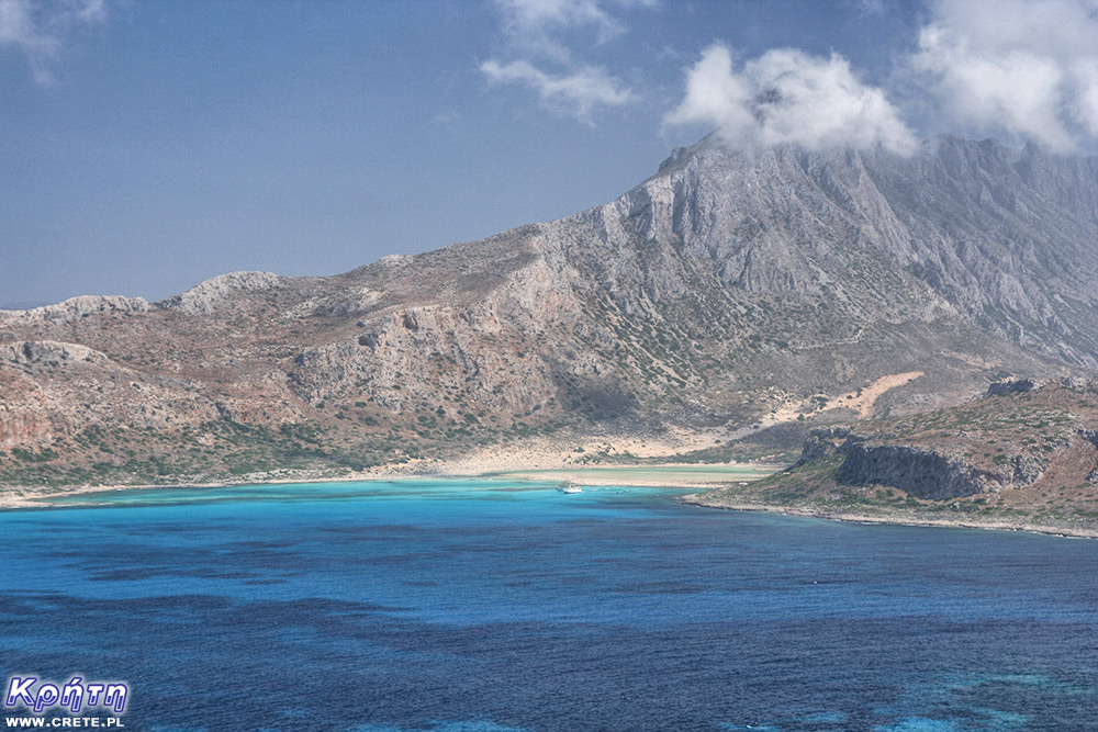
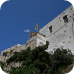
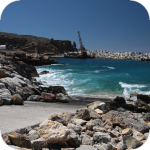
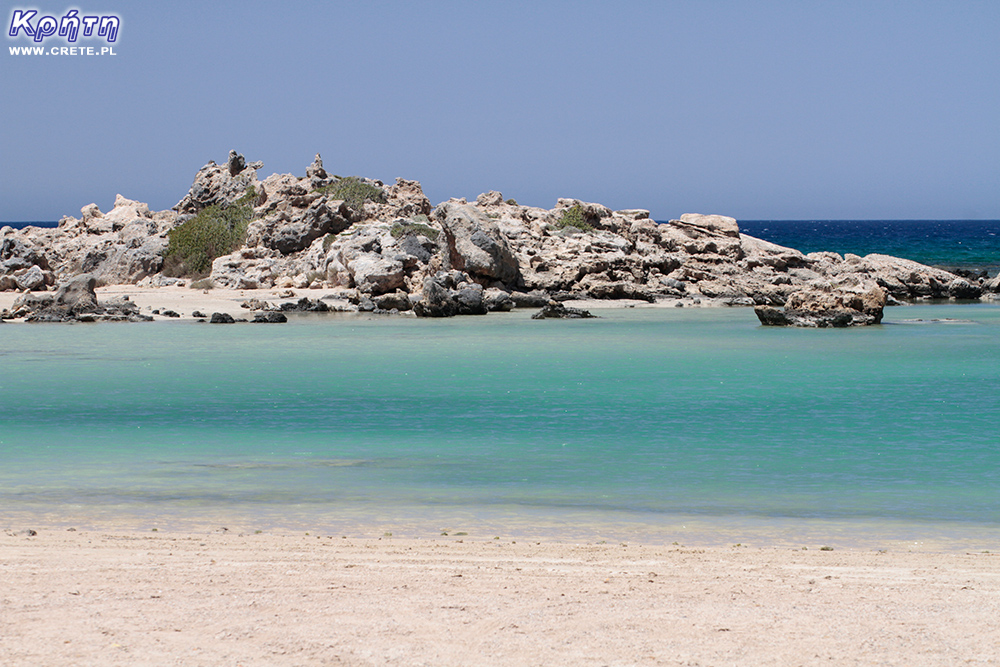
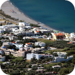
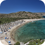
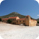
Imeri Gramvousa Island from the side of the Balos Lagoon
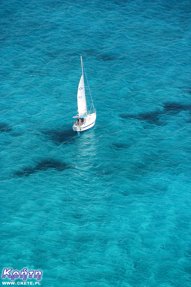
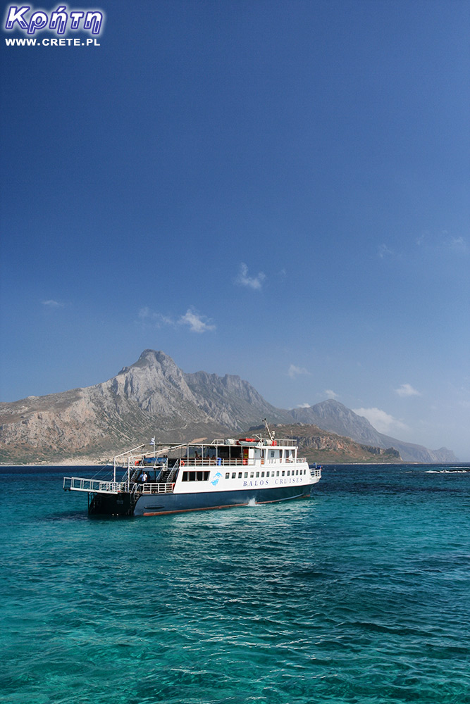
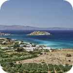
The island of Gramvousa, or in fact Imeri Gramvousa ( Ήμερη Γραμβούσ α), is an inseparable point of a trip that combines a stay in the Balos Lagoon with visiting the remains of a fortress located on the top of the island of Imeri Gramovousa. This is one of the most popular tourist trips in Crete. And unlike the Balos Lagoon, there is no room for dilemmas such as "better by car or by boat". Imeri Gramovusa is an island, so outside of the boat you won't get here otherwise.
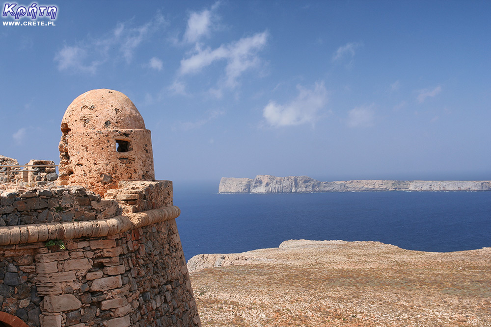
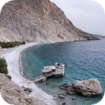
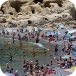
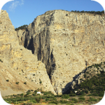
It is also one of the most stunning places in Crete. The views from the old Venetian fortress compensate for the hardships of climbing steep steps. The delightful color of the water, shimmering with various shades of blue, azure and turquoise, contrasts beautifully with the orange shade of the rocks and the walls of the fortress. In the distance, you can see the Balos lagoon located at the foot of the 715-meter peak Geroskinos crowning the Gramvousa peninsula belonging to Crete.
Geroskinos peak as seen from the fortress
North of Imeri Gramovusa is another island called Agria Gramvousa. This name came about for a reason, Agria, meaning wild. Access to it is difficult due to high rocks. This hostile island is protected under the Natura program.
Imeri Gramovysa's landscape is reminiscent of African landscapes. This region, together with the Balos Lagoon, is one of the most important protected areas in the Eastern Mediterranean. There are over 100 species of birds and 400 species of plants. These areas are visited by the Mediterranean monk seal (a species of seal), which is threatened with extinction. Currently, its number is estimated at no more than 500 individuals. There are also individuals of the endangered Caretta caretta turtle species.
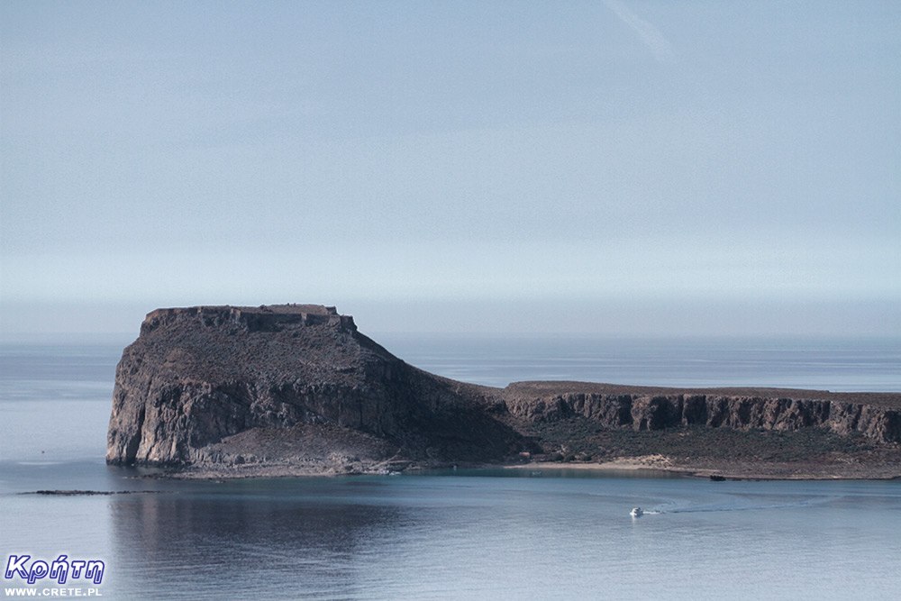
Imeri Gramvousa area
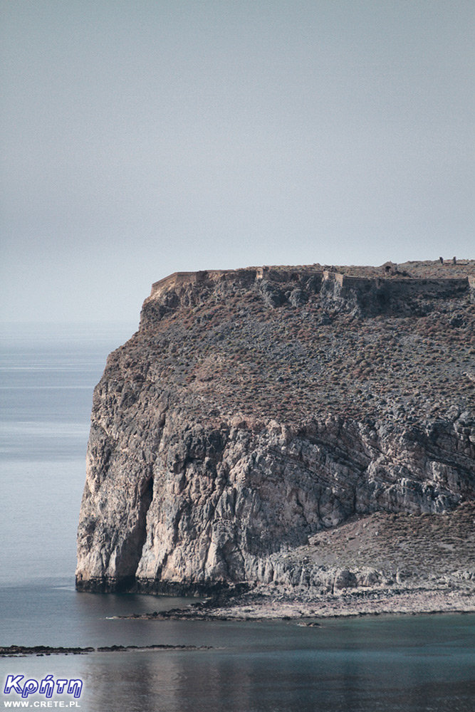
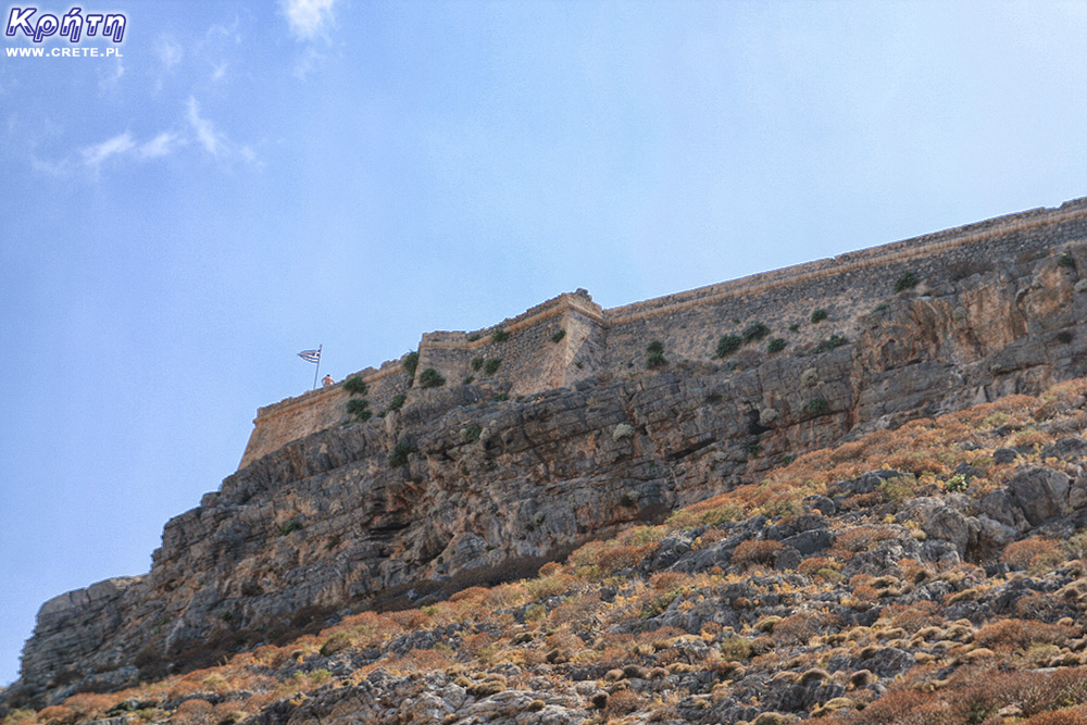
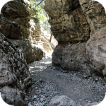
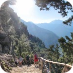
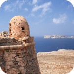
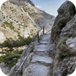
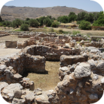
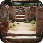
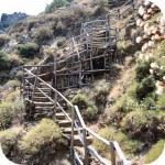
The main and, in fact, the only destination for excursions to Imeri Gramvousa is the Venetian fortress erected about 137 meters above the water surface, to which access is blocked by 365 steep steps. Overcoming them in 30-degree heat in the rays of the scorching sun is quite a challenge.
Dimitrios P.
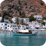
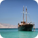
Until recently, the attention of visitors was also attracted by the rusty wreckage of the Dimitrios P ship, lying here on the shoal of the bay, but time and salty sea water slowly "worked it out". The ship was carrying a cargo of cement in 1967 when bad weather forced the captain to seek shelter. Misfortunes like to go in pairs, and in this case the anchor turned out to be the second negative event. During the stop, the chain of the left anchor broke, and the ship ran aground and remained there.
Tak wyglądał Dimitros P.
w 2009 roku. Co roku jednak
było go coraz mniej
Ship condition in the 2020 film
Long long time ago...
In ancient times, the island of Imeri Gramovousa was called Korykos. Some associate this island with the mythical Ajaja ( Αιαία ), but of course this is just one of the hypotheses, because some of Ajaja's location is on the Apennine peninsula, others in Croatia or other Greek islands. On Ajaja lived the fairy Circe, who lured the companions of Odysseus returning from Troy with her beautiful singing. They wanted to get off the ship for a while, so they seized the opportunity. However, under Murphy's Law, if anything can go wrong, it will. As a result, after a great feast, Odysseus' companions were transformed by Circe into various animals. Odysseus missed it, but he fell under the charm of the sorceress and stayed with her for a year on the island, begetting a descendant. These are all ancient myths and fantasies, of course. The subsequent history of Gramvous is much better known and documented.
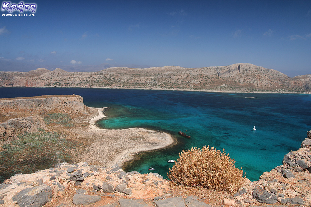
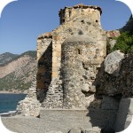
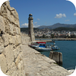
View from the fortress
Venetians are building a fortress
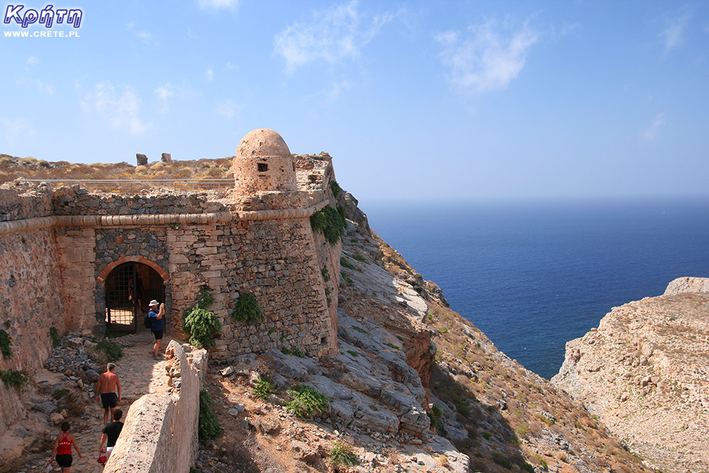
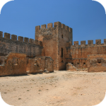
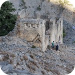
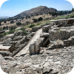
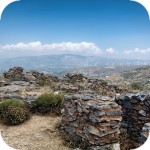
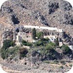
In the years 1579-1584, the Venetians who ruled over Crete at that time, built an impressive fortress on this small island. The choice was not accidental because its strategic location made it possible to protect north-eastern Crete and the area between western Crete and the Peloponnese. Even today, when little is left of the fortress's glory days, its majestic size is impressive. The fortress has a triangular shape, and the walls, built of limestone, are nearly 600 meters long. It should be noted that from the west side of the access to the fortress there are steep rocks, and the fortress covers an area of 3 hectares. This fortress was able to accommodate 3,000 people, but interestingly, at a time when it was under the Venetian jurisdiction, its potential was not used in larger battles.
Słynne podejście
Mury twierdzy
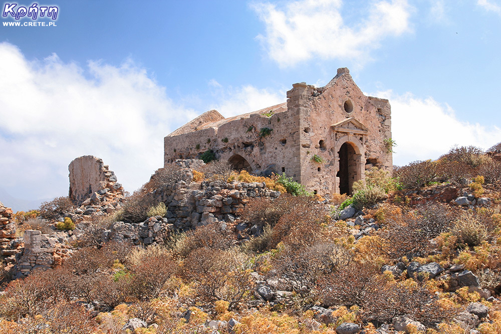
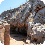
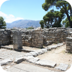
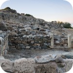
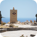
The entrance gate and the characteristic corner bastions have survived to our times. Inside the fortress there are two cisterns to collect rainwater, the remains of the Church of the Annunciation, which was converted into a mosque in Turkish times, and a gunpowder warehouse. The imagination of visitors can be fueled by a legend about a great treasure buried here.
Entrance to the fortress
The Turks take control of Crete
In 1645, the Turks, expanding their sphere of influence, became interested in Crete, who transferred their army of 60,000 here. In three years, the Ottoman army systematically took control of the largest cities of the island. The resistance of each of them lasted about 2 months on average. The exception was Candia, today's Heraklion, which defended itself for 22 years. In 1669, the commander of the Venetian army, Francesco Morosini, signed a capitulation agreement, which finally sealed the fate of Crete, which from then on was entirely subordinated to Turkish rule.
One of the points of the act of capitulation was, however, leaving the Venetians in the hands of three fortresses located in Souda, Spinalonga and the island of Imeri Gramvousa. Thanks to this, the Venetians hoped to regain control over Crete.
In this way Gramvousa became the base of the Venetians, who took action from there to recover the island from the Ottoman hands. This situation, however, did not last long, because in 1692 one of the Venetian commanders, Luca Della Rocca, a Neapolitan, was bribed by the Turks and simply handed over the fortress to them. Even the ironic nickname "Captain Gramvous", given to him by the Turks, clung to him. The Turks began to fortify the fortress. They transported 66 guns here, transferred strong troops and made the fortress unavailable for many years.
In 1821, another uprising broke out, which was to give Greece the longed-for independence and allow it to throw off the hated Turkish yoke. In 1825, Greek and Cretan revolutionaries recaptured the Gramovous Fortress from Turkish hands, using an old-fashioned trick of disguising themselves as the enemy. For three years, the fortress became a "nest" of several thousand Cretan revolutionaries and a base for armed actions against the Ottoman occupiers. Both sides waged a devastating battle against each other, and in the meantime, the current residents of Gramvous increasingly adapted the fortress to their needs and organized daily life on the island. A school and a church appeared on the island.
Pirate nest
At that time, many people sought refuge in this place from the increasingly devastating revolutionary turmoil. If you have been to this island, you know that it is not a fertile agricultural area that would be able to feed thousands of inhabitants of the fortress. Notorious food supply problems caused revolutionaries to attack ships passing nearby. Other countries whose ships fell victim to the pirates of Gramvousa could not turn a blind eye to such "arbitrariness".
In 1828, pressure from France and Great Britain forced the Greek government to take action, which put an end to piracy, and the island's inhabitants once again had to change their place of residence. After these events, the islet temporarily came under British rule, but in 1830 the island was again handed over to the Turkish authorities under the London Protocol as a sign of international "solidarity" and remained in Turkish hands until independence was regained by Crete.
The island has been uninhabited since then, and the last decades of organized tourism development have attracted considerable interest. And so Gramvousa from the seat of revolutionaries turned into one of the main tourist attractions of people vacationing in Crete.
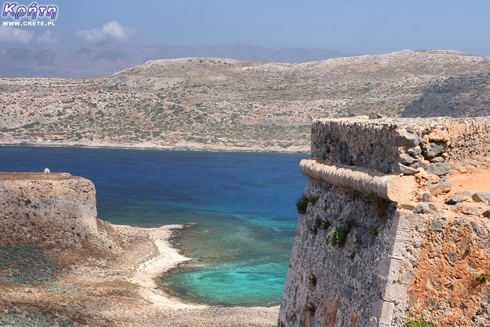
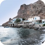
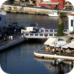
View of the marina from the fortress
Visiting Gramvous
If you are going to visit Gramvousa it is best to bring more comfortable shoes and put them on before entering. Of course, we know that there are powerful people who will run up to Kazbek in socks, but twisting your leg on the approach to this fortress is no fun. Like climbing that rocky climb in thin-soled sandals. Of course it is possible, but no comfort.
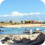
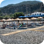
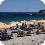
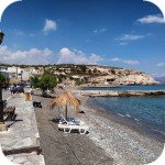
In addition, it is also worth taking something with you that will protect your head and skin from the scorching sun and a supply of water. After 20 minutes of ascent, you will definitely need it. Those who cannot climb the mountain for some reason can of course stay at the bottom of the island, near the marina. Then sunbathing accessories will come in handy.
west
central
east
Interesting places on Crete
↤ click the appropriate part of the island to change the bottom map
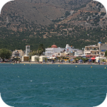
W 2002 roku Falasarna zdobyła tytuł najlepszej plaży w Grecji. Wyróżnienie to nie jest bynajmniej przypadkowe, gdyż miejsce to jak na standardy Krety jest naprawdę unikalne.
Elafonisi is a small island located at the end of the southwestern edge of Crete. A characteristic feature of Elafonisi is the shallow lagoon connecting it with Crete.
Elafonisi is a small island located at the end of the southwestern edge of Crete. A characteristic feature of Elafonisi is the shallow lagoon connecting it with Crete.
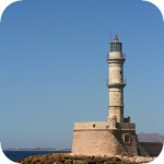
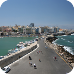
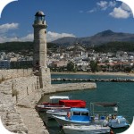
Chania (Χανιά) is the second largest (after Heraklion) city of Crete. The biggest advantage of Chania is the area of the Old Town and the beautiful Venetian Harbor.
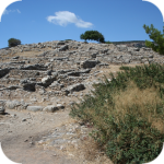
Aptera is a city whose history dates back to at least a thousand years before our era. In the peak period, about 20,000 lived in it. people, of which only 1/5 were free people.
Chania (Χανιά) is the second largest (after Heraklion) city of Crete. The biggest advantage of Chania is the area of the Old Town and the beautiful Venetian Harbor.
Omalos is a perfect starting point for exploring the Samaria Gorge. Located over 1,100 m above sea level extends over an area of 25 km2. Its size corresponds more or less to the size of the Lasithi Plateau.
Located 47 km from the city of Chania, it is the only freshwater lake in Crete. Its area is about 580 thousand. sqm. and the maximum depth is about 45 meters
Omalos is a perfect starting point for exploring the Samaria Gorge. Located over 1,100 m above sea level extends over an area of 25 km2. Its size corresponds more or less to the size of the Lasithi Plateau.
The steel crossing, which in the central part is separated from the ground by nearly 150 m, is at the leading position of the places where the longest bungee jumps are made.
Chania (Χανιά) is the second largest (after Heraklion) city of Crete. The biggest advantage of Chania is the area of the Old Town and the beautiful Venetian Harbor.
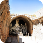
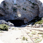
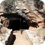
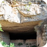
The cave is less than 1 km from Moni Gouvernetou Monastery. You will reach it using the pedestrian trail that has been marked out along the slope of the Avlaki Gorge.
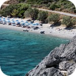
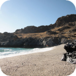
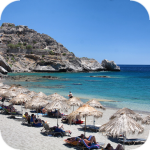
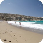
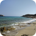
Balos is one of Crete's flagship beaches if not all of Greece. We can assure you that the landscapes you see during your trip to Balos will remain with you for a very long time.
The Orthodox monastery of Agia Triada, located on the northern part of the Akrotiri peninsula, is one of the most beautiful and richest monasteries in Crete.
The Orthodox monastery of Agia Triada, located on the northern part of the Akrotiri peninsula, is one of the most beautiful and richest monasteries in Crete.
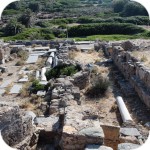
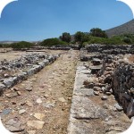
On the north-western coast of Crete, at the foot of the Gramovous peninsula, there are ruins of the ancient port of Korikos, later known as Falassarna.
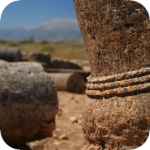
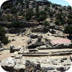
Polyrinia was one of the most important city-states of western Crete during the Hellenistic and Roman periods. It was built amphitheater on a steep hill, rising to a height of 481 meters above sea level
The island of Gramvousa, or in fact Imeri Gramvousa (Ήμερη Γραμβούσα), is an inseparable point of a trip that combines a stay in the Balos Lagoon with visiting the remains of a fortress located on the top of the island of Imeri Gramovousa.
There is a beach in Crete that literally makes some people shiver. This place is Seitan Limania which can be translated as Satan's Ports or Cursed Ports.
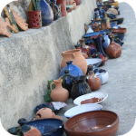
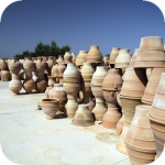
Dozens of craft workshops located in this small mountain village make Margarites one of the four main centers where traditional Cretan ceramics are made.
The date of the foundation of Moni Arkadiou (Arkadi) is not exactly known. According to tradition, the name of this church refers to the name of the Emperor Arkadiusz, who supposedly was to be its founder.
The date of the foundation of Moni Arkadiou (Arkadi) is not exactly known. According to tradition, the name of this church refers to the name of the Emperor Arkadiusz, who supposedly was to be its founder.
Rethymnon with around 40,000 inhabitants are the third largest city of Crete. This place was populated already in the Minoan period. Historically, the city was an important commercial center.
Skinaria is a small beach located along a small bay, whose outlet on both sides ends with a rocky coast. It is still a little-known place overlooked by mass tourism
Skinaria is a small beach located along a small bay, whose outlet on both sides ends with a rocky coast. It is still a little-known place overlooked by mass tourism
According to Greek mythology, Zeus hid (and perhaps even gave birth) in the Ida cave. This myth is the greatest asset of this cave, which is not as interesting and beautiful as the Dikte cave.
Tripiti is a small beach covered with a mixture of gray sand, gravel and stones. Despite the fact that the beach is unorganized and has a semi-natural appearance, one small tavern works here.
Tripiti is a small beach covered with a mixture of gray sand, gravel and stones. Despite the fact that the beach is unorganized and has a semi-natural appearance, one small tavern works here.
Tripiti is a small beach covered with a mixture of gray sand, gravel and stones. Despite the fact that the beach is unorganized and has a semi-natural appearance, one small tavern works here.
Plakias is a perfect place for people who like to spend time hiking. In the area of the town and the surrounding area, there are several hiking trails that lead to interesting beaches.
Currently, the lower monastery is still not open to the public and is not used by the monks. The buildings of the upper monastery have undergone partial renovation and are the main seat of the Preveli monastery.
Currently, the lower monastery is still not open to the public and is not used by the monks. The buildings of the upper monastery have undergone partial renovation and are the main seat of the Preveli monastery.
Currently, the lower monastery is still not open to the public and is not used by the monks. The buildings of the upper monastery have undergone partial renovation and are the main seat of the Preveli monastery.
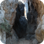
The Kourtaliotiko Gorge, also known as the Asomatos Gorge, is perhaps one of the most spectacular natural attractions available in the central part of Crete.
Agia Triada is a small Minoan archaeological site in the south of Crete, located near Timpaki, located on the western slope of the hill about 40 meters above sea level.
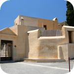
This fortress is a perfect example of Crete's multiculturalism. Located today in Greek hands, it was built by the Venetians, but is called a name taken from the Turkish language.
Rouvas Gorge is one of the most interesting places in this part of Crete. The interesting trail leads in a perfect way to the changing appearance of this gorge.
Matala is one of the most popular towns not only of the southern coast but also of the whole of Crete. In the 1960s and 1970s, this small fishing village was a mecca for hippies.
The Odigitrias Monastery is one of the most famous monasteries of southern Crete. Unfortunately, in terms of popularity, he is far from other Cretan monasteries.
In addition to the famous grand palaces on the island in the Minoan period, a number of smaller residences were created. One of the most important examples is the Vathipetro discovered about 5 km north of Archanes, on the southeastern slope of Mount Juchtas in the central part of Crete.
When traveling around Crete, it is not difficult to pay attention to the fact that most of the beaches there are relatively small and short. For this reason, people who are used to our national Baltic standards, where the sandy coast stretches for kilometers, may experience a special disappointment. However, fortunately, nothing is lost, because Crete in its rich arsenal of various beaches can boast of those that allow for long walks along the coast. One of them, our favorite is the Kommos beach located in the south of the central part of the island.
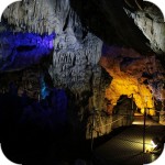
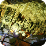
Although there are countless caves in Crete, only a few can be visited. Sfendoni is the largest cave open to the public. content comes from: http://www.crete.pl www.CRETE.pl
Only a few kilometers separate the bustling city of Rethymno from Mili, a village abandoned by its inhabitants. This place is also known as the village hidden in the gorge.
Information about one of the more known tourist cities of Crete, or about Malia. Description of attractions located in the city of Malia and a description of the specificity of this town.
The Lasithi Plateau is located about 70 kilometers from the capital of Crete - Heraklion. The average height at which the terrain of this plateau is located is 840 m above sea level.
One of the tourist attractions eagerly visited by people spending their holidays in Crete is the Dikte (Psychro) cave. The main factors that attract people to this cave are a rich and varied dripstone robe and a close connection with mythology.
Among the olive groves in the place called Logari, which is less than a kilometer from the village of Kritsa, there is a small Byzantine church of Panagia Kera from the 13th-14th centuries.
Stalida is located directly along the coast and is one of the most famous tourist destinations in Crete, which definitely comes alive with the advent of the tourist season
Most people crossing the route between Agios Nikolaos and Ierapetra will definitely notice the large crack which is marked by the mountain located east of this road. This majestic geological creation called Ha was probably created as a result of an earthquake.
Xerokambos is a small settlement in which you will find literally several taverns, and most of the buildings are single-storey and one-story houses. The big advantage of this beach is a gentle sandy descent to the sea.
Agios Nikolaos (Άγιος Νικόλαος) is a small town with less than 20,000 inhabitants. permanent residents (according to statistical data from 2001). This city is the capital of the Lasithi nomos.
Although Elounda seems to be a sleepy fishing town to this day, however, appearances should not fool you, because this town and its surroundings can boast of probably the largest number of the best hotels.
Although Elounda seems to be a sleepy fishing town to this day, however, appearances should not fool you, because this town and its surroundings can boast of probably the largest number of the best hotels.
Stalida is located directly along the coast and is one of the most famous tourist destinations in Crete, which definitely comes alive with the advent of the tourist season
Zakros is the fourth-largest Minoan palace in Crete in importance and size. This latest found, built on the east coast of the island is located in the village of Káto Zákros.
Zakros is the fourth-largest Minoan palace in Crete in importance and size. This latest found, built on the east coast of the island is located in the village of Káto Zákros.
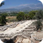
The first palace was built around 1900 BC. in the place where there was a quite impressive settlement whose remains were later transformed into the central part of the city.
The ruins of the ancient city of Itanos are located at the eastern tip of Crete, less than 3 kilometers north of the famous palm beach of Vai. Although there are also nice beaches at Itanos, unlike its well-known neighbor, this place does not attract crowds. There are either accidental stray tourists or excavation enthusiasts here.
Less than 10,000 population of Sitia makes the city the smallest in Crete. Some even go a step further and say perversely that it is rather the largest village of Crete.
Napoleon's house is one of the few typically tourist attractions in Ierapetra. About what could have happened here in the summer of 1798 and possibly how much in this legend is the truth we write in the article on the page below.
Moni Kapsa Monastery is one of the most interesting monasteries in Crete. Its massive buildings were erected on rocky, gray slopes surrounding the nearby Pervolakia Gorge.
Frangokastello is a small fortress that was built by the Venetians over four years from 1371. Initially, the castle was named after Saint Nikitas, but the local population, who did not like the Venetians, renamed the castle at Frangokastello, or the Franks Castle (a Catholic foreigner). The name was so good that in time the Venetians also treated it as officially in force.
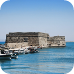
Koules is a great example of Crete's multiculturalism. Located today in Greek hands, it was built by the Venetians, but is called a name taken from the Turkish language. Koules is derived from the words of Su Kulesi, which signify the Water Tower. Through the Venetians, this building was called the sea fortress - CastelloMare or RoccaMare.
Agia Roumeli is the end point of the Samaria National Park route. Most people, after several kilometers of walking through the gorge, only dream of reaching the white buildings of the village, regenerating their strength and jumping into the sea. However, if, after passing Samaria, someone still has a lot of energy and enough time before the ferry leaves, we suggest entering the Turkish fortress located just above the village. To see its massive walls, just look up as you stroll through the streets of this village.
gość PiotrWie Jeździliśmy na Kretę od 2008r, bywały lata że byliśmy w kilku kawałkach w sumie czterdzieści kilka dni ( samoloty z Wrocławia latały w piątek wieczorem tak że można było polecieć po pracy, powrotem był w poniedziałek w nocy więc za 11 dni urlopu można było być 17 dni, jak się zaplanowało z jakimś świętem to można było być 2 x 17 dni i raz 10 dni) i z roku na rok było coraz więcej ludzi - nie tylko na plażach ale ... (...)
Czy wyspa jest w stanie pomieścić 15 mln turystów, zapewne tak. Pytanie moje: skąd będzie woda?! Jak już brakuje, tama na Aposelemis sucha, gdzie ścieki popłyną, gdzie będą składowane śmieci??? Smutne, że wyspa zamienia się na globalną destynację.. rozumiem, że pieniądze są ważne ale żeby dewastować naturalne tereny np.triopetra, plakias etc... przykro
Można próbować zrozumieć ludzi, którzy z tego żyją. Można też puścić ludzi na żywioł i nie zajmować się takimi głupotami, jak ofiary śmiertelne. Samaria nie jest szlakiem w 100% bezpiecznym (który szlak jest), to głęboki wąwóz, narażony na erozyjne osunięcia skał. Poza ty, to jest region aktywny sejsmicznie i dość kapryśny pogodowo.
Myślę, że tu nie ma miejsca na ustępstwa. (...)
gość PiotrWie Dziś po raz pierwszy ( a jeździmy dużo od 2008 roku i dużo chodzimy po szlakach) widzieliśmy w Grecji ekipę przygotowującą szlak do sezonu. Nie była to co prawda zbyt duża ekipa - dwie osoby z motyką, sekatorem i niewielką piłą ręczną - ale zawsze coś - na wyspach Kanaryjskich ekipa to pierwszy z kosą spalinową a zanim kilka osób zmiatających resztki na bok. (...)
 Imeri Gramvousa Island from the side of the Balos Lagoon
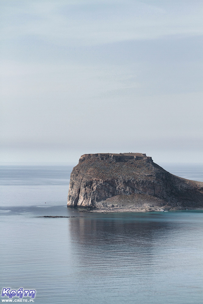
 Geroskinos peak as seen from the fortress
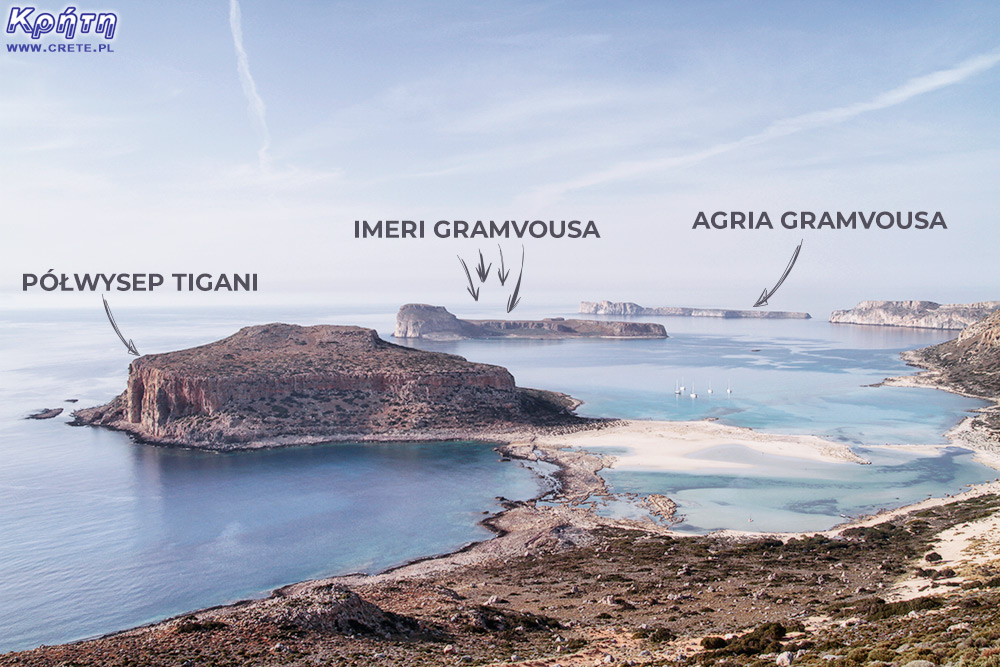
 Imeri Gramvousa area
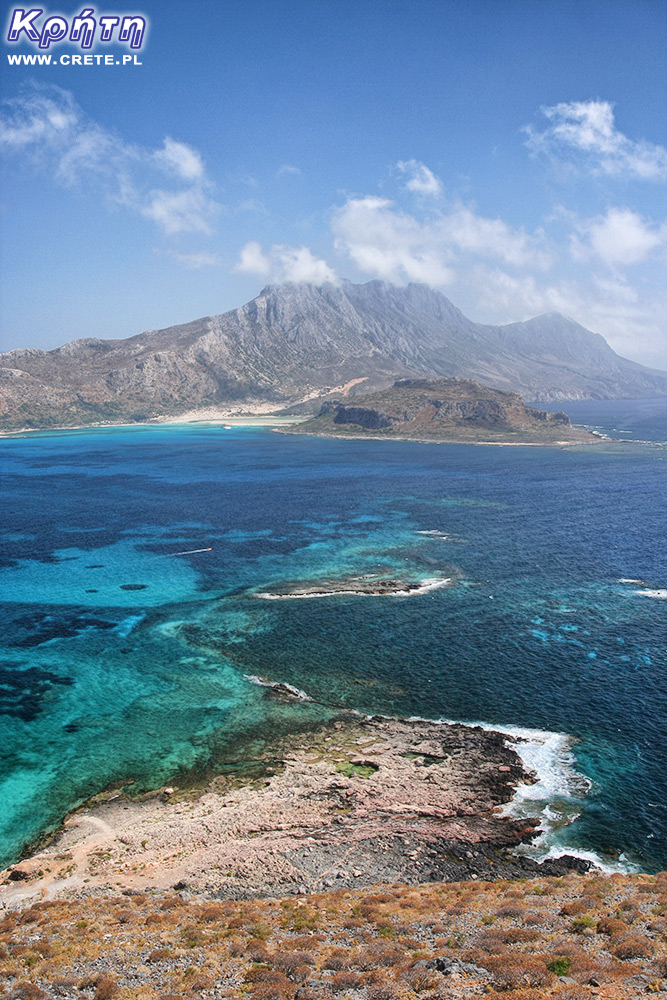


 View from the fortress

 Entrance to the fortress
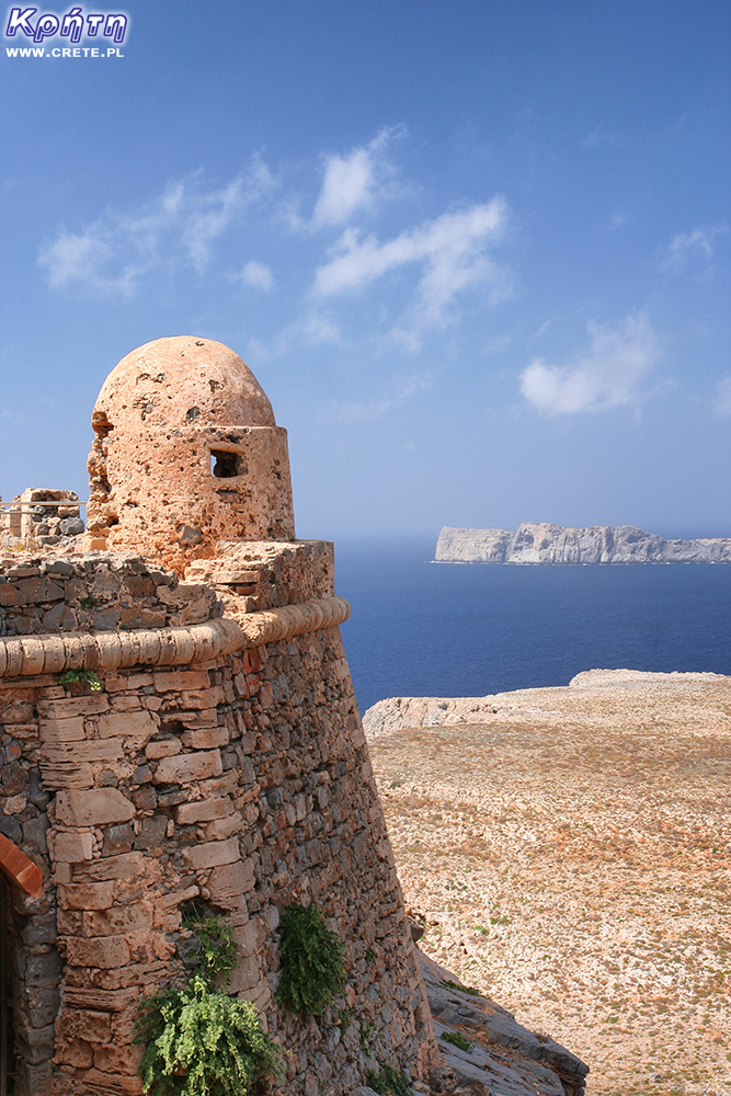

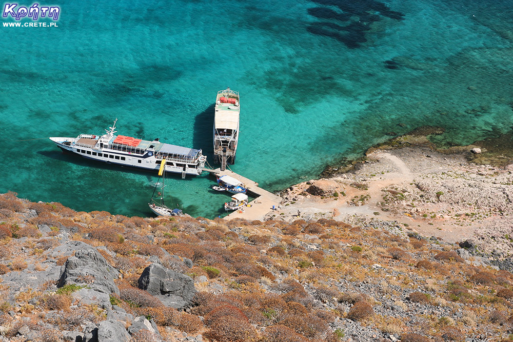 View of the marina from the fortress


Komentarze
komentarz z
Byliśmy, zwiedziliśmy
komentarz z
Warto zobaczyć, widoki przednie
komentarz z
Tydzień temu
komentarz z
Miałem okazję zwiedzać, super
komentarz z
komentarz z
Naprawdę warto Polecam
komentarz z
Przepiękne miejsce , byłam i polecam widoki mega ❤
komentarz z
Piękne wspomnienia !
komentarz z
komentarz z
To jedno z tych miejsc, do których chce się wrócić
komentarz z
Niezapomniane widoki z Gramvousy godne polecenia!
komentarz z
Coś wspaniałego
komentarz z
Byłam, widoki przepiękne!
komentarz z
Polecam
Wypełnij poniższy formularz aby dodać komentarz
lub kliknij w poniższy link aby skorzystać z możliwosci komentowania przez facebooka:
https://www.facebook.com/crete.poland/posts/10158035578797551