Serwis wymaga plików cookies do prawidłowego działania strony. Korzystanie z serwisu bez zmiany ustawień dla plików cookies oznacza, że będą one zapisywane w pamięci urządzenia. Ustawienia te można zmieniać w przeglądarce internetowej.
The best Polish website dedicated to the Greek island Crete and to a small extent of continental Greece. You will find useful information related to visiting Crete that goes beyond the offer of optional tours. On the website you will also find descriptions of the most interesting places that we visited by visiting this largest Greek island. The content complements the current news, photographs and recipes of Greek cuisine.
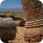
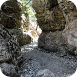
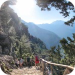
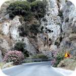
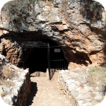
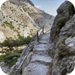
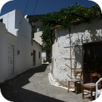
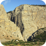
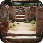
If you want to avoid the crowds of organized trips, and yet you want to visit one of the many gorges in Crete, a trip to the Imbros gorge ( Φαράγγι Ίμπρου ) may be a good alternative to go to Samaria. The total length of the trail leading through this place is about 8 kilometers, during which the difference in altitude is about 600 m. Organizing a trip to the ravine is not too difficult or requires too complicated planning. If you have a rental car, you can definitely opt out of buying a trip sold by local travel agencies.
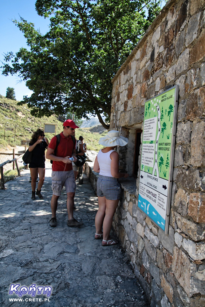
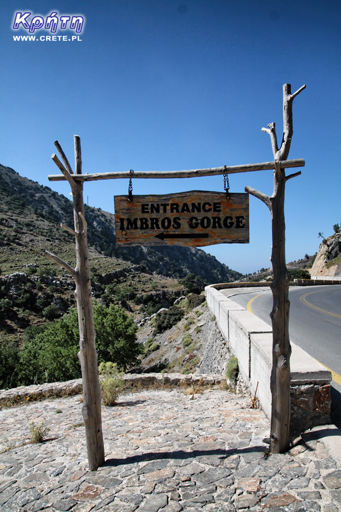
The entrance to the ravine is located near the town of Imbros. A large wooden sign clearly indicates the direction in which you must go. The beginning of the trail is a steep path that reaches a small stone building, where tickets entitling to enter are sold (cost 2 € - condition for 2014). The valid ticket system is solved in a similar way as in the Samaria Gorge. The ticket's ticket consists of three parts. The first one is torn off at the entrance to the ravine, the second at the exit, and the rest is your souvenir from the trip.
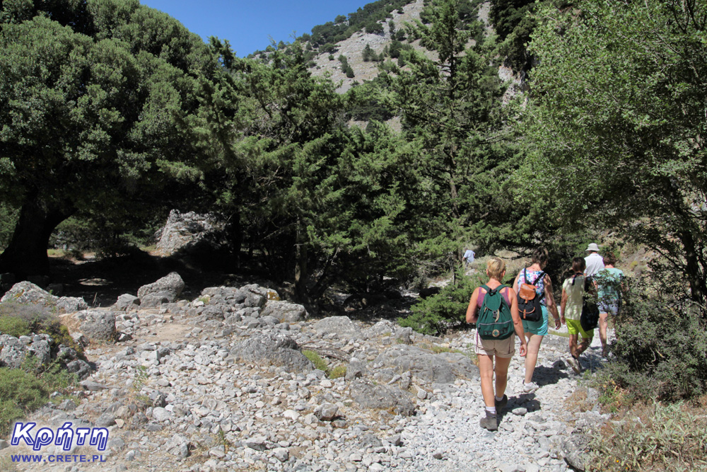
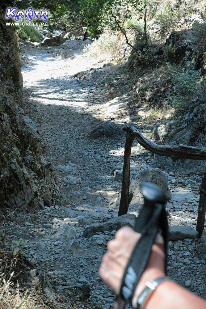
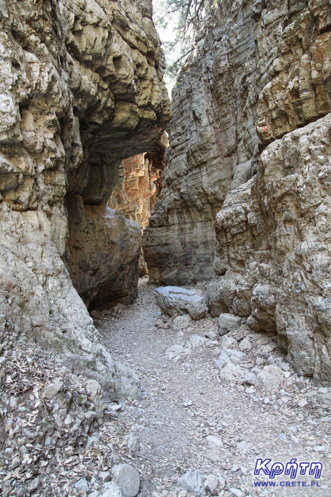
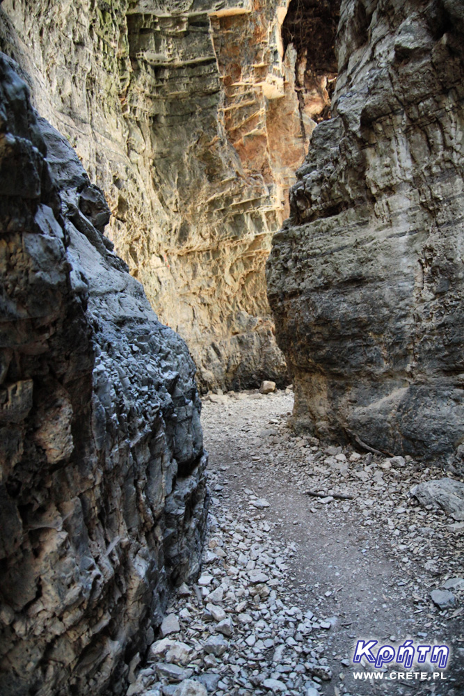
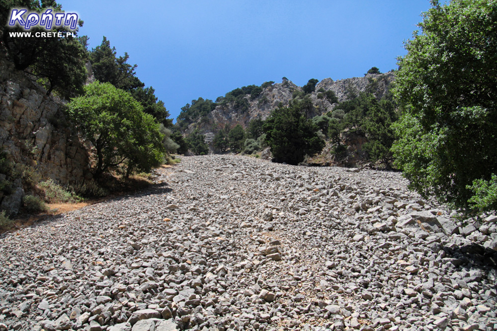
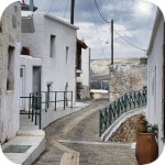
The rest of the route leading through the Imbros gorge is relatively easy. Although the route is not demanding, remember to take the right amount of water and wear suitable footwear. The trail is covered with sharp stones in many places, so trekking sandals are really a minimum. Of course, on the trail you can meet people who will go to this place in flip-flops or light sandals, but such cases are examples of extreme disregard for their own safety. Personally, we recommend footwear with covered fingers, sports shoes with a strong sole or even better approach shoes.
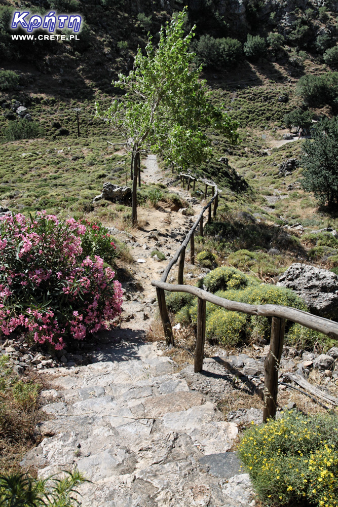
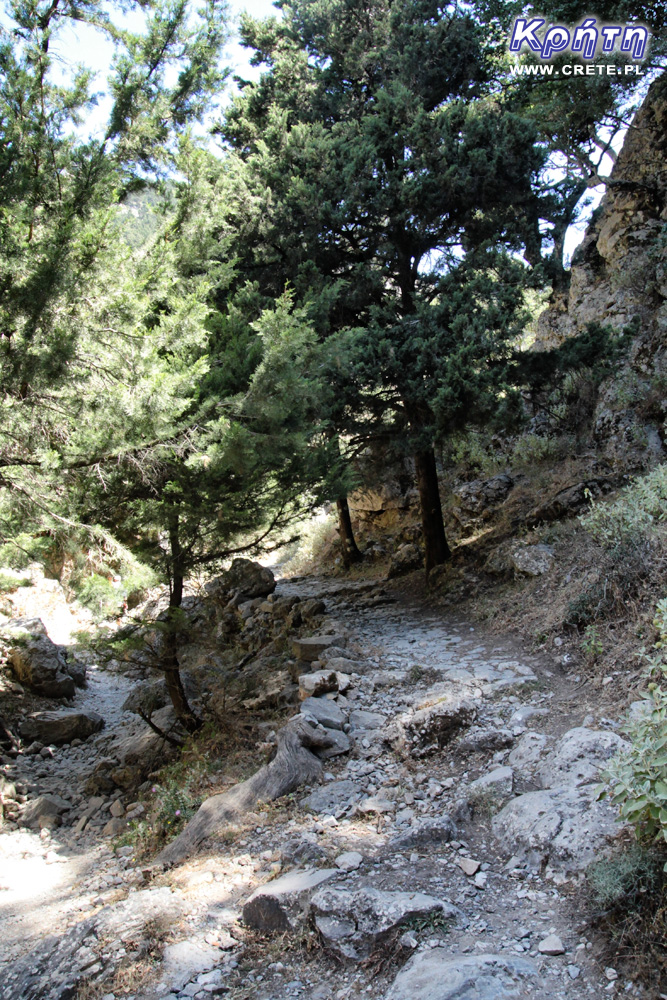
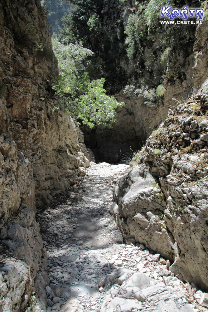
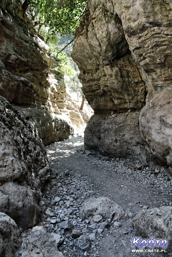
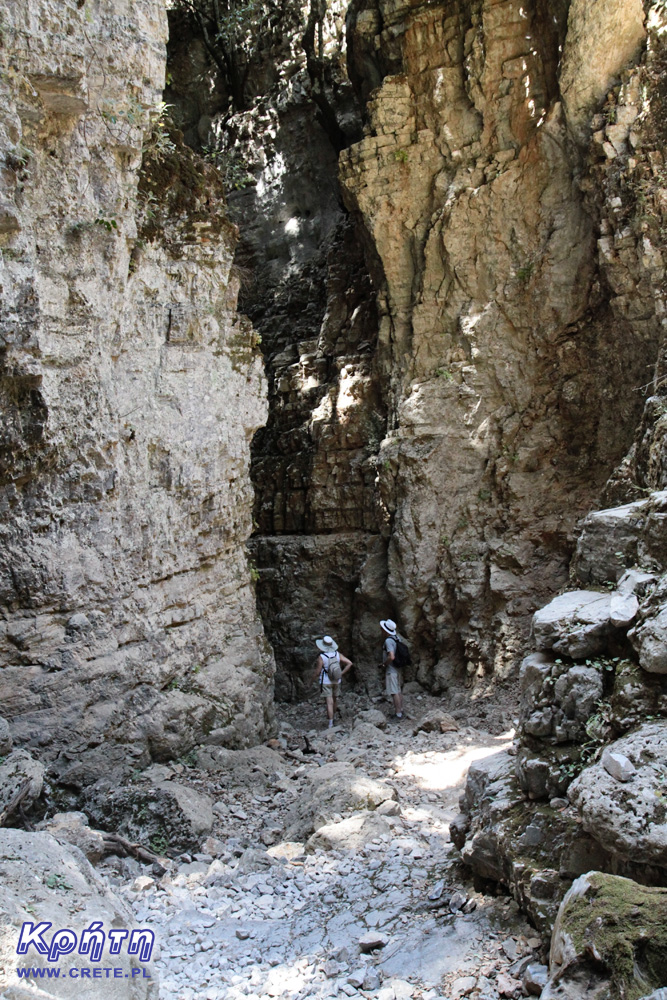
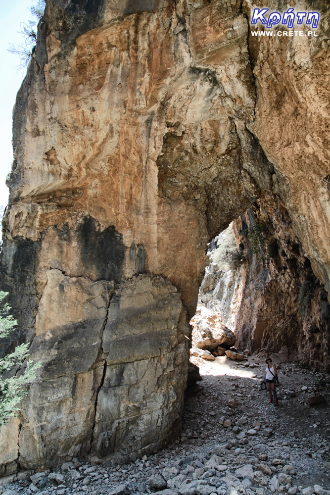
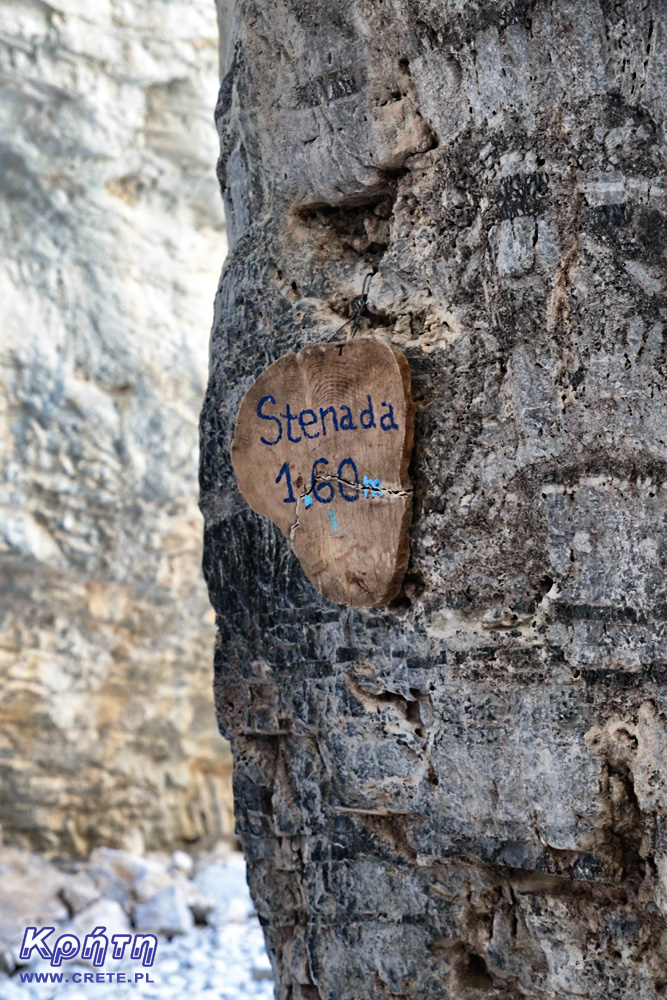
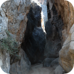
By defeating the following kilometers, it is clearly visible that the walls of the ravine are approaching each other. In two climatic places, they form narrow transitions, the width of which oscillates around 2 meters. The narrowest isthmus, which is marked with a wooden plaque, has a width slightly exceeding one and a half meters. These are the most spectacular places where tourists are willing to take pictures of themselves.
Even on hot days, a hike through this gorge should not be too tiring, because most of the trail leads shady places. The last stage, which is definitely a more extensive part of the ravine that gives no protection against the sun's rays, can be troublesome.
Logistics, i.e. I went through a gorge and what next
Some people take a trip through the Imbros gorge as a return trip. This is obviously much more tiring, but in this case the problem of returning to the car left at the entrance is eliminated.
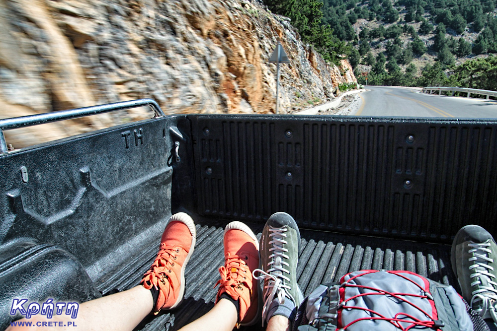
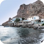
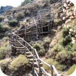
Another method is to leave the car in the parking lot next to the tavern at the beginning of the route, and then the gorge to the point where there is a pickup waiting for a taxi next to a small tavern to take the taxi that takes people to the top of the Imbros gorge.
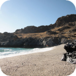
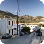
We have chosen another method. We left our car by the tavern at the end of the ravine, just outside the Komitades village. Then we got on a taxi-pickup and after a several-minute drive, which is a real attraction in itself, we went to the top of the ravine. We got off here and started descending down the Imbros gorge.
In both cases, the cost of a taxi-pickup is around € 20 per trip. This amount is divided by the number of people taken, so if you wait for someone who also wants to go the route, the unit cost of travel will be smaller.
Good advice
We have already written about the establishment of the appropriate footwear. It is also necessary to take the right amount of water, which is enough for you to pass the entire ravine. In our opinion, if you beat Imbros down, 1-1.5 liters of fluid per person should be enough. It is also worth taking with you the appropriate headgear and sunglasses.
History
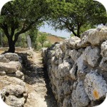
Afterby following the route leading along the bottom of the Imbros Gorge, you will surely notice the remains of the "girdle" of the road, which in the old days was one of the main routes connecting Sfaka to other parts of Crete. Fragments of this stone route give an idea of how much the isolated area was in the past. After the trip through the Imbros gorge, it should not come as a surprise that even at the time when Crete was under the rule of successive occupants, Sfakia enjoyed much greater freedom and independence than the area of the northern coast. The lack of convenient roads meant that the region was the perfect refuge for insurgents and people living outside the law.
The Imbros Gorge also appeared on the pages of the history of the Second World War. At the end of May 1941, after losing the battle for Crete, the trail through this gorge was one of the main escape routes for the Allied troops. About 20,000 soldiers defeated him, and more than half of them were embarked on ships that came to the port of Chora Sfakion. Today in this village there is a monument commemorating these events.
How to get
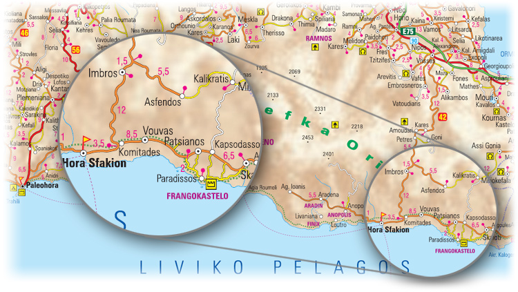
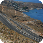
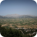
The vast majority of tourists going to the Imbros gorge arrives from the northern coast of Crete. The most convenient access is via the road that connects to the New National Road at the height of the town of Vryses located roughly halfway between Chania and Rethymnon.
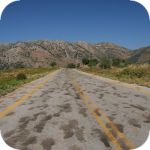
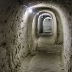
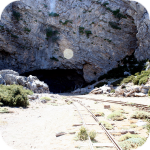
The road itself through the Imbros gorge is also noteworthy. In several places, new sections of the route were led through short tunnels carved in the mountain slope. The last section of the road are picturesque streamers, which are slowly descending towards the Libyan Sea.
west
central
east
Interesting places on Crete
↤ click the appropriate part of the island to change the bottom map
W 2002 roku Falasarna zdobyła tytuł najlepszej plaży w Grecji. Wyróżnienie to nie jest bynajmniej przypadkowe, gdyż miejsce to jak na standardy Krety jest naprawdę unikalne.
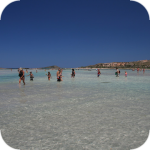
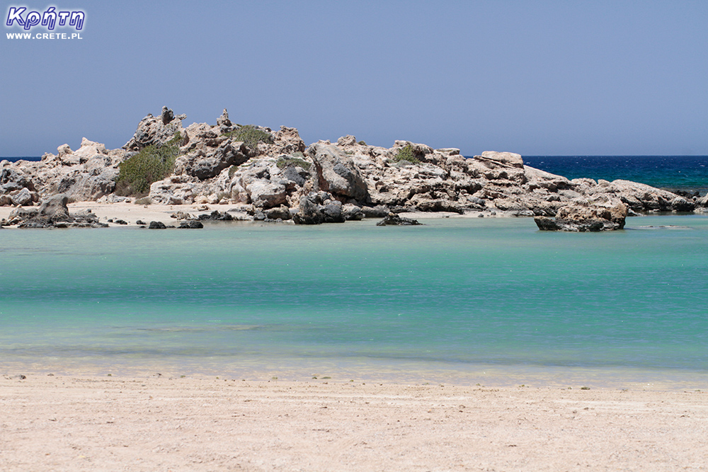
Elafonisi is a small island located at the end of the southwestern edge of Crete. A characteristic feature of Elafonisi is the shallow lagoon connecting it with Crete.
Elafonisi is a small island located at the end of the southwestern edge of Crete. A characteristic feature of Elafonisi is the shallow lagoon connecting it with Crete.
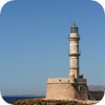
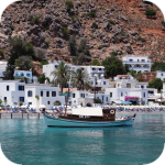
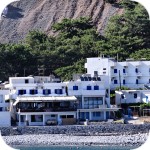
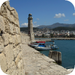
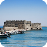
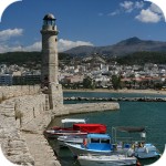
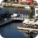
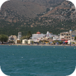
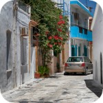
Chania (Χανιά) is the second largest (after Heraklion) city of Crete. The biggest advantage of Chania is the area of the Old Town and the beautiful Venetian Harbor.
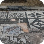
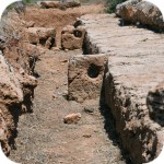
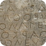
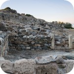
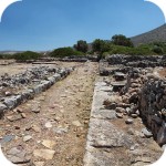
Aptera is a city whose history dates back to at least a thousand years before our era. In the peak period, about 20,000 lived in it. people, of which only 1/5 were free people.
Chania (Χανιά) is the second largest (after Heraklion) city of Crete. The biggest advantage of Chania is the area of the Old Town and the beautiful Venetian Harbor.
Omalos is a perfect starting point for exploring the Samaria Gorge. Located over 1,100 m above sea level extends over an area of 25 km2. Its size corresponds more or less to the size of the Lasithi Plateau.
Located 47 km from the city of Chania, it is the only freshwater lake in Crete. Its area is about 580 thousand. sqm. and the maximum depth is about 45 meters
Omalos is a perfect starting point for exploring the Samaria Gorge. Located over 1,100 m above sea level extends over an area of 25 km2. Its size corresponds more or less to the size of the Lasithi Plateau.
The steel crossing, which in the central part is separated from the ground by nearly 150 m, is at the leading position of the places where the longest bungee jumps are made.
Chania (Χανιά) is the second largest (after Heraklion) city of Crete. The biggest advantage of Chania is the area of the Old Town and the beautiful Venetian Harbor.
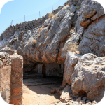
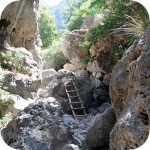
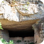
The cave is less than 1 km from Moni Gouvernetou Monastery. You will reach it using the pedestrian trail that has been marked out along the slope of the Avlaki Gorge.
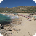
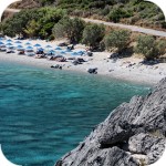
Balos is one of Crete's flagship beaches if not all of Greece. We can assure you that the landscapes you see during your trip to Balos will remain with you for a very long time.
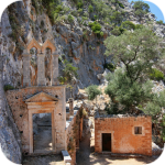
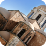
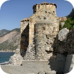
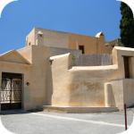
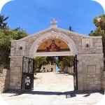
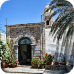
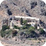
The Orthodox monastery of Agia Triada, located on the northern part of the Akrotiri peninsula, is one of the most beautiful and richest monasteries in Crete.
The Orthodox monastery of Agia Triada, located on the northern part of the Akrotiri peninsula, is one of the most beautiful and richest monasteries in Crete.
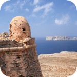
On the north-western coast of Crete, at the foot of the Gramovous peninsula, there are ruins of the ancient port of Korikos, later known as Falassarna.
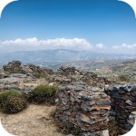
Polyrinia was one of the most important city-states of western Crete during the Hellenistic and Roman periods. It was built amphitheater on a steep hill, rising to a height of 481 meters above sea level
The island of Gramvousa, or in fact Imeri Gramvousa (Ήμερη Γραμβούσα), is an inseparable point of a trip that combines a stay in the Balos Lagoon with visiting the remains of a fortress located on the top of the island of Imeri Gramovousa.
There is a beach in Crete that literally makes some people shiver. This place is Seitan Limania which can be translated as Satan's Ports or Cursed Ports.
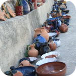
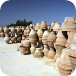
Dozens of craft workshops located in this small mountain village make Margarites one of the four main centers where traditional Cretan ceramics are made.
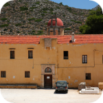
The date of the foundation of Moni Arkadiou (Arkadi) is not exactly known. According to tradition, the name of this church refers to the name of the Emperor Arkadiusz, who supposedly was to be its founder.
The date of the foundation of Moni Arkadiou (Arkadi) is not exactly known. According to tradition, the name of this church refers to the name of the Emperor Arkadiusz, who supposedly was to be its founder.
Rethymnon with around 40,000 inhabitants are the third largest city of Crete. This place was populated already in the Minoan period. Historically, the city was an important commercial center.
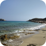
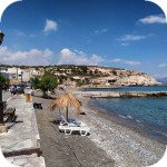
Skinaria is a small beach located along a small bay, whose outlet on both sides ends with a rocky coast. It is still a little-known place overlooked by mass tourism
Skinaria is a small beach located along a small bay, whose outlet on both sides ends with a rocky coast. It is still a little-known place overlooked by mass tourism
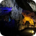
According to Greek mythology, Zeus hid (and perhaps even gave birth) in the Ida cave. This myth is the greatest asset of this cave, which is not as interesting and beautiful as the Dikte cave.
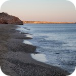
Tripiti is a small beach covered with a mixture of gray sand, gravel and stones. Despite the fact that the beach is unorganized and has a semi-natural appearance, one small tavern works here.
Tripiti is a small beach covered with a mixture of gray sand, gravel and stones. Despite the fact that the beach is unorganized and has a semi-natural appearance, one small tavern works here.
Tripiti is a small beach covered with a mixture of gray sand, gravel and stones. Despite the fact that the beach is unorganized and has a semi-natural appearance, one small tavern works here.
Plakias is a perfect place for people who like to spend time hiking. In the area of the town and the surrounding area, there are several hiking trails that lead to interesting beaches.
Currently, the lower monastery is still not open to the public and is not used by the monks. The buildings of the upper monastery have undergone partial renovation and are the main seat of the Preveli monastery.
Currently, the lower monastery is still not open to the public and is not used by the monks. The buildings of the upper monastery have undergone partial renovation and are the main seat of the Preveli monastery.
Currently, the lower monastery is still not open to the public and is not used by the monks. The buildings of the upper monastery have undergone partial renovation and are the main seat of the Preveli monastery.
The Kourtaliotiko Gorge, also known as the Asomatos Gorge, is perhaps one of the most spectacular natural attractions available in the central part of Crete.
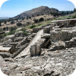
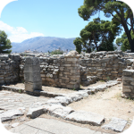
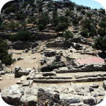
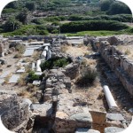
Agia Triada is a small Minoan archaeological site in the south of Crete, located near Timpaki, located on the western slope of the hill about 40 meters above sea level.
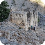
This fortress is a perfect example of Crete's multiculturalism. Located today in Greek hands, it was built by the Venetians, but is called a name taken from the Turkish language.
Rouvas Gorge is one of the most interesting places in this part of Crete. The interesting trail leads in a perfect way to the changing appearance of this gorge.
Matala is one of the most popular towns not only of the southern coast but also of the whole of Crete. In the 1960s and 1970s, this small fishing village was a mecca for hippies.
The Odigitrias Monastery is one of the most famous monasteries of southern Crete. Unfortunately, in terms of popularity, he is far from other Cretan monasteries.
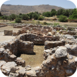
In addition to the famous grand palaces on the island in the Minoan period, a number of smaller residences were created. One of the most important examples is the Vathipetro discovered about 5 km north of Archanes, on the southeastern slope of Mount Juchtas in the central part of Crete.
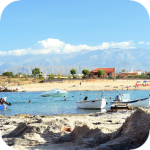
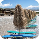
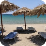
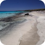
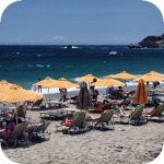
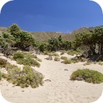
When traveling around Crete, it is not difficult to pay attention to the fact that most of the beaches there are relatively small and short. For this reason, people who are used to our national Baltic standards, where the sandy coast stretches for kilometers, may experience a special disappointment. However, fortunately, nothing is lost, because Crete in its rich arsenal of various beaches can boast of those that allow for long walks along the coast. One of them, our favorite is the Kommos beach located in the south of the central part of the island.
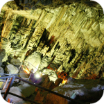
Although there are countless caves in Crete, only a few can be visited. Sfendoni is the largest cave open to the public. content comes from: http://www.crete.pl www.CRETE.pl
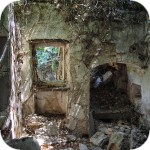
Only a few kilometers separate the bustling city of Rethymno from Mili, a village abandoned by its inhabitants. This place is also known as the village hidden in the gorge.
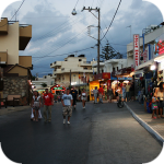
Information about one of the more known tourist cities of Crete, or about Malia. Description of attractions located in the city of Malia and a description of the specificity of this town.
The Lasithi Plateau is located about 70 kilometers from the capital of Crete - Heraklion. The average height at which the terrain of this plateau is located is 840 m above sea level.
One of the tourist attractions eagerly visited by people spending their holidays in Crete is the Dikte (Psychro) cave. The main factors that attract people to this cave are a rich and varied dripstone robe and a close connection with mythology.
Among the olive groves in the place called Logari, which is less than a kilometer from the village of Kritsa, there is a small Byzantine church of Panagia Kera from the 13th-14th centuries.
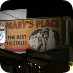
Stalida is located directly along the coast and is one of the most famous tourist destinations in Crete, which definitely comes alive with the advent of the tourist season
Most people crossing the route between Agios Nikolaos and Ierapetra will definitely notice the large crack which is marked by the mountain located east of this road. This majestic geological creation called Ha was probably created as a result of an earthquake.
Xerokambos is a small settlement in which you will find literally several taverns, and most of the buildings are single-storey and one-story houses. The big advantage of this beach is a gentle sandy descent to the sea.
Agios Nikolaos (Άγιος Νικόλαος) is a small town with less than 20,000 inhabitants. permanent residents (according to statistical data from 2001). This city is the capital of the Lasithi nomos.
Although Elounda seems to be a sleepy fishing town to this day, however, appearances should not fool you, because this town and its surroundings can boast of probably the largest number of the best hotels.
Although Elounda seems to be a sleepy fishing town to this day, however, appearances should not fool you, because this town and its surroundings can boast of probably the largest number of the best hotels.
Stalida is located directly along the coast and is one of the most famous tourist destinations in Crete, which definitely comes alive with the advent of the tourist season
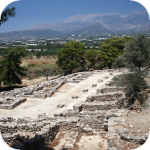
Zakros is the fourth-largest Minoan palace in Crete in importance and size. This latest found, built on the east coast of the island is located in the village of Káto Zákros.
Zakros is the fourth-largest Minoan palace in Crete in importance and size. This latest found, built on the east coast of the island is located in the village of Káto Zákros.
The first palace was built around 1900 BC. in the place where there was a quite impressive settlement whose remains were later transformed into the central part of the city.
The ruins of the ancient city of Itanos are located at the eastern tip of Crete, less than 3 kilometers north of the famous palm beach of Vai. Although there are also nice beaches at Itanos, unlike its well-known neighbor, this place does not attract crowds. There are either accidental stray tourists or excavation enthusiasts here.
Less than 10,000 population of Sitia makes the city the smallest in Crete. Some even go a step further and say perversely that it is rather the largest village of Crete.
Napoleon's house is one of the few typically tourist attractions in Ierapetra. About what could have happened here in the summer of 1798 and possibly how much in this legend is the truth we write in the article on the page below.
Moni Kapsa Monastery is one of the most interesting monasteries in Crete. Its massive buildings were erected on rocky, gray slopes surrounding the nearby Pervolakia Gorge.
Faktycznie wąwóz Imbros wywarł na nas ogromne wrażenia, które na długo zostaną w naszej pamięci! Kojarzył mi się z wąwozem Wadi Rum z Jordanii, tylko kolorystyka inna. Bardzo dziękujemy za rady z taxi pickupem, były nie ocenione. Wąwóz wydawał się jedynie nasz i okolicznych kóz (mimo iż była to połowa lipca), gdyż po drodze minęliśmy bodaj tylko 3 osoby i chyba z 10 niezwykle sympatycznych pozujących do zdjęć kóz!
Sam przejazd z Komitades na pace pickupa również jest fajnym przeżyciem. Ceny transportu są chyba jednak ruchome, gdyż koszt przejazdu niby faktycznie wynoszący 20E nagle wzrósł, kiedy zebrało się więcej chętnych i cena już wyniosła 5E od osoby a było nas (wraz z rodziną z Belgii) siedmioro. Kierowca powiedział nam, że rusza w drogę z minimum 4 osobami i wtedy przejazd kosztuje faktycznie 20E, czyli i tak 5E/os. Maksymalnie zabiera do chyba 11 osób i wtedy również każdy płaci po 5E.
Sama droga nie jest męcząca i wiedzie często w zacienionych miejscach, jednak również przestrzegam przed zbyt lekkim obuwiem, bo droga jest bardzo kamienista i łatwo skręcić kostkę. Ponadto miękka podeszwa to nie jest dobry pomysł w żadne góry.
gość kalva
2017-07-14 21:46:07
droga
Ile czasu zajmie droga z Retimno do wąwozu Imbros?
Z góry dzięki za pomoc
Gosia | crete.pl
2017-07-14 23:09:46
odp. droga
Licząc z centrum miasta do górnego wejścia do wąwozu to około 50 km, na dojazd trzeba liczyć około godzinę.
gość kalva
2017-07-15 09:56:16
droga
Dzięki za info
Ale czy w godzinę przejedzie się przez te serpentyny - przynajmniej na mapie tak to wygląda?
Czy to jest droga przez góry?
gość kalva
2017-07-15 17:41:35
droga 2
A czy jest to droga przez góry?
Jest bardzo pokrecona czy to serpentyny?
Gosia | crete.pl
2017-07-15 19:00:34
droga odp
Samochód zostawiasz we wsi Imbros przy górnej części wąwozu więc jeszcze przed tymi serpentynami. Dzięki temu schodzisz wąwozem w dół. Jeśli chciałabyś wejść do wąwozu od drugiej strony to trzeba dojechać mniej więcej do wsi Komitades, gdzie jest wyjście. Wtedy też czas dojazdu będzie dłuższy właśnie przez te serpentyny. Przy czym w tej opcji idziesz wąwozem pod górę.
Góry są ale niewysokie. :)
gość kalva
2017-07-15 23:26:51
droga3
Gosia, pięknie dziękuję za informacje
Pozdrawiam
Wypełnij poniższy formularz aby dodać komentarz
lub kliknij w poniższy link aby skorzystać z możliwosci komentowania przez facebooka: https://www.facebook.com/crete.poland/posts/10154561293342551
The Agia Irini gorge, located a short distance from the village of Sougia, is one of the most popular hiking destinations organized in this area of Crete. The approximately 10 km long trail is a great alternative for all of these. who do not want to or cannot afford to cross the Samaria Gorge.
Most people crossing the route between Agios Nikolaos and Ierapetra will definitely notice the large crack which is marked by the mountain located east of this road. This majestic geological creation called Ha was probably created as a result of an earthquake. The total length of the ravine is just over 1.5 km. Despite the fact that it is so perfectly visible, it still remains one of the wildest nooks in Crete. A few-meter rocky steep that forms the mouth of this gorge, effectively deters most visitors. Only people who have knowledge about climbing and having the necessary climbing equipment will be able to fully enjoy the beauty of this place.
Samaria is one of the places we often devote a place to on our site. This gorge is not without exaggeration is considered one of the biggest attractions of the western part of Crete. Every year in high season it is visited by even over a thousand people a day. Its popularity was influenced not only by the natural beauty of this place, but also by the name of the longest gorge in Europe. Although there is already a guide on our site, in which we described in detail the trip from Paleochora to the Samaria Gorge, we decided to supplement it with an additional article. Below you will find detailed information on how to organize this trip yourself from some of the more important towns of central and western Crete.
gość PiotrWie Jeździliśmy na Kretę od 2008r, bywały lata że byliśmy w kilku kawałkach w sumie czterdzieści kilka dni ( samoloty z Wrocławia latały w piątek wieczorem tak że można było polecieć po pracy, powrotem był w poniedziałek w nocy więc za 11 dni urlopu można było być 17 dni, jak się zaplanowało z jakimś świętem to można było być 2 x 17 dni i raz 10 dni) i z roku na rok było coraz więcej ludzi - nie tylko na plażach ale ... (...)
Czy wyspa jest w stanie pomieścić 15 mln turystów, zapewne tak. Pytanie moje: skąd będzie woda?! Jak już brakuje, tama na Aposelemis sucha, gdzie ścieki popłyną, gdzie będą składowane śmieci??? Smutne, że wyspa zamienia się na globalną destynację.. rozumiem, że pieniądze są ważne ale żeby dewastować naturalne tereny np.triopetra, plakias etc... przykro
Można próbować zrozumieć ludzi, którzy z tego żyją. Można też puścić ludzi na żywioł i nie zajmować się takimi głupotami, jak ofiary śmiertelne. Samaria nie jest szlakiem w 100% bezpiecznym (który szlak jest), to głęboki wąwóz, narażony na erozyjne osunięcia skał. Poza ty, to jest region aktywny sejsmicznie i dość kapryśny pogodowo.
Myślę, że tu nie ma miejsca na ustępstwa. (...)
gość PiotrWie Dziś po raz pierwszy ( a jeździmy dużo od 2008 roku i dużo chodzimy po szlakach) widzieliśmy w Grecji ekipę przygotowującą szlak do sezonu. Nie była to co prawda zbyt duża ekipa - dwie osoby z motyką, sekatorem i niewielką piłą ręczną - ale zawsze coś - na wyspach Kanaryjskich ekipa to pierwszy z kosą spalinową a zanim kilka osób zmiatających resztki na bok. (...)


Komentarze
Wąwóz jak z bajki
Faktycznie wąwóz Imbros wywarł na nas ogromne wrażenia, które na długo zostaną w naszej pamięci! Kojarzył mi się z wąwozem Wadi Rum z Jordanii, tylko kolorystyka inna. Bardzo dziękujemy za rady z taxi pickupem, były nie ocenione. Wąwóz wydawał się jedynie nasz i okolicznych kóz (mimo iż była to połowa lipca), gdyż po drodze minęliśmy bodaj tylko 3 osoby i chyba z 10 niezwykle sympatycznych pozujących do zdjęć kóz!
Sam przejazd z Komitades na pace pickupa również jest fajnym przeżyciem. Ceny transportu są chyba jednak ruchome, gdyż koszt przejazdu niby faktycznie wynoszący 20E nagle wzrósł, kiedy zebrało się więcej chętnych i cena już wyniosła 5E od osoby a było nas (wraz z rodziną z Belgii) siedmioro. Kierowca powiedział nam, że rusza w drogę z minimum 4 osobami i wtedy przejazd kosztuje faktycznie 20E, czyli i tak 5E/os. Maksymalnie zabiera do chyba 11 osób i wtedy również każdy płaci po 5E.
Sama droga nie jest męcząca i wiedzie często w zacienionych miejscach, jednak również przestrzegam przed zbyt lekkim obuwiem, bo droga jest bardzo kamienista i łatwo skręcić kostkę. Ponadto miękka podeszwa to nie jest dobry pomysł w żadne góry.
droga
Ile czasu zajmie droga z Retimno do wąwozu Imbros?
Z góry dzięki za pomoc
odp. droga
Licząc z centrum miasta do górnego wejścia do wąwozu to około 50 km, na dojazd trzeba liczyć około godzinę.
droga
Dzięki za info
Ale czy w godzinę przejedzie się przez te serpentyny - przynajmniej na mapie tak to wygląda?
Czy to jest droga przez góry?
droga 2
A czy jest to droga przez góry?
Jest bardzo pokrecona czy to serpentyny?
droga odp
Samochód zostawiasz we wsi Imbros przy górnej części wąwozu więc jeszcze przed tymi serpentynami. Dzięki temu schodzisz wąwozem w dół. Jeśli chciałabyś wejść do wąwozu od drugiej strony to trzeba dojechać mniej więcej do wsi Komitades, gdzie jest wyjście. Wtedy też czas dojazdu będzie dłuższy właśnie przez te serpentyny. Przy czym w tej opcji idziesz wąwozem pod górę.
Góry są ale niewysokie. :)
droga3
Gosia, pięknie dziękuję za informacje
Pozdrawiam
Wypełnij poniższy formularz aby dodać komentarz
lub kliknij w poniższy link aby skorzystać z możliwosci komentowania przez facebooka:
https://www.facebook.com/crete.poland/posts/10154561293342551