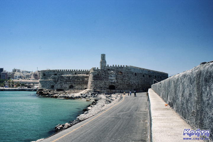
One of the typical paths that tourists visiting Heraklion are following leads through 25 August (odos 25 Avgoustou), which is one of the representative promenades of this city. Its beginning is marked by the square Elefterios Venizelos (Ελευθέριος Βενιζέλος), where the Morsini Fountain is located, and the end is the main pool of the old Venetian port. Going down this street towards the well-visible sea you will arrive directly in front of the Venetian fortress of Koules. It is one of the most characteristic monuments of Heraklion. In ancient times, it was part of the fortifications that once formed a sealed ring girdling the capital of Crete. Although today this building has only a historical function, it still perfectly reminds of the power of Venetians who ruled Crete during the period of splendor of this fortress.
This fortress is a perfect example of Crete's multiculturalism. Located today in Greek hands, it was built by the Venetians, but is called a name taken from the Turkish language. Koules is derived from the words of Su Kulesi, which signify the Water Tower. Through the Venetians this building was called the sea fortress - Castello del Molo or Rocca a Mare.
Unfortunately, the exact history of this place has not survived to this day. Certainly, some fortifications were guarded long before the current fortress of access to the port. On the basis of several surviving sketches and not very precise descriptions, we know that it was probably a kind of tower with a round or oval base, which was called castellum comunis . The oldest image of these fortifications was immortalized in the image of the Florentine monk Cristoforo Buondelmonti in 1429.
In 1462, the Venetian Senate approved a plan to build fortifications around Heraklion. A wide range of works envisaged in this ambitious project also included the reconstruction of the existing tower, which was far from the battlefield reality of Europe at that time. However, the Castellum Comunis, which was still rebuilt, lasted until 1523, when the Venetians finally exhausted the possibilities of further adapting the building. The port tower was completely demolished revealing a natural rocky platform. The current fortress was built here.
Work on Koules lasted seventeen years until 1540. Long construction time should not be surprising when you look closely at the parameters of this fortress. The outer walls have a thickness of almost 9 meters, and the thickness of the internal walls reaches up to 3 meters in some places. The work also extended the strengthening of foundations permanently damaged by the sea. For the creation of breakwaters, the Venetians used an innovative technique involving the sinking of old ships filled with stones, which were obtained from the island of Dia located a short distance from Heraklion .
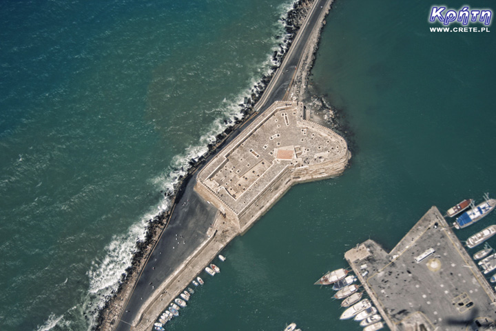
The total area occupied by two wings of the fortress is 3600 m2. The slightly higher south-western part has a rectangular section, while the lower north-east has an elliptical contour. Three entrances led to the fortress, of which the western one was treated as the main gate. The other two entrances located in the north and south-west sides of the fortress were treated as auxiliary gates. Of course, the symbol of the Venetian Republic, the winged lion of St. Mark. These two bas-reliefs can be admired to this day.
There are 26 rooms on two floors of Koules. Originally, in the lower storey of the fortress there were five rooms (casemates) in which the cannons were placed. On the ground floor there were also munitions warehouses, food depots and a prison. In order to ensure maximum autonomy in Koules rooms, there was room for a separate mill, bakery and even a chapel. In the upper tier of the fortress, rooms of soldiers and officers constituting the cast of the garrison were located.
les "width =" 720 "height =" 480 "/>
Although even from the perspective of today, the fortress seems to be a well thought-out well-functioning building, however, its design unfortunately suffered from many errors. Already in the initial period of use, it turned out that the arrangement of cannons in the lower storey was not a happy solution. Narrow shooting holes did not allow for good observation of the foreground, and thus it was not possible to conduct effective firing of the opponent. It is worth noting that the black powder used at the time by the artillery burned out, emitting clouds of black, acrid smoke. This was a very big problem, because after a few cannon fires this smoke tightly filled the cases, thus preventing the cast from performing further tasks. The only sensible solution eliminating this disadvantage was the transfer of cannons to platforms, which were placed on top of the fortress.
Koules' weaknesses have also been noticed by Turkish troops, which from 1646 have besieged Heraklion for over 20 years. Already in the initial stage of fighting, this fortress was effectively eliminated by the Turkish artillery and the Venetians lost control over entering the port.
Over the next several hundred years, the fortress, without major modifications, was also used by Turkish troops occupying Crete. During this period, the characteristic toothed finials of the walls, the so-called blanks, were expanded. On the upper level, a small mosque was built near the tower. One of the major changes introduced by the Ottoman army in the fortification system surrounding Heraklion was the construction of a smaller twin fortress called the Little Koules. This fortification was located directly on land next to the Venetian arsenals. Reconstruction of the street network of Heraklion, which was conducted just before the outbreak of World War II, forced the demolition of this building with a part of the Venetian Arsenal, whose remains can be admired to this day.


Unfortunately, currently (as at the beginning of 2014), Koules is still not open to tourists. It's a shame because from the top of this fortress there is a beautiful panorama of the entire port of Heraklion . In previous years during the holiday season, the fortress could be visited daily from 8.30 to 19.00. The interior of Koules, except for very few exhibits, is completely empty, but the reasonably priced ticket price (€ 2) more than compensated for this defect. For our part, we recommend visiting this fortress ... of course, how the renovation will be completed.
The fortress is located in the old port area of Heraklion. Arriving by car to this place, especially on weekdays, may involve traffic in traffic jams, which are quite typical of the capital of Crete. However, if you decide to take such a step, it is definitely the best solution to enter Heraklion by the road leading to the new port. After reaching the intersection located just in front of its gate, turn left. Look out for free parking spaces, which are located further down this street, on the section before the visible from the distance the Venetian Arsenals. We suggest leaving the car here, and continue on foot. Please note that this part of Heraklion is subject to paid parking, so you do not need to pay for a parking ticket if you do not have to pay for additional costs associated with the ticket.
A much better option will be walking to Koules from the central part of Herkalion . It is worth to attach it as one of the points of a trip around this city.
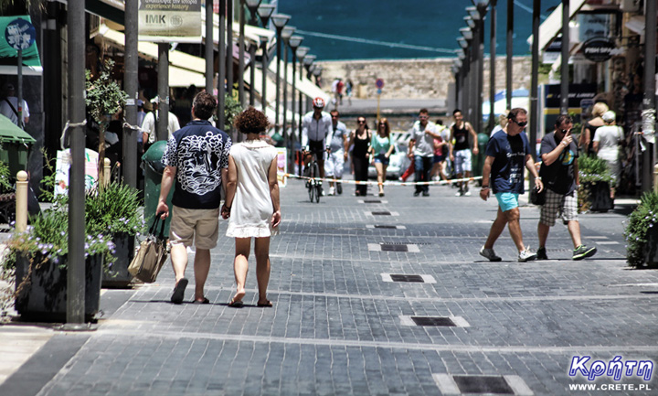
25 Sierpnia Street - one of the main pedestrian streets of Heraklion that connects Elefterios Venizelos Square with the old Venetian Harbor
↤ click the appropriate part of the island to change the bottom map
Knossos is one of the flagship monuments visited by tourists, it is also the most popular place where organized trips go.
Heraklion (Iraklion) is the largest city of Crete. With almost 140,000 inhabitants, it is the fourth largest city in Greece.
Dozens of craft workshops located in this small mountain village make Margarites one of the four main centers where traditional Cretan ceramics are made.
International airport. Nikos Kazantzakis in Heraklion is currently the largest airport in Crete.
Heraklion (Iraklion) is the largest city of Crete. With almost 140,000 inhabitants, it is the fourth largest Greek city.
The date of the foundation of Moni Arkadiou (Arkadi) is not exactly known. According to tradition, the name of this church refers to the name of the Emperor Arkadiusz, who supposedly was to be its founder.
The date of the foundation of Moni Arkadiou (Arkadi) is not exactly known. According to tradition, the name of this church refers to the name of the Emperor Arkadiusz, who supposedly was to be its founder.
Rethymnon with around 40,000 inhabitants are the third largest city of Crete. This place was populated already in the Minoan period. Historically, the city was an important commercial center.
Thrapsano is a small town inhabited by slightly over 2,500 people, the vast majority of which until recently maintained their activity as a potter.
Skinaria is a small beach located along a small bay, whose outlet on both sides ends with a rocky coast. It is still a little-known place overlooked by mass tourism
Skinaria is a small beach located along a small bay, whose outlet on both sides ends with a rocky coast. It is still a little-known place overlooked by mass tourism
According to Greek mythology, Zeus hid (and perhaps even gave birth) in the Ida cave. This myth is the greatest asset of this cave, which is not as interesting and beautiful as the Dikte cave.
Tripiti is a small beach covered with a mixture of gray sand, gravel and stones. Despite the fact that the beach is unorganized and has a semi-natural appearance, one small tavern works here.
Tripiti is a small beach covered with a mixture of gray sand, gravel and stones. Despite the fact that the beach is unorganized and has a semi-natural appearance, one small tavern works here.
Tripiti is a small beach covered with a mixture of gray sand, gravel and stones. Despite the fact that the beach is unorganized and has a semi-natural appearance, one small tavern works here.
Plakias is a perfect place for people who like to spend time hiking. In the area of the town and the surrounding area, there are several hiking trails that lead to interesting beaches.
Currently, the lower monastery is still not open to the public and is not used by the monks. The buildings of the upper monastery have undergone partial renovation and are the main seat of the Preveli monastery.
Currently, the lower monastery is still not open to the public and is not used by the monks. The buildings of the upper monastery have undergone partial renovation and are the main seat of the Preveli monastery.
Currently, the lower monastery is still not open to the public and is not used by the monks. The buildings of the upper monastery have undergone partial renovation and are the main seat of the Preveli monastery.
The Kourtaliotiko Gorge, also known as the Asomatos Gorge, is perhaps one of the most spectacular natural attractions available in the central part of Crete.
Agia Triada is a small Minoan archaeological site in the south of Crete, located near Timpaki, located on the western slope of the hill about 40 meters above sea level.
Około 60 kilometrów na południowy zachód od stolicy Krety - Heraklionu znajdują się ruiny drugiego co do wielkości starożytnego pałacu - Fajstos.
Currently, Melidoni Cave (originally called Gerontospilios) is associated mainly with the tragic events that took place here in 1824.
This fortress is a perfect example of Crete's multiculturalism. Located today in Greek hands, it was built by the Venetians, but is called a name taken from the Turkish language.
It is one of the most important and largest museums in Greece and one of the most important in Europe.
Tylissos is one of the few places in Crete that has kept its name since ancient times.
Plaża w Damnoni jest położona po sąsiedzku z Plakias - popularną turystyczną miejscowością
Agios Pavlos is a small town located on the southern coast of Crete near Saktouria.
Triopetra is located at the foot of the Siderotas mountain about 52 km south of Rethymno.
gia Galini (Αγία Γαλήνη) jest jednym z najpopularniejszych nadmorskich kurortów na południowym wybrzeżu Krety.
The observatory is located at the top of the Skinakas mountain at an altitude of 1750 m. The idea for its construction was born in 1984.
The Late-Romanesque cemetery in Armeni is located on the outskirts of this town, located less than 10 km south of the center of Rethymno.
The museum presents the dramatic history of Crete written over the last several hundred years.
The modern settlement known as Argyroupolis was built on the site of the ancient city of Lappa (also called Lambi)
Lentas is a good idea for those who want to get away from villages steeped in industrial tourism.
This ancient quarry, consisting of two parts by modern times, is called Λαβυρινθάκι and Λαβύρινθος.
If anyone of you is looking for a good restaurant near Matala and Kalamaki, then we would like to recommend estiório Chrisopigi.
Psiloritis (Timios Stavros - Holy Cross) is the top of the highest mountain of Crete, rising to 2456 m above sea level.
Rouvas Gorge is one of the most interesting places in this part of Crete. The interesting trail leads in a perfect way to the changing appearance of this gorge.
Matala is one of the most popular towns not only of the southern coast but also of the whole of Crete. In the 1960s and 1970s, this small fishing village was a mecca for hippies.
The Odigitrias Monastery is one of the most famous monasteries of southern Crete. Unfortunately, in terms of popularity, he is far from other Cretan monasteries.
Kali Limenes (meaning Dobre Porty or Piękny Przystanie) is a coastal town located in the Asterousia Mountains on the southern coast of Crete.
In addition to the famous grand palaces on the island in the Minoan period, a number of smaller residences were created. One of the most important examples is the Vathipetro discovered about 5 km north of Archanes, on the southeastern slope of Mount Juchtas in the central part of Crete.
When traveling around Crete, it is not difficult to pay attention to the fact that most of the beaches there are relatively small and short. For this reason, people who are used to our national Baltic standards, where the sandy coast stretches for kilometers, may experience a special disappointment. However, fortunately, nothing is lost, because Crete in its rich arsenal of various beaches can boast of those that allow for long walks along the coast. One of them, our favorite is the Kommos beach located in the south of the central part of the island.
Although there are countless caves in Crete, only a few can be visited. Sfendoni is the largest cave open to the public. content comes from: http://www.crete.pl www.CRETE.pl
The old Venetian port and the lighthouse are one of the most recognizable elements of Rethymno.
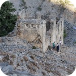
Agia Roumeli is the end point of the Samaria National Park route. Most people, after several kilometers of walking through the gorge, only dream of reaching the white buildings of the village, regenerating their strength and jumping into the sea. However, if, after passing Samaria, someone still has a lot of energy and enough time before the ferry leaves, we suggest entering the Turkish fortress located just above the village. To see its massive walls, just look up as you stroll through the streets of this village.
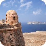
Gramvousa Island, or in fact Imeri Gramvousa (Ήμερη Γραμβούσα), is an inseparable point of a trip that combines a stay in the Balos Lagoon with visiting the remains of a fortress located on the top of Gramovousa. This is one of the most popular tourist trips in Crete.
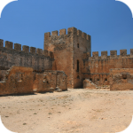
Frangokastello is a small fortress that was built by the Venetians over four years from 1371. Initially, the castle was named after Saint Nikitas, but the local population, who did not like the Venetians, renamed the castle at Frangokastello, or the Franks Castle (a Catholic foreigner). The name was so good that in time the Venetians also treated it as officially in force.
Komentarze
Wypełnij poniższy formularz aby dodać komentarz