Serwis wymaga plików cookies do prawidłowego działania strony. Korzystanie z serwisu bez zmiany ustawień dla plików cookies oznacza, że będą one zapisywane w pamięci urządzenia. Ustawienia te można zmieniać w przeglądarce internetowej.
The best Polish website dedicated to the Greek island Crete and to a small extent of continental Greece. You will find useful information related to visiting Crete that goes beyond the offer of optional tours. On the website you will also find descriptions of the most interesting places that we visited by visiting this largest Greek island. The content complements the current news, photographs and recipes of Greek cuisine.
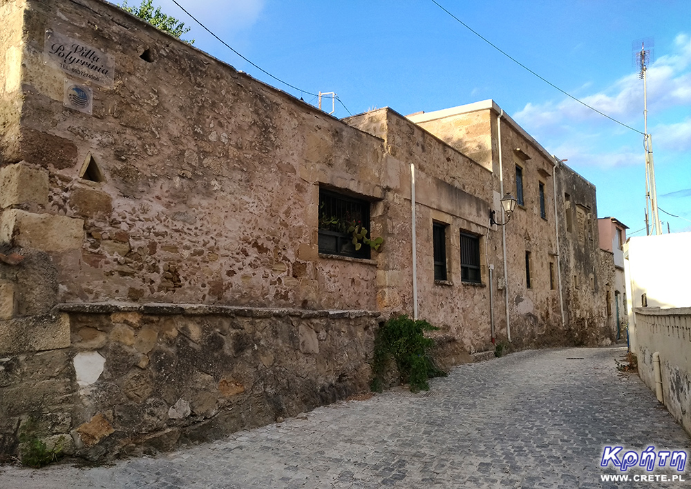
The region of western Crete abounds primarily in natural attractions. The most beautiful Cretan beaches, mountains, gorges are places attracting crowds of tourists and supporters of active leisure every year. On the other hand, lovers of history and excavations in this region do not have much to watch. In fact, apart from Aptera or excavations in Falassarna, there are no major archaeological sites here. Smaller traces of the past are of course spread all over the island, but in the western part you will not find magnificent Minoan palaces or villas. Therefore, archeology fans in this area of Crete should pay attention to the remains of ancient Polyrinia. Although it is one of the most interesting archaeological sites, it still remains little known among tourists.
Polyrinia (Polirinia, Polyrrhenia, Polirrinia) is located about 45 km west of Chania. To get here, head towards Kissamos, where at the beginning of the village you should look for a signpost for Polyrinia. After leaving the New National Road less than 8 km separating it from Kissamos you have to overcome a narrow winding road that climbs the surrounding hills.
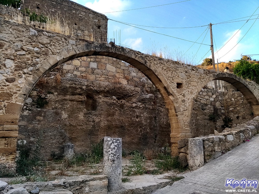
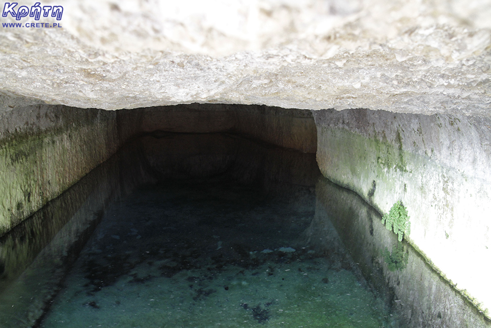
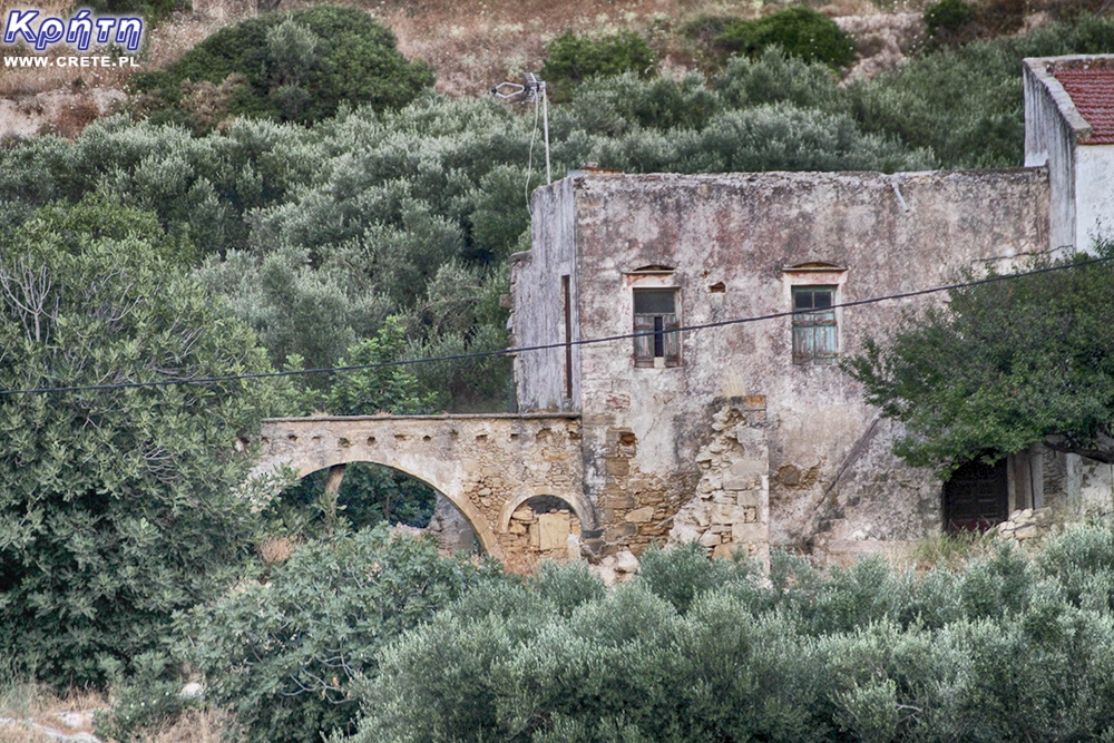
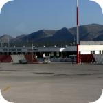
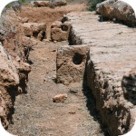
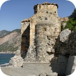
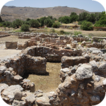
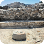
Roman aqueduct
History of the city of Polyrinia
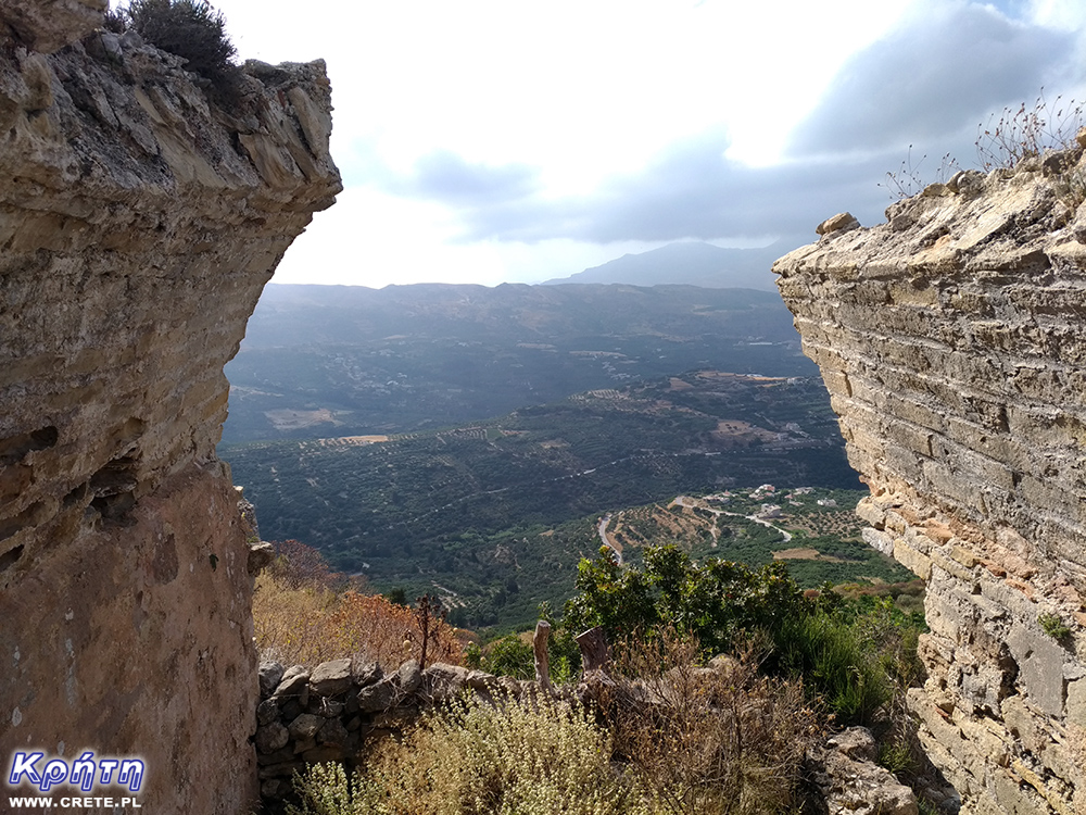
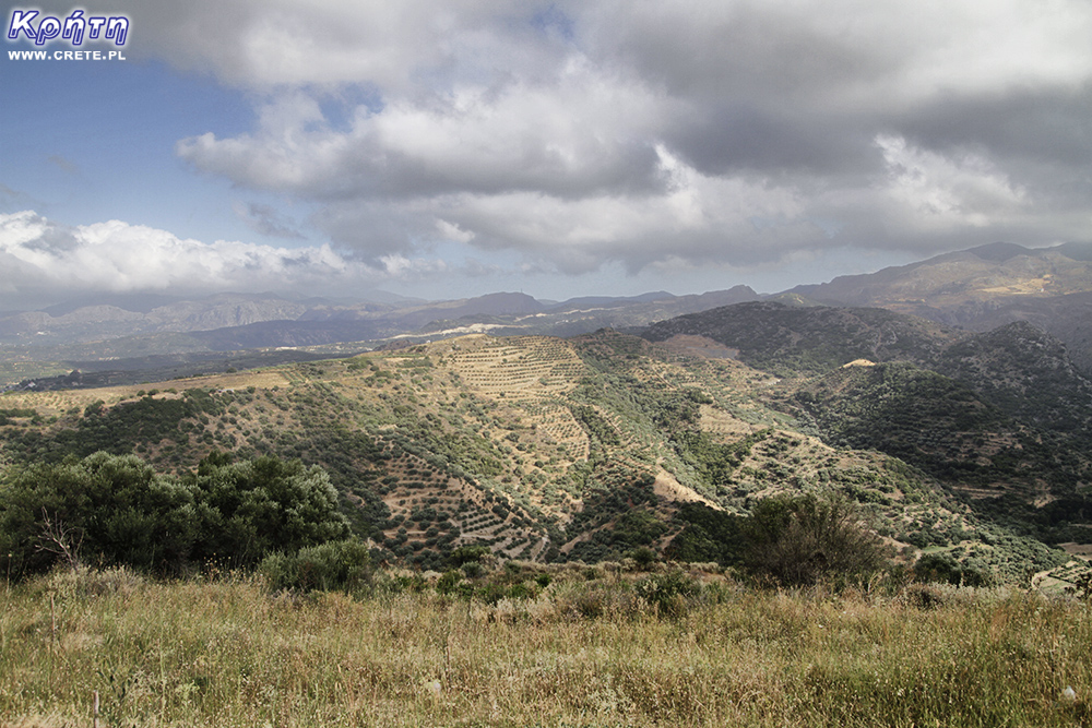
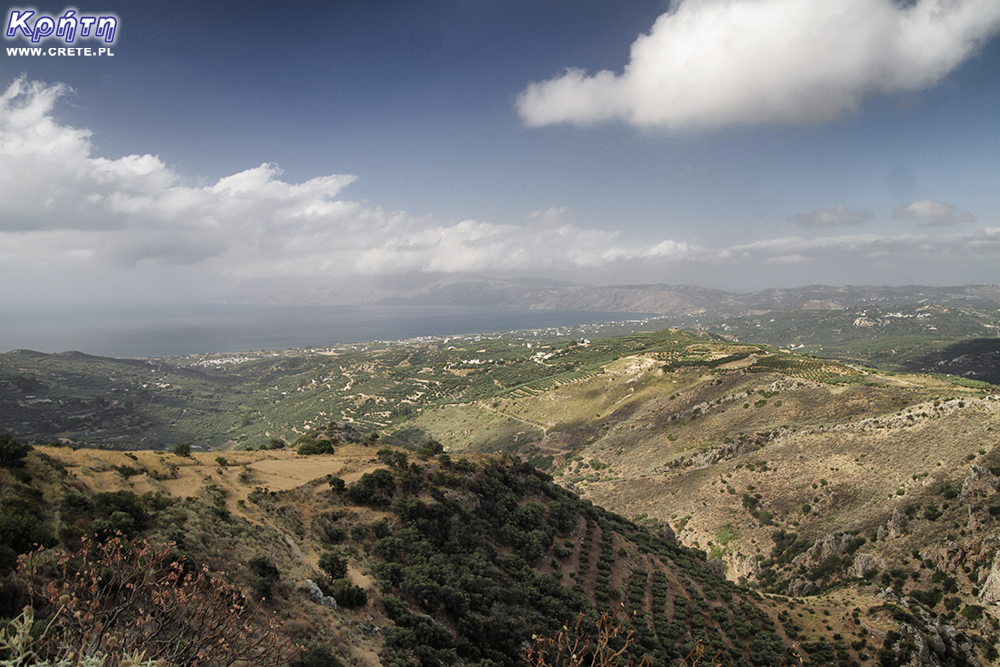
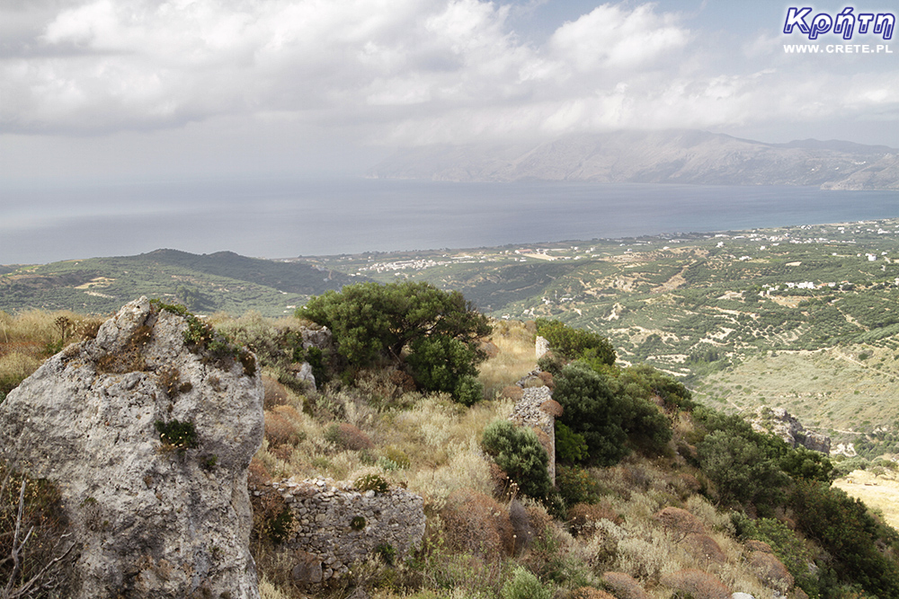
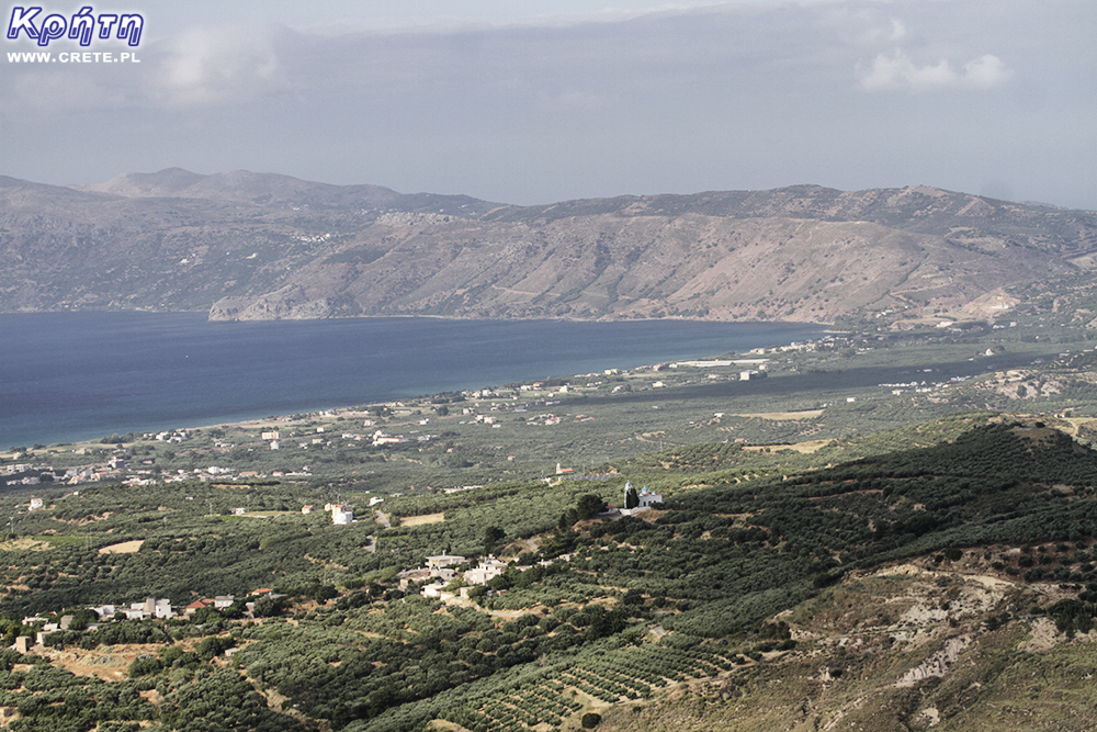
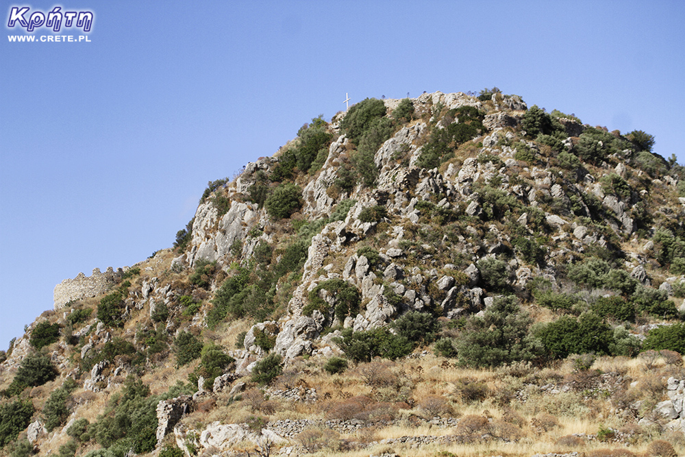
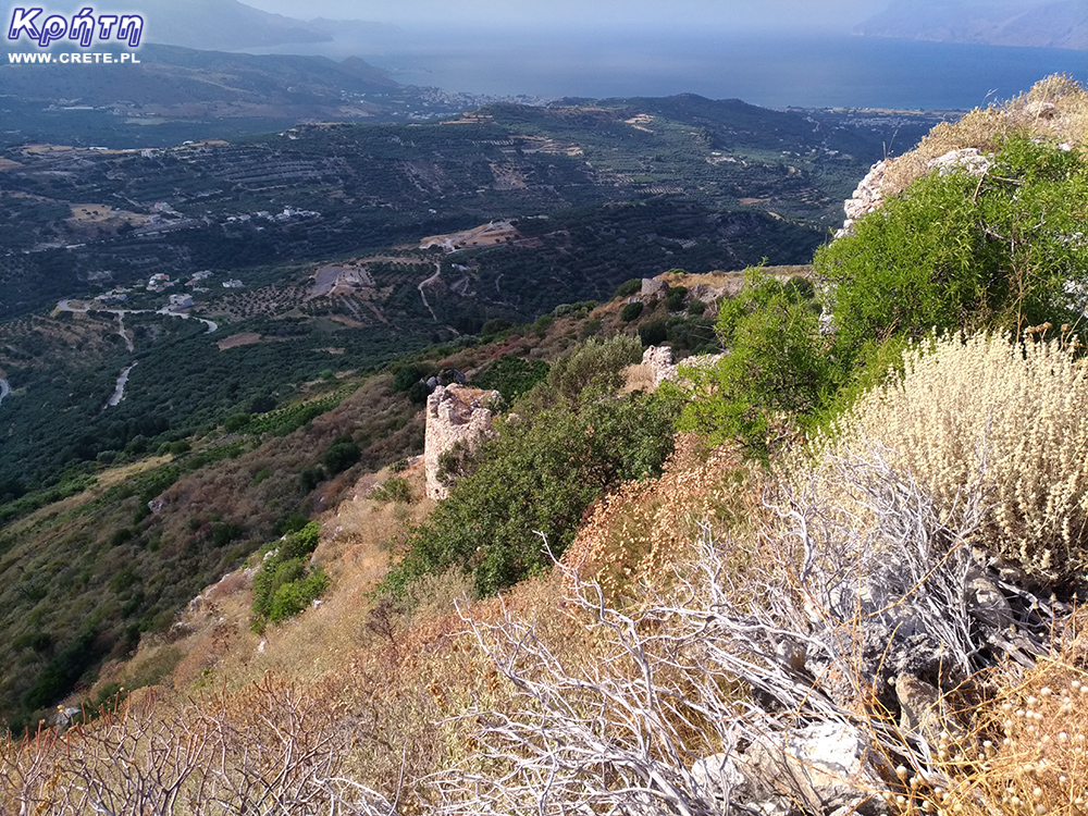
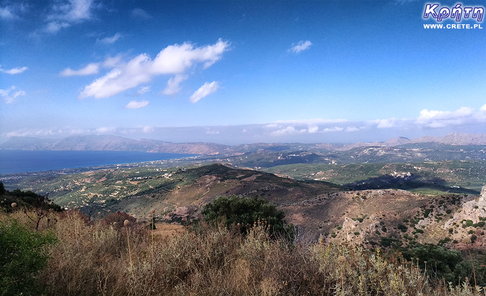
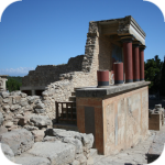
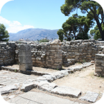
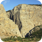
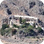
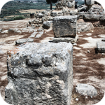
Polyrinia was one of the most important city-states of western Crete during the Hellenistic and Roman periods. It was built amphitheater on a steep hill, rising to a height of 481 meters above sea level. From its top there is an impressive view of the Cretan and Libyan Sea and the picturesque surroundings. The city was probably founded by the Achaeans in 1100 BC, and its full flowering occurred in the Roman period. It is worth noting that although the history of this place began in the Minoan period, it continues to this day. You won't find a magnificent city here, but only a calm and somewhat sleepy village, in which the remains of the former splendor of this place are woven.
Polyrinia was the most fortified city of ancient Crete that dominated the western part of the island. It developed close trade relations with Sparta, Milos, Rhodes, Thebes, the coast of ancient Ionia and Egypt. Ships with cargo docked at both Kissamos and the ancient Falassarna, as both of these places served as ports in Polyrinia. In addition to trade, the city was also known for breeding, some of its inhabitants engaged in shepherding. The name of the city indicates just such a direction of development, polla rinia means many lambs / sheep.
During the Roman invasion of Crete, when the city was conquered by the Romans, Polyrinia decided to paradoxically support its invaders. Thanks to this catwalk, the city was not destroyed. It is worth remembering that Gortyna adopted a similar tactic. Both cities gained position and privileges thanks to their support of the Romans.
The inhabitants of Polyrinia quickly erected a monument to the Roman conqueror of Crete, Quintus Metellus, while the Romans constructed a water supply system with an aqueduct and fountains in a newly conquered place. It was a gift for new allies from Emperor Hadrian.
Polyrinia, thanks to the new Roman allies, defeated its eternal rival, which was the most powerful city of western Crete: today's Chania, or then Kydonia. Undoubtedly, the takeover of the Sanctuary of Diktynna located on Cape Spatha on the nearby Rodopou Peninsula was an undoubted profit. Control over this place has always been a source of conflict between ancient Kydonia and Polyrinia. The proof of the importance of this sanctuary was a paved road with a length of 11 Roman miles, or over 16 km, connecting Diktinna with Polyrinia.
In its heyday, Polyrinia was very wealthy and powerful. From the 4th century to the Roman period, the city minted its own coins with the head of a bull on one side and the image of Zeus on the other. The bull's head motif also appeared in the city's coat of arms.
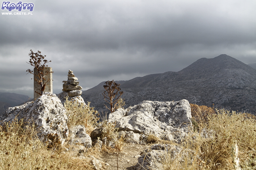
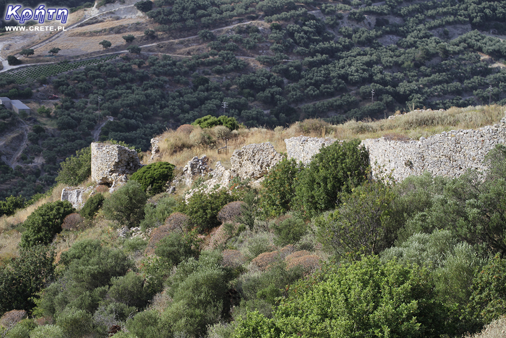
The hill on which Polyrynia is located
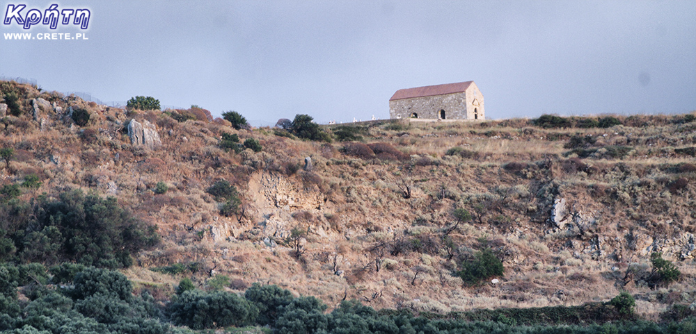
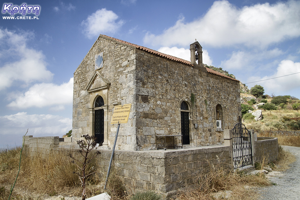
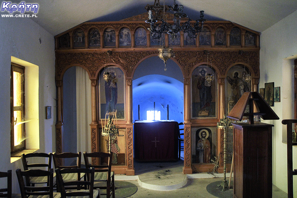
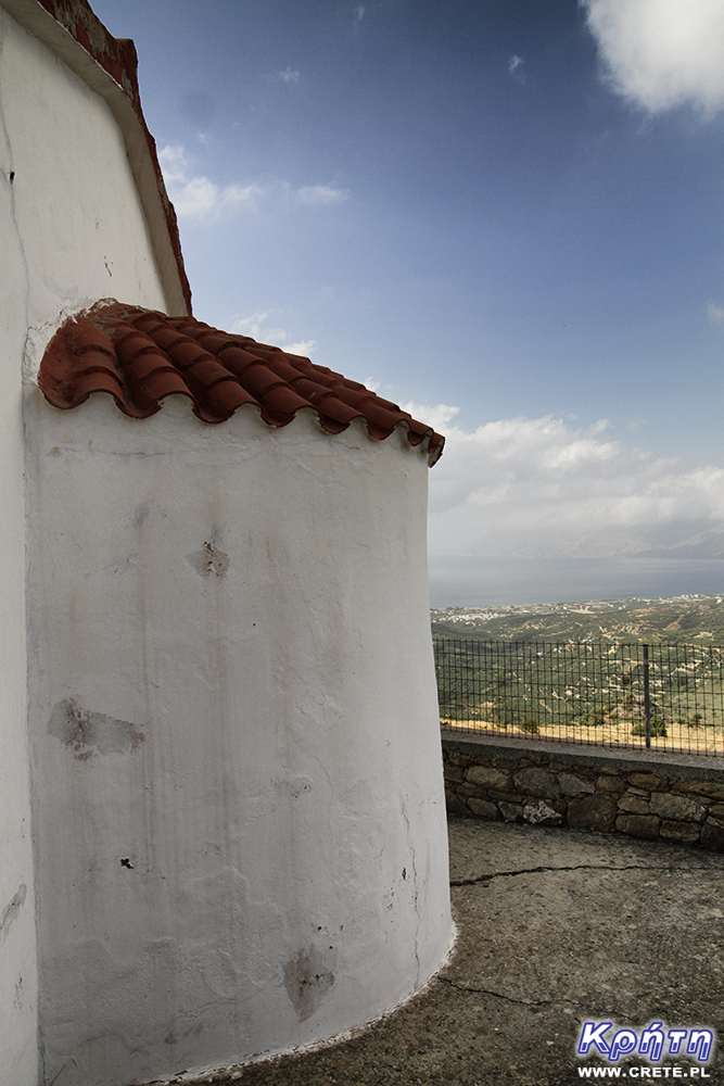
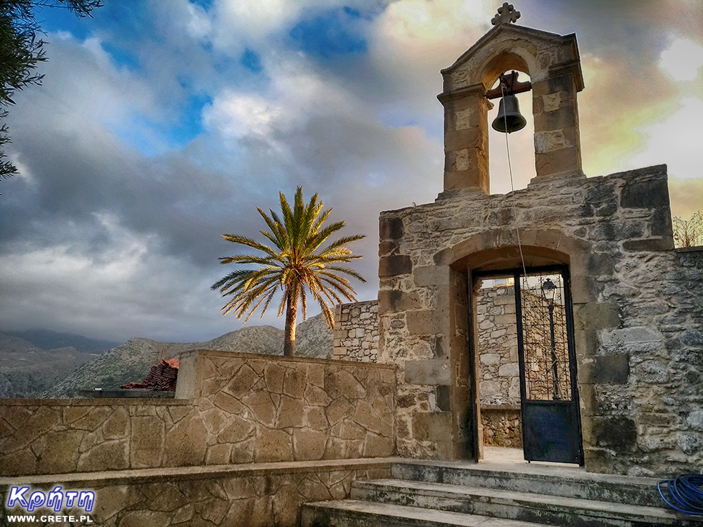
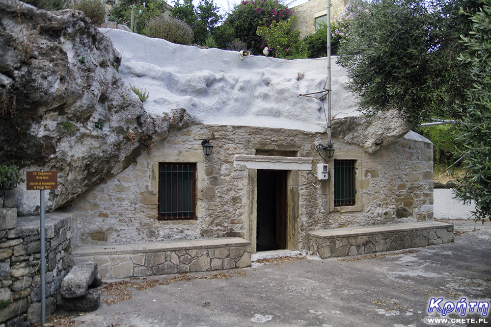
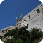
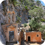
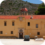
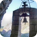
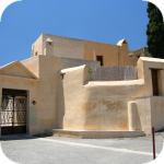
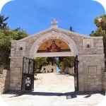
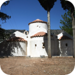
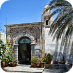
On the Polyrinia acropolis there was a temple dedicated to the goddess Artemis. Nowadays, the stones from this building were used to build the church of 99 Saints, which was built at the end of the 19th century in 1894 in the place where the temple of Artemis was built in ancient times.
Church of 99 Saints
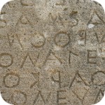
Stones with inscriptions, treatises and dedications were also used to build the church. But not only they were used to build a modern temple. An ancient altar, which is part of the eastern wall of a modern building, has also been used.
According to myths, winning Agamemnon, returning from the Trojan war, stopped in Polyrinia. His ships anchored in Honi (today's Nopigia), and he went to the temple of Artemis in Polyrinia to sacrifice to the gods there. During this ceremony, he saw his naval fleet burn on fire by prisoners of war. Agamemnon stopped making sacrifices to return to ships as soon as possible. The story "Cretan sacrifices " that refers to incomplete desires and goals has remained after this story.
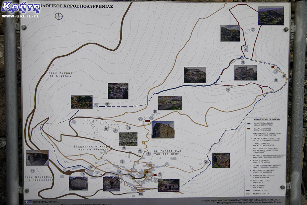
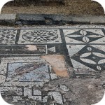
From 1938, no excavations were carried out in Polyrinia. Thus, today's visible ruins are the highest "layer" dated to the Roman and Middle Ages.
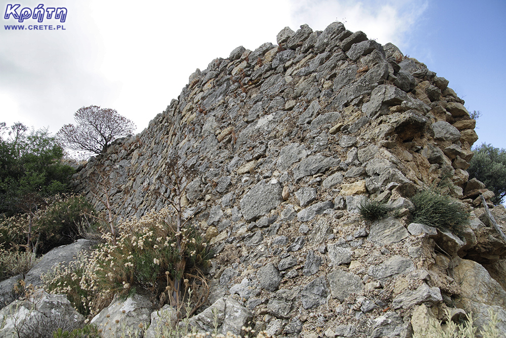
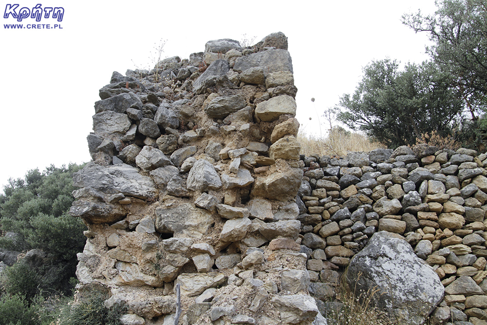
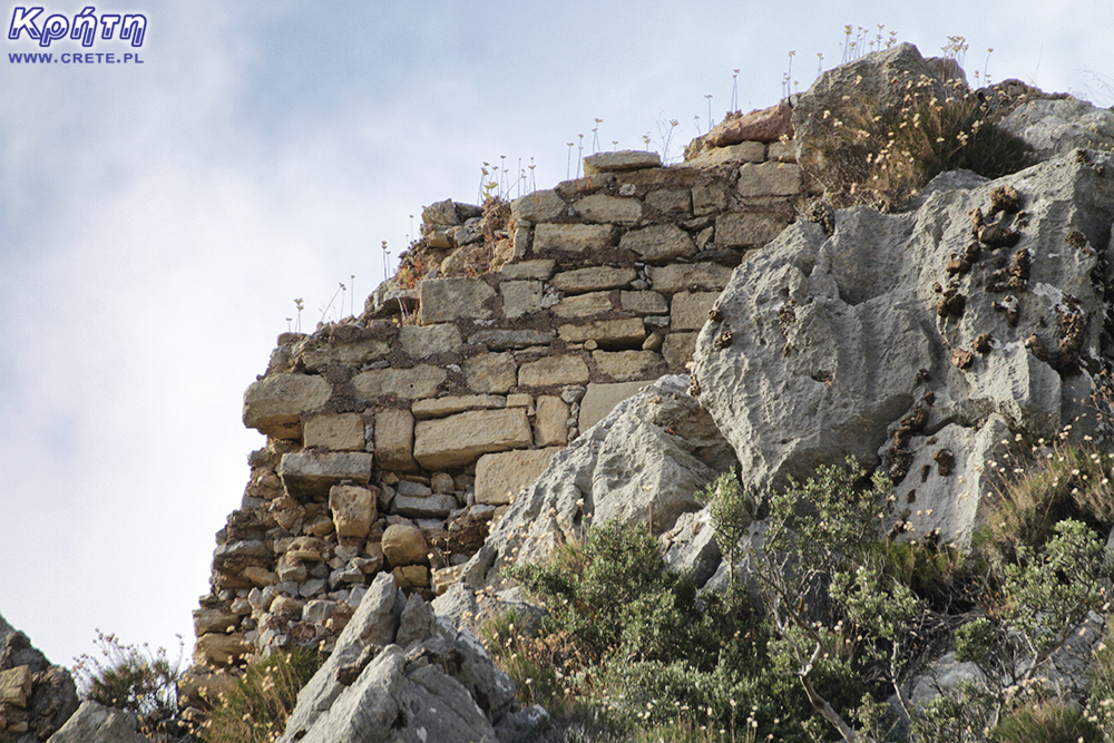
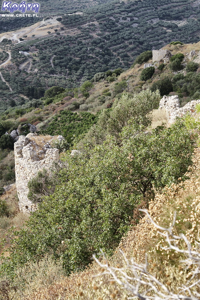
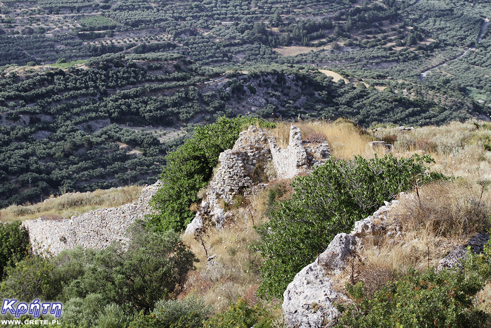
The walls surrounding the top of the hill were built on top of the previous ones. They have been modified in each period and now have fragments representing Greek, Roman, Byzantine and Venetian techniques.
Visiting Polyrinia
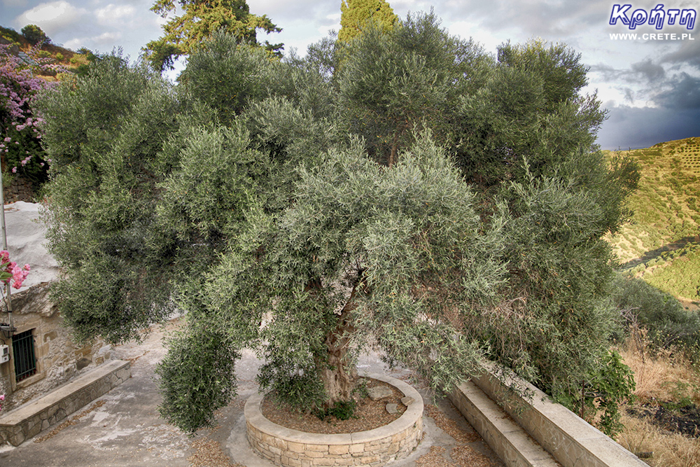
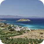
Located between vast hills, surrounded by sleepy villages and modern olive groves, Polyrinia not only stores the remains of ancient civilization, but also offers magnificent views of the Bay of Kissamos and the picturesque surroundings. That is why visiting this place is worth starting with climbing the former Acropolis.
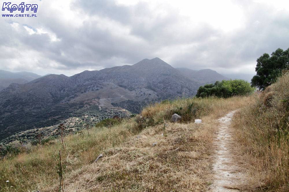
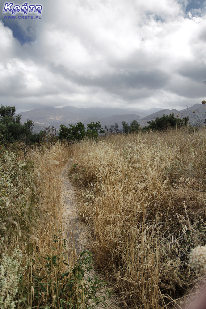
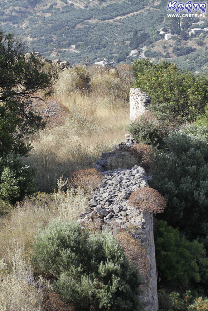
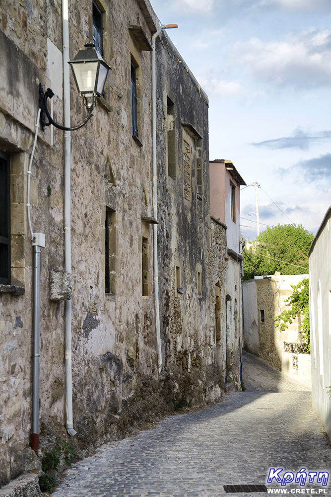
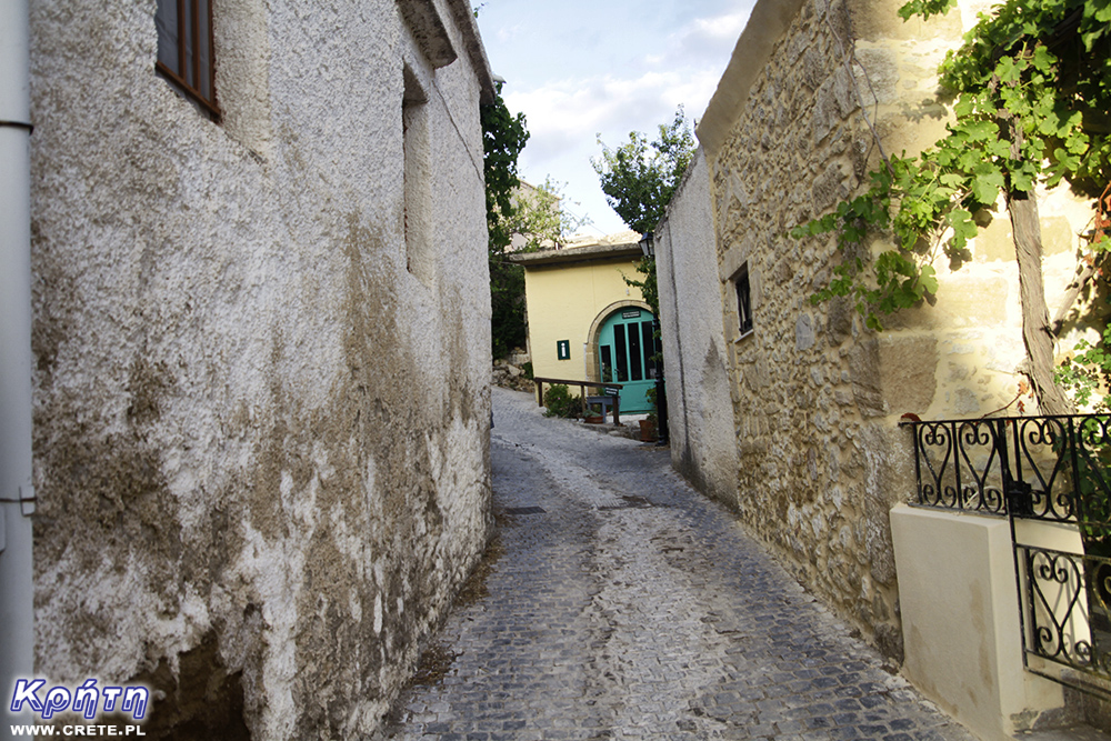
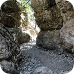
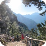
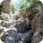
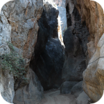
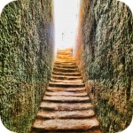
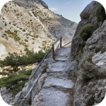
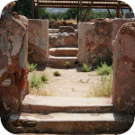
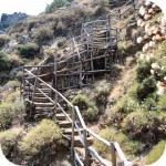
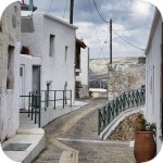
Lower fragment of the path leading to the Acropolis
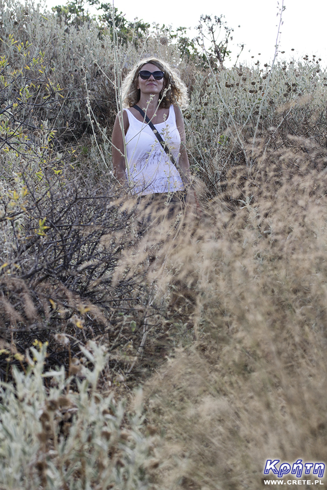
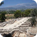
Following the signposts of Ancient Polyrrhenia Acropolis, you must first bypass the modern village and drive a bit on a steep road, passing the Acropolis tavern. You can leave your car nearby or drive further near the 99 Saints church and the church cemetery located here. Then go on foot along the path that slowly climbs up, winding initially along the southern and later the eastern part of the hill. Although the path has been clearly marked, it is now led between quite thick and sharp thickets. Unfortunately, after this trip, especially if you walk in shorts here, you will probably have scratched legs.
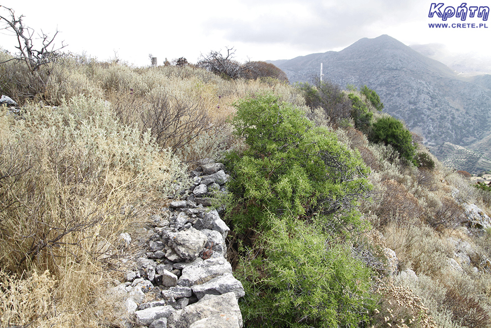
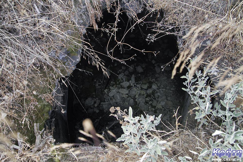
The path sometimes runs along the walls of the former city, and the higher you go, the more traces of the former city-state you will come across on your way. Going to the top of the hill you will pass a small chapel and the remains of Roman tanks. It is worth to be vigilant here because in its present form these old water tanks are simply large holes in the ground located next to the path.
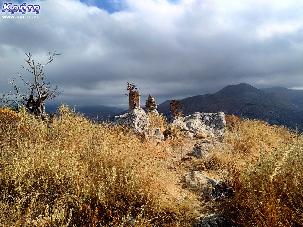
Entering the top of the hill takes about 15-20 minutes, being at the very top is worth looking around because the views are really impressive.
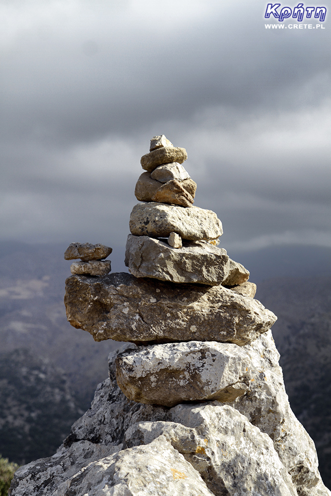
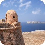
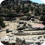
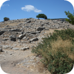
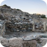
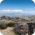
Ancient acropolis
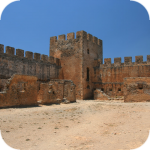
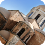
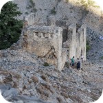
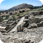
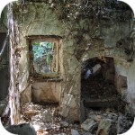
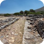
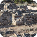
On the hill are the remains of the ancient Acropolis and Byzantine fort. Parts of the defensive walls reinforced with towers have survived to this day. On the eastern side of the fortifications there is an arched gate, which was one of the secondary entrances to the city.
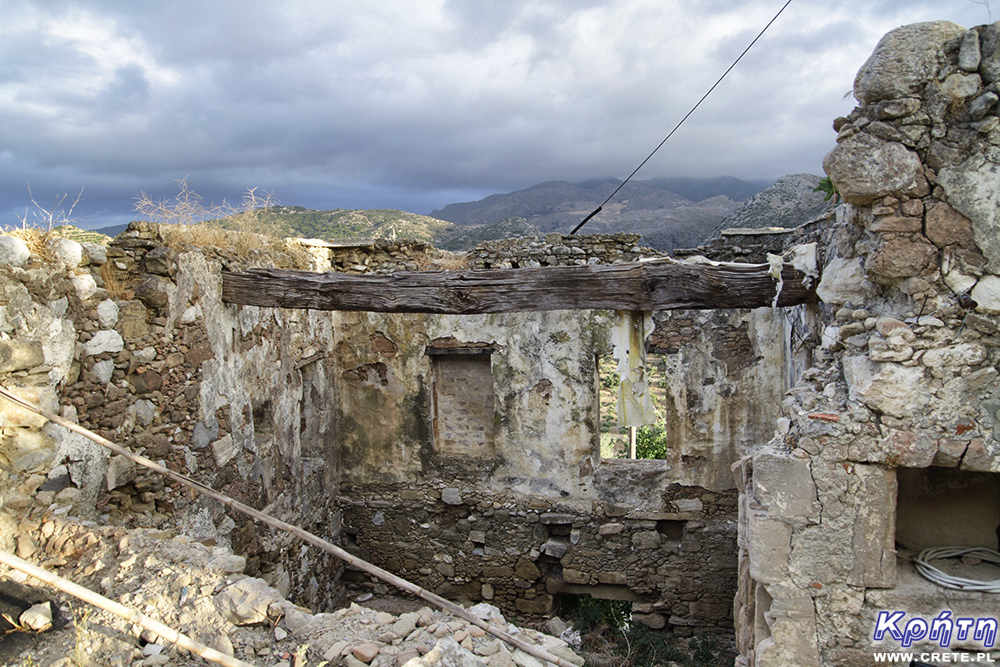
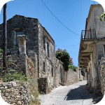
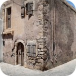
In the city itself there were characteristic rock-carved houses and they have survived to our times. They can be seen in today's Polyrinia.
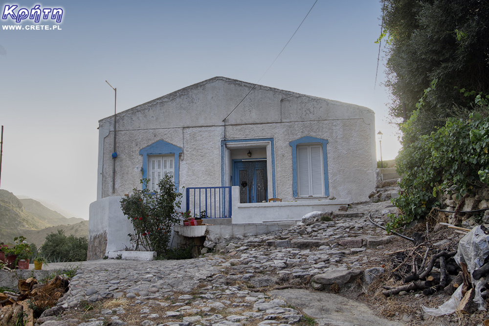
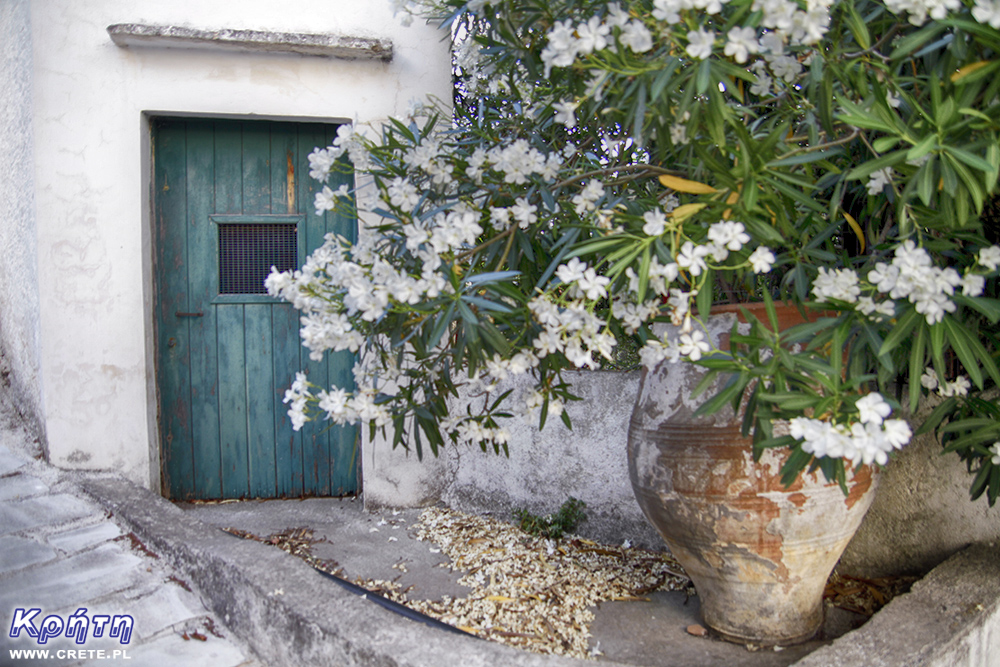
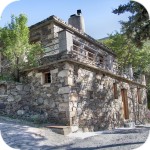
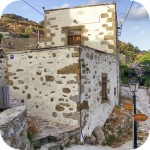
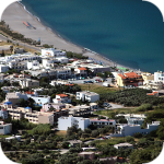
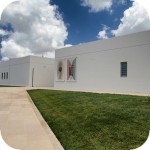
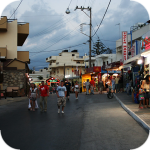
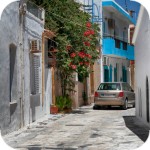
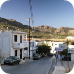
Contemporary village of Polyrinia
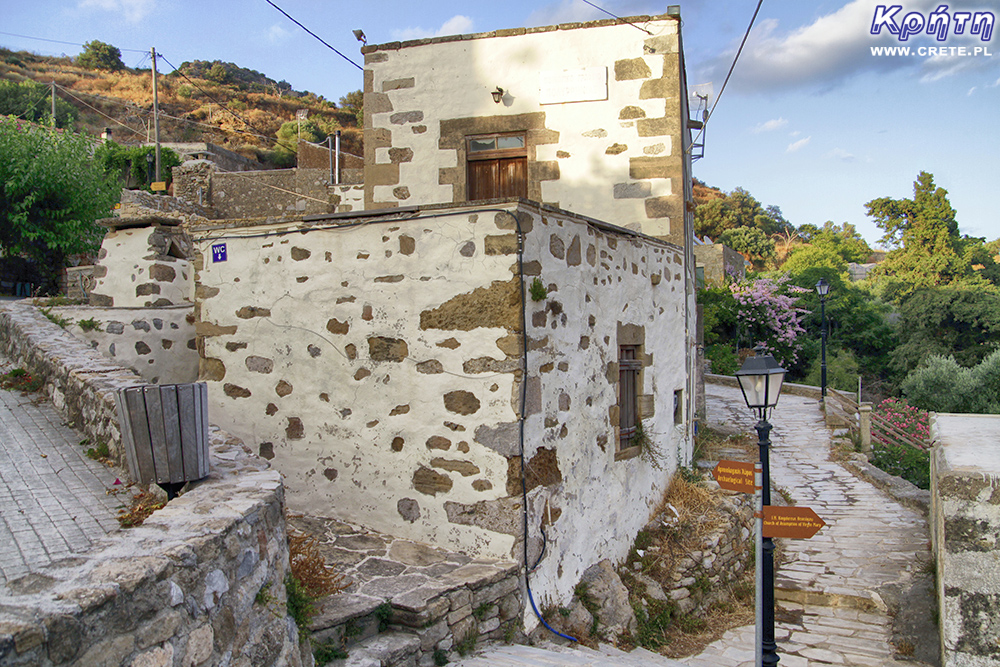
After leaving the Acropolis, it is necessary to go down or go down to the modern village. Signs and signposts placed here lead to the most interesting historical places.
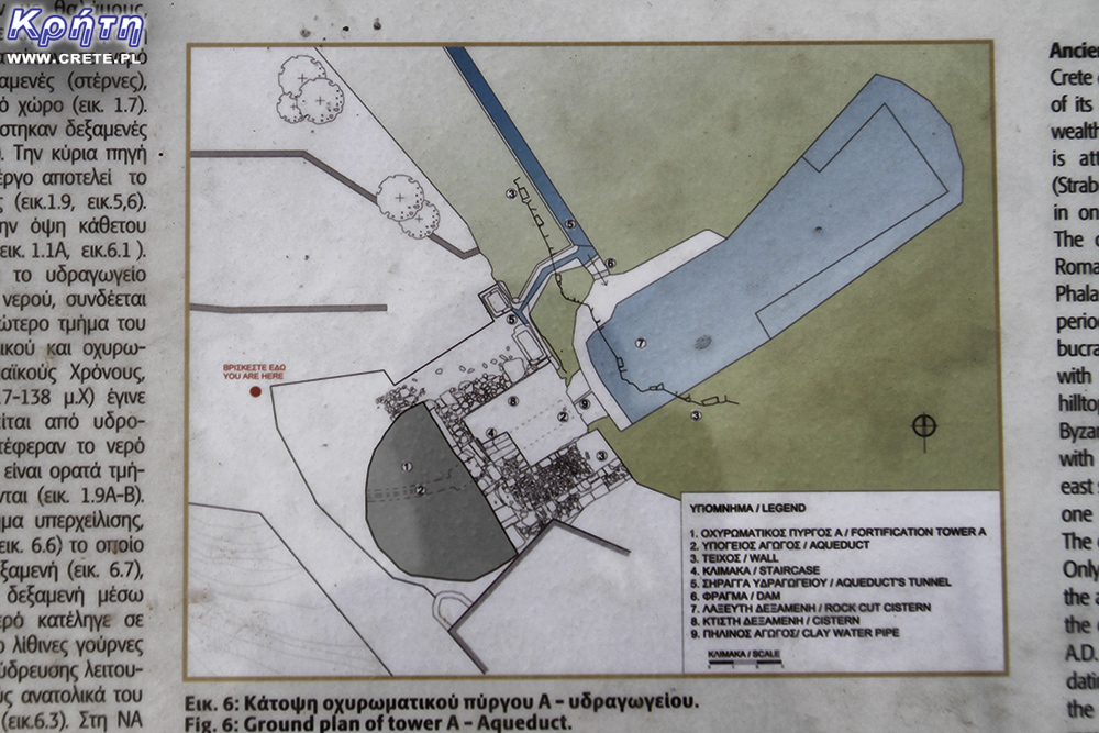
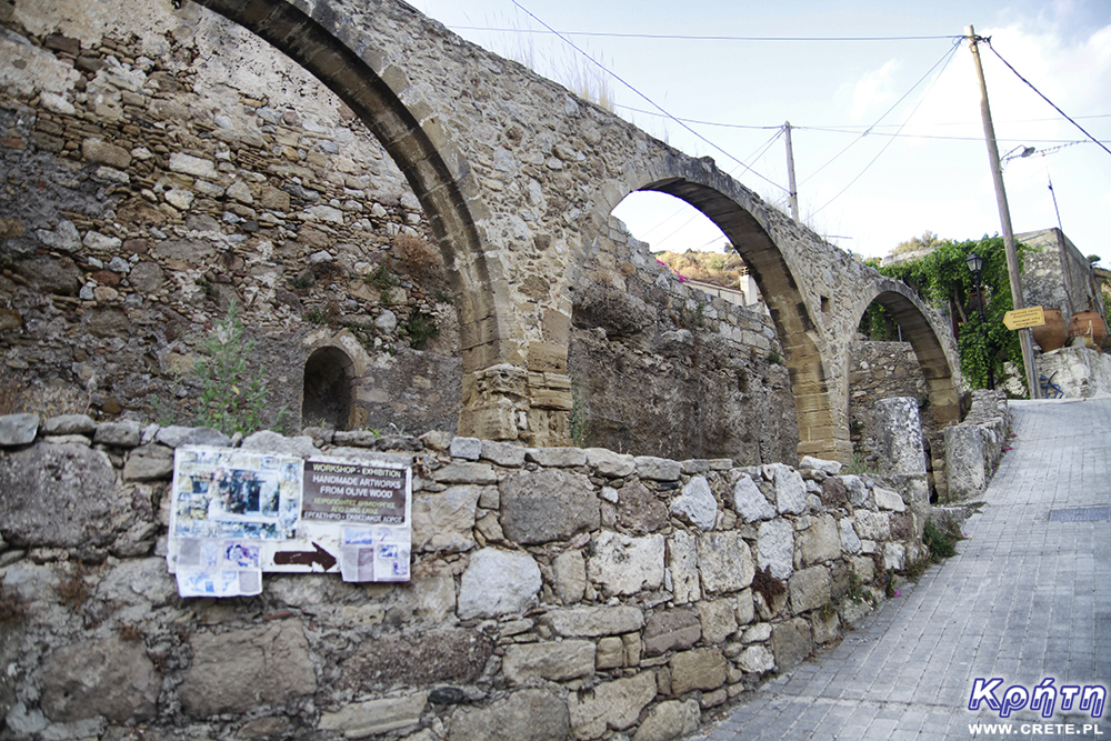
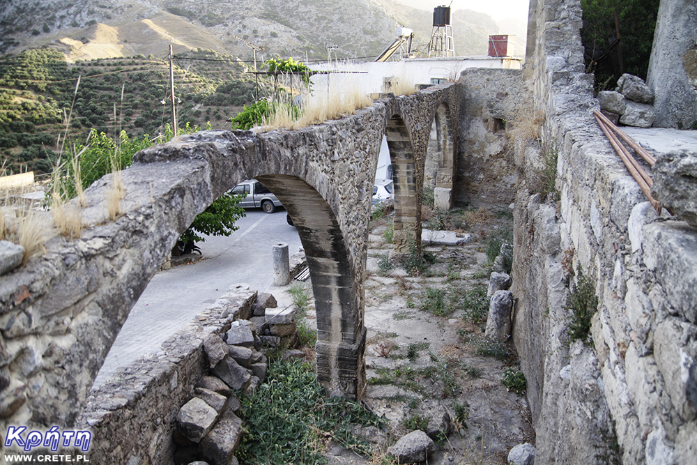
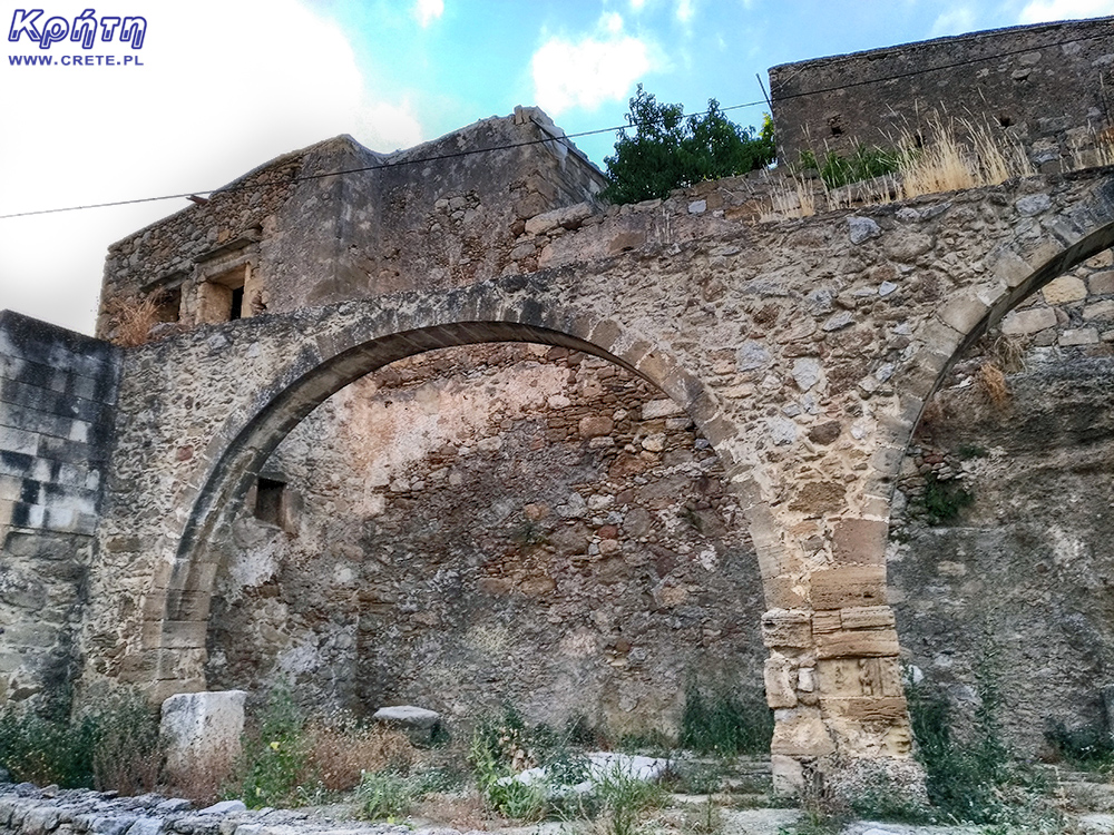
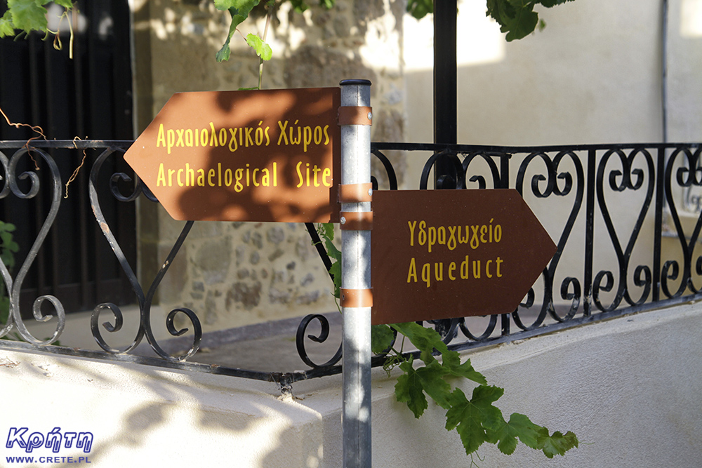
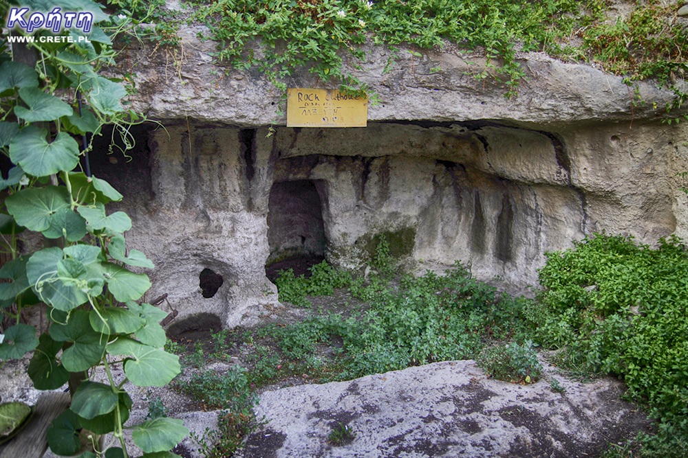
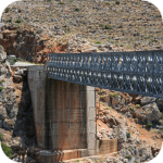
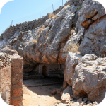
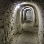
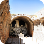
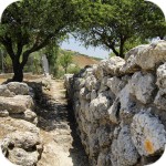
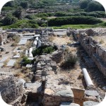
The most important of them include, first of all, the remains of a Roman aqueduct. The aqueduct, along with rock-carved tankers, built in different places on the hill, collected water and distributed it around the city. He provided water supply not only to residents, but also supplied public fountains. Water supply was regulated by a movable dam, and any excess water was directed to a tank dug in the rock.
One of the main tunnels of the aqueduct is located at the bottom of the modern settlement, near the semicircular tower, to which it is connected by a special channel passing through the foundations. This combination had tactical significance, because during a possible siege you could protect the water reserves. This architectural complex of fortifications and water supply facilities was a major technological achievement. Interestingly, this ancient water supply system supposedly works effectively to this day.
Other interesting places that are worth paying attention to are the building with Venetian arches, a nice small stone church of the Assumption of the Virgin Mary, and outside the village the already mentioned church of 99 Fathers erected on the site of the former temple of Artemis. In addition to watching historical remains, it is also worth paying attention to the village itself, which is full of charming nooks.
Church of the Assumption of the Blessed Virgin Mary
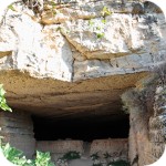
Near the road leading to the Sirikari Gorge is the cemetery of ancient Polyrinia, where there are tombs carved in the rock. A steep, narrow dirt road leads there, so if you also want to see this place, it is best to go on foot.
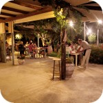
At the end of the tour, it is worth going to the Acropolis tavern, which you pass by at the beginning. You won't find such delicious home-made Cretan cuisine as the owners here.
Acropolis Tavern
west
central
east
Interesting places on Crete
↤ click the appropriate part of the island to change the bottom map
W 2002 roku Falasarna zdobyła tytuł najlepszej plaży w Grecji. Wyróżnienie to nie jest bynajmniej przypadkowe, gdyż miejsce to jak na standardy Krety jest naprawdę unikalne.
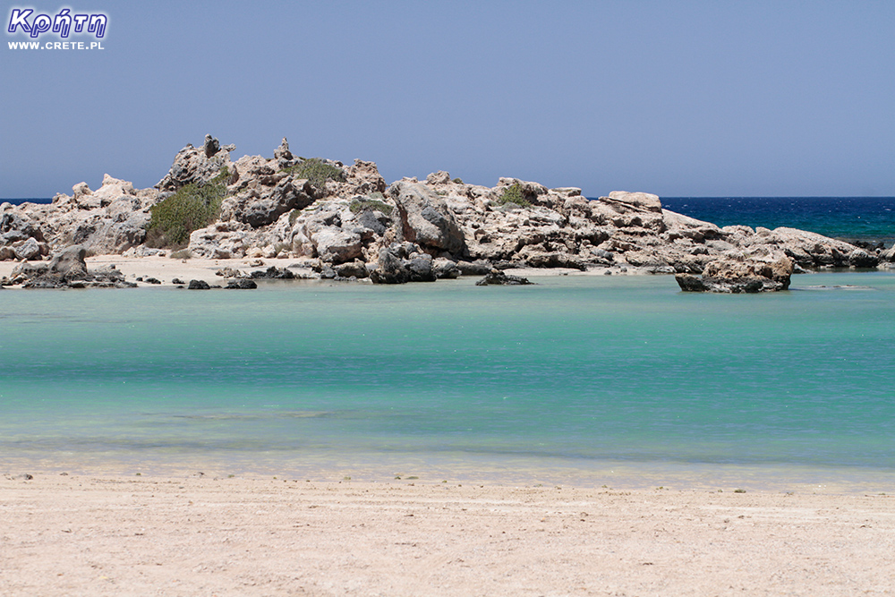
Elafonisi is a small island located at the end of the southwestern edge of Crete. A characteristic feature of Elafonisi is the shallow lagoon connecting it with Crete.
Elafonisi is a small island located at the end of the southwestern edge of Crete. A characteristic feature of Elafonisi is the shallow lagoon connecting it with Crete.
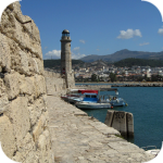
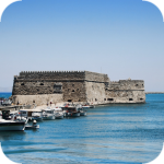
Chania (Χανιά) is the second largest (after Heraklion) city of Crete. The biggest advantage of Chania is the area of the Old Town and the beautiful Venetian Harbor.
Aptera is a city whose history dates back to at least a thousand years before our era. In the peak period, about 20,000 lived in it. people, of which only 1/5 were free people.
Chania (Χανιά) is the second largest (after Heraklion) city of Crete. The biggest advantage of Chania is the area of the Old Town and the beautiful Venetian Harbor.
Omalos is a perfect starting point for exploring the Samaria Gorge. Located over 1,100 m above sea level extends over an area of 25 km2. Its size corresponds more or less to the size of the Lasithi Plateau.
Located 47 km from the city of Chania, it is the only freshwater lake in Crete. Its area is about 580 thousand. sqm. and the maximum depth is about 45 meters
Omalos is a perfect starting point for exploring the Samaria Gorge. Located over 1,100 m above sea level extends over an area of 25 km2. Its size corresponds more or less to the size of the Lasithi Plateau.
The steel crossing, which in the central part is separated from the ground by nearly 150 m, is at the leading position of the places where the longest bungee jumps are made.
Chania (Χανιά) is the second largest (after Heraklion) city of Crete. The biggest advantage of Chania is the area of the Old Town and the beautiful Venetian Harbor.
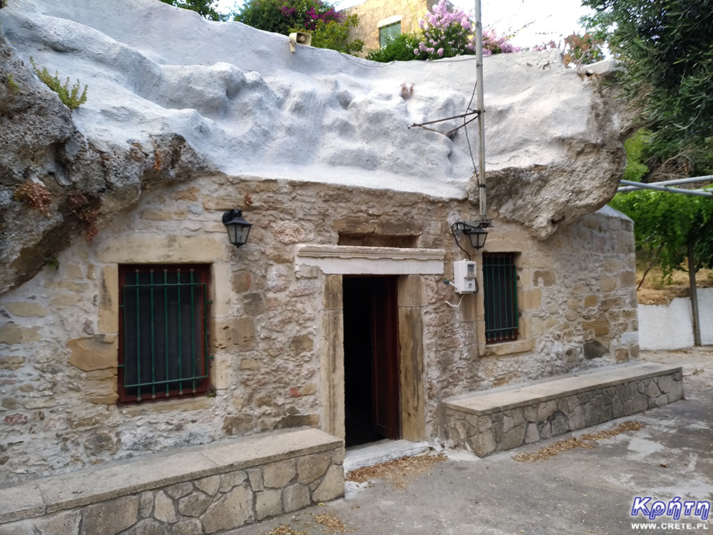
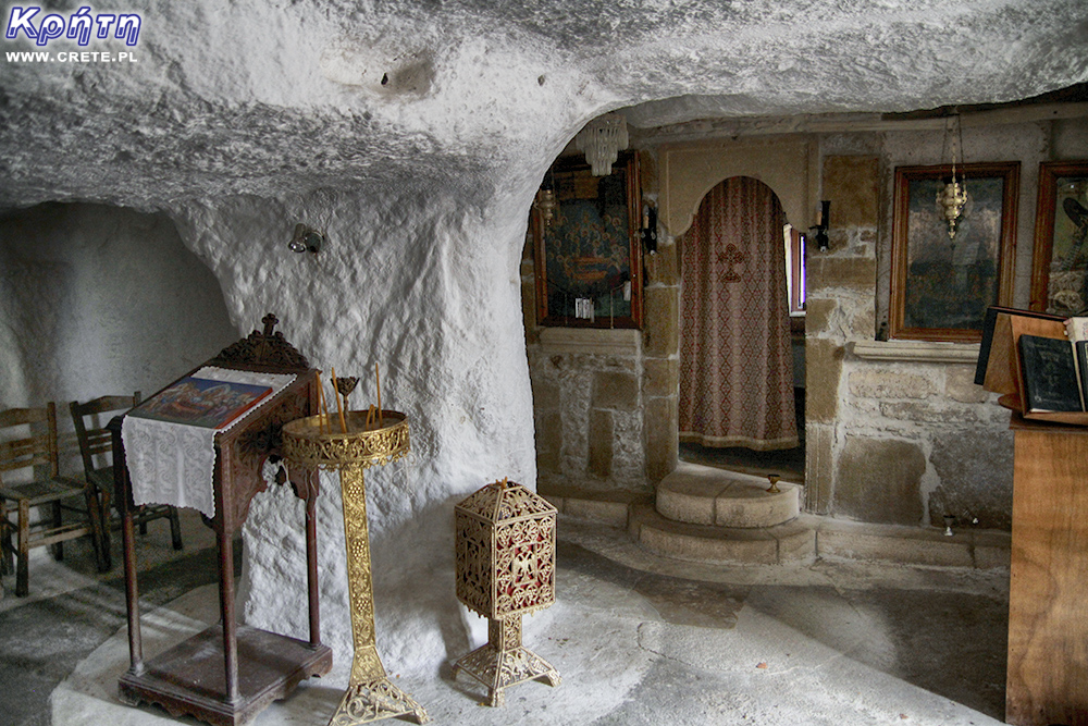
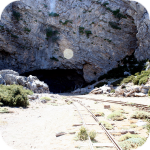
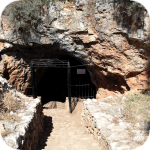
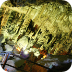
The cave is less than 1 km from Moni Gouvernetou Monastery. You will reach it using the pedestrian trail that has been marked out along the slope of the Avlaki Gorge.
Balos is one of Crete's flagship beaches if not all of Greece. We can assure you that the landscapes you see during your trip to Balos will remain with you for a very long time.
The Orthodox monastery of Agia Triada, located on the northern part of the Akrotiri peninsula, is one of the most beautiful and richest monasteries in Crete.
The Orthodox monastery of Agia Triada, located on the northern part of the Akrotiri peninsula, is one of the most beautiful and richest monasteries in Crete.
On the north-western coast of Crete, at the foot of the Gramovous peninsula, there are ruins of the ancient port of Korikos, later known as Falassarna.
Polyrinia was one of the most important city-states of western Crete during the Hellenistic and Roman periods. It was built amphitheater on a steep hill, rising to a height of 481 meters above sea level
The island of Gramvousa, or in fact Imeri Gramvousa (Ήμερη Γραμβούσα), is an inseparable point of a trip that combines a stay in the Balos Lagoon with visiting the remains of a fortress located on the top of the island of Imeri Gramovousa.
There is a beach in Crete that literally makes some people shiver. This place is Seitan Limania which can be translated as Satan's Ports or Cursed Ports.
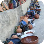
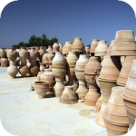
Dozens of craft workshops located in this small mountain village make Margarites one of the four main centers where traditional Cretan ceramics are made.
The date of the foundation of Moni Arkadiou (Arkadi) is not exactly known. According to tradition, the name of this church refers to the name of the Emperor Arkadiusz, who supposedly was to be its founder.
The date of the foundation of Moni Arkadiou (Arkadi) is not exactly known. According to tradition, the name of this church refers to the name of the Emperor Arkadiusz, who supposedly was to be its founder.
Rethymnon with around 40,000 inhabitants are the third largest city of Crete. This place was populated already in the Minoan period. Historically, the city was an important commercial center.
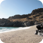
Skinaria is a small beach located along a small bay, whose outlet on both sides ends with a rocky coast. It is still a little-known place overlooked by mass tourism
Skinaria is a small beach located along a small bay, whose outlet on both sides ends with a rocky coast. It is still a little-known place overlooked by mass tourism
According to Greek mythology, Zeus hid (and perhaps even gave birth) in the Ida cave. This myth is the greatest asset of this cave, which is not as interesting and beautiful as the Dikte cave.
Tripiti is a small beach covered with a mixture of gray sand, gravel and stones. Despite the fact that the beach is unorganized and has a semi-natural appearance, one small tavern works here.
Tripiti is a small beach covered with a mixture of gray sand, gravel and stones. Despite the fact that the beach is unorganized and has a semi-natural appearance, one small tavern works here.
Tripiti is a small beach covered with a mixture of gray sand, gravel and stones. Despite the fact that the beach is unorganized and has a semi-natural appearance, one small tavern works here.
Plakias is a perfect place for people who like to spend time hiking. In the area of the town and the surrounding area, there are several hiking trails that lead to interesting beaches.
Currently, the lower monastery is still not open to the public and is not used by the monks. The buildings of the upper monastery have undergone partial renovation and are the main seat of the Preveli monastery.
Currently, the lower monastery is still not open to the public and is not used by the monks. The buildings of the upper monastery have undergone partial renovation and are the main seat of the Preveli monastery.
Currently, the lower monastery is still not open to the public and is not used by the monks. The buildings of the upper monastery have undergone partial renovation and are the main seat of the Preveli monastery.
The Kourtaliotiko Gorge, also known as the Asomatos Gorge, is perhaps one of the most spectacular natural attractions available in the central part of Crete.
Agia Triada is a small Minoan archaeological site in the south of Crete, located near Timpaki, located on the western slope of the hill about 40 meters above sea level.
This fortress is a perfect example of Crete's multiculturalism. Located today in Greek hands, it was built by the Venetians, but is called a name taken from the Turkish language.
Rouvas Gorge is one of the most interesting places in this part of Crete. The interesting trail leads in a perfect way to the changing appearance of this gorge.
Matala is one of the most popular towns not only of the southern coast but also of the whole of Crete. In the 1960s and 1970s, this small fishing village was a mecca for hippies.
The Odigitrias Monastery is one of the most famous monasteries of southern Crete. Unfortunately, in terms of popularity, he is far from other Cretan monasteries.
In addition to the famous grand palaces on the island in the Minoan period, a number of smaller residences were created. One of the most important examples is the Vathipetro discovered about 5 km north of Archanes, on the southeastern slope of Mount Juchtas in the central part of Crete.
When traveling around Crete, it is not difficult to pay attention to the fact that most of the beaches there are relatively small and short. For this reason, people who are used to our national Baltic standards, where the sandy coast stretches for kilometers, may experience a special disappointment. However, fortunately, nothing is lost, because Crete in its rich arsenal of various beaches can boast of those that allow for long walks along the coast. One of them, our favorite is the Kommos beach located in the south of the central part of the island.
Although there are countless caves in Crete, only a few can be visited. Sfendoni is the largest cave open to the public. content comes from: http://www.crete.pl www.CRETE.pl
Only a few kilometers separate the bustling city of Rethymno from Mili, a village abandoned by its inhabitants. This place is also known as the village hidden in the gorge.
Information about one of the more known tourist cities of Crete, or about Malia. Description of attractions located in the city of Malia and a description of the specificity of this town.
The Lasithi Plateau is located about 70 kilometers from the capital of Crete - Heraklion. The average height at which the terrain of this plateau is located is 840 m above sea level.
One of the tourist attractions eagerly visited by people spending their holidays in Crete is the Dikte (Psychro) cave. The main factors that attract people to this cave are a rich and varied dripstone robe and a close connection with mythology.
Among the olive groves in the place called Logari, which is less than a kilometer from the village of Kritsa, there is a small Byzantine church of Panagia Kera from the 13th-14th centuries.
Stalida is located directly along the coast and is one of the most famous tourist destinations in Crete, which definitely comes alive with the advent of the tourist season
Most people crossing the route between Agios Nikolaos and Ierapetra will definitely notice the large crack which is marked by the mountain located east of this road. This majestic geological creation called Ha was probably created as a result of an earthquake.
Xerokambos is a small settlement in which you will find literally several taverns, and most of the buildings are single-storey and one-story houses. The big advantage of this beach is a gentle sandy descent to the sea.
Agios Nikolaos (Άγιος Νικόλαος) is a small town with less than 20,000 inhabitants. permanent residents (according to statistical data from 2001). This city is the capital of the Lasithi nomos.
Although Elounda seems to be a sleepy fishing town to this day, however, appearances should not fool you, because this town and its surroundings can boast of probably the largest number of the best hotels.
Although Elounda seems to be a sleepy fishing town to this day, however, appearances should not fool you, because this town and its surroundings can boast of probably the largest number of the best hotels.
Stalida is located directly along the coast and is one of the most famous tourist destinations in Crete, which definitely comes alive with the advent of the tourist season
Zakros is the fourth-largest Minoan palace in Crete in importance and size. This latest found, built on the east coast of the island is located in the village of Káto Zákros.
Zakros is the fourth-largest Minoan palace in Crete in importance and size. This latest found, built on the east coast of the island is located in the village of Káto Zákros.
The first palace was built around 1900 BC. in the place where there was a quite impressive settlement whose remains were later transformed into the central part of the city.
The ruins of the ancient city of Itanos are located at the eastern tip of Crete, less than 3 kilometers north of the famous palm beach of Vai. Although there are also nice beaches at Itanos, unlike its well-known neighbor, this place does not attract crowds. There are either accidental stray tourists or excavation enthusiasts here.
Less than 10,000 population of Sitia makes the city the smallest in Crete. Some even go a step further and say perversely that it is rather the largest village of Crete.
Napoleon's house is one of the few typically tourist attractions in Ierapetra. About what could have happened here in the summer of 1798 and possibly how much in this legend is the truth we write in the article on the page below.
Moni Kapsa Monastery is one of the most interesting monasteries in Crete. Its massive buildings were erected on rocky, gray slopes surrounding the nearby Pervolakia Gorge.
At present, the beginnings of settlement in this place date back to 1200 BC. Later, after 630 BC Azoria developed into a small town, whose population is estimated at between 2 and 5 thousand people.
The ruins of the ancient city of Lissos are located about 3.5 km from Sougia on the southern coast of Crete and about 70 km southwest of the city of Chania in the place where Agios Kirikos is currently located. Lissos is one of those places that can be reached either on foot over a part of the E4 route or a rented boat.
Zakros is the fourth-largest Minoan palace in Crete in importance and size. This latest found, built on the east coast of the island is located in the village of Káto Zákros. Rocky mountains surround the ruins of the palace complex with the remains of a once thriving city, built on a fairly hard-to-reach and inhabited area. Paradoxically, Zakros, being several centuries ago, a city with extensive contacts with other countries, was (and is actually still) the most isolated Minoan center on the island.
gość PiotrWie Jeździliśmy na Kretę od 2008r, bywały lata że byliśmy w kilku kawałkach w sumie czterdzieści kilka dni ( samoloty z Wrocławia latały w piątek wieczorem tak że można było polecieć po pracy, powrotem był w poniedziałek w nocy więc za 11 dni urlopu można było być 17 dni, jak się zaplanowało z jakimś świętem to można było być 2 x 17 dni i raz 10 dni) i z roku na rok było coraz więcej ludzi - nie tylko na plażach ale ... (...)
Czy wyspa jest w stanie pomieścić 15 mln turystów, zapewne tak. Pytanie moje: skąd będzie woda?! Jak już brakuje, tama na Aposelemis sucha, gdzie ścieki popłyną, gdzie będą składowane śmieci??? Smutne, że wyspa zamienia się na globalną destynację.. rozumiem, że pieniądze są ważne ale żeby dewastować naturalne tereny np.triopetra, plakias etc... przykro
Można próbować zrozumieć ludzi, którzy z tego żyją. Można też puścić ludzi na żywioł i nie zajmować się takimi głupotami, jak ofiary śmiertelne. Samaria nie jest szlakiem w 100% bezpiecznym (który szlak jest), to głęboki wąwóz, narażony na erozyjne osunięcia skał. Poza ty, to jest region aktywny sejsmicznie i dość kapryśny pogodowo.
Myślę, że tu nie ma miejsca na ustępstwa. (...)
gość PiotrWie Dziś po raz pierwszy ( a jeździmy dużo od 2008 roku i dużo chodzimy po szlakach) widzieliśmy w Grecji ekipę przygotowującą szlak do sezonu. Nie była to co prawda zbyt duża ekipa - dwie osoby z motyką, sekatorem i niewielką piłą ręczną - ale zawsze coś - na wyspach Kanaryjskich ekipa to pierwszy z kosą spalinową a zanim kilka osób zmiatających resztki na bok. (...)
 Roman aqueduct
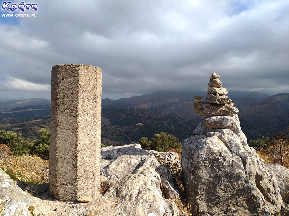

 The hill on which Polyrynia is located
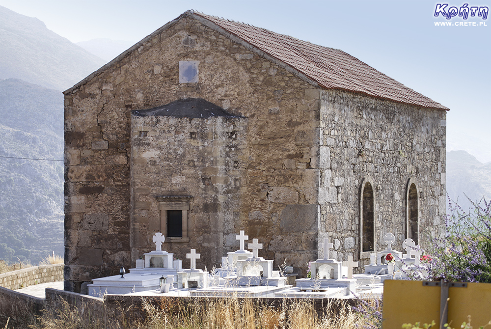
 Church of 99 Saints
 Lower fragment of the path leading to the Acropolis
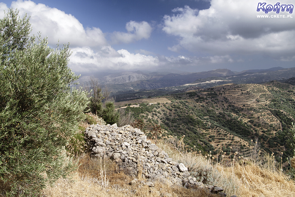
 Ancient acropolis
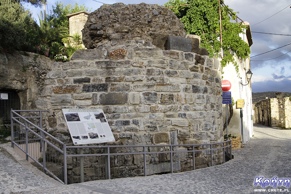
 Church of the Assumption of the Blessed Virgin Mary
 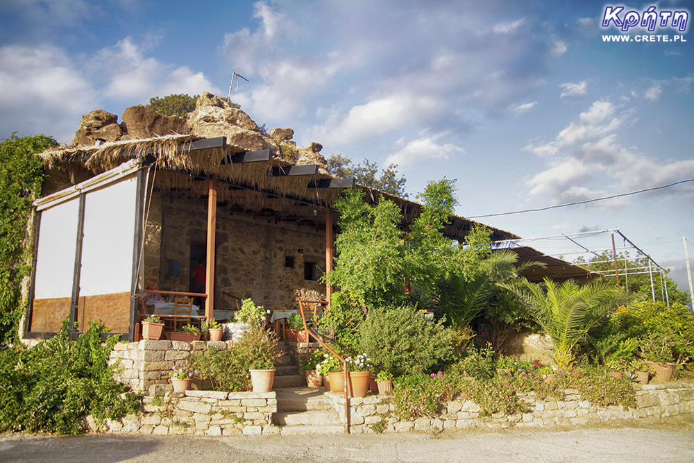 Acropolis Tavern


Komentarze
komentarz z
Cudowne miejsce! Warto przejść 10 km w jedną stronę dla takiego widoku! ❤
komentarz z
Skąd szłaś?
komentarz z
CRETE - Kreta z Kissamos :)
komentarz z
Aleksandra ciężko było wejść ale widok zrekompensował trud :D
komentarz z
Tam nie bylismy
komentarz z
Trzeba będzie nadrobić zaległości w sprzyjających okolicznościach.
komentarz z
CRETE - Kreta koniecznie
Wypełnij poniższy formularz aby dodać komentarz
lub kliknij w poniższy link aby skorzystać z możliwosci komentowania przez facebooka:
https://www.facebook.com/crete.poland/posts/10156905092822551