Crete tourist guide

The best Polish website dedicated to the Greek island Crete and to a small extent of continental Greece. You will find useful information related to visiting Crete that goes beyond the offer of optional tours. On the website you will also find descriptions of the most interesting places that we visited by visiting this largest Greek island. The content complements the current news, photographs and recipes of Greek cuisine.

Restrictions on access to hiking trails in the Heraklion region

data_2018-08-30 19:03:36 2018-08-30 19:03:36

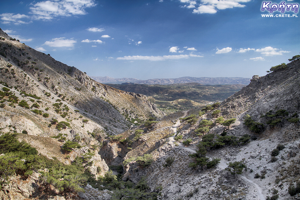
Nomos Heraklion is another region of Crete, in which laws have been passed limiting the accessibility of some hiking routes during periods of high fire risk. In particular, the access ban is to concern forests and so-called sensitive areas. In the Heraklion region these are: Symi (Σύμης) in the municipality of Viannos, Rouvas - Zaros (Ρούβα-Ζαρού) in the municipalities of Fajstos and Gortyna , Juhta (Γιούχτα - Φουρνί) - Fourni in the municipality of Archanes - Asterousia, Keris (Κέρης) in the municipality of Malewizi.

Rouvas

In accordance with the adopted provisions, the decision to introduce an entry ban depends on the current forecast visible on the fire hazard map. Restrictions on the availability of routes are valid for 24 hours from 6.00 am on these days. This prohibition applies to both vehicle traffic and the entry of persons walking. Obviously, vehicles and those who supervise compliance with these regulations are excluded from these restrictions.

It is worth noting that unlike in the Chania region of Heraklion, slightly different fire hazard thresholds have been adopted that exclude hiking trails from tourist traffic. In August, admission to sensitive areas will be impossible in the case of forecasting the 3rd degree of threat, while in the remaining months the ban will apply to days with 4 and 5 fire risk levels.

Crete - fire hazard map

Municipalities in which these areas are located are obliged to set appropriate markings and installation of information boards. So let's look out for them by going to these areas of Crete. We also recommend checking current fire risk forecasts:
https://www.civilprotection.gr/el/daily-fire-prediction-map

We, for our part, have also launched a new subpage on our website, where you will have the current Crete fire risk map available. The forecast is updated at 20.
http://www.crete.pl/kreta-informacje-turystyczne/mapa-zagrozen-pozarowych.html

Gosia i Piotrek,  data_2018-08-30 19:03:36 2018-08-30 19:03:36
Średnia: 0
Liczba ocen: 0
  • 0.5
  • 1.0
  • 1.5
  • 2.0
  • 2.5
  • 3.0
  • 3.5
  • 4.0
  • 4.5
  • 5.0
 
 
Oceniłeś na:
 
see other news from this month »
Wszystkie treści i zdjęcia występujące w serwisie są naszą własnością.
Wykorzystanie ich w dowolnej formie wymaga pisemnej zgody autorów.

Komentarze

Wypełnij poniższy formularz aby dodać komentarz

lub kliknij w poniższy link aby skorzystać z możliwosci komentowania przez facebooka:
https://www.facebook.com/crete.poland/posts/10155649840397551

Nazwa użytkownika:

Adres e-mail:

Tytuł:

Treść:

Przepisz kod z obrazka:
Kod obrazka

Wpisanie prawidowego kodu oznacza zgodę na przetwarzanie danych w celu wyświetlania komentarza.
Kontakt Administratorem Danych Osobowych zgromadzonych na stronie możliwy jest pod adresem mailowym [email protected]

Zapisz komentarz
Zapisz komentarz

Polecamy:

Oliwa i kosmetyki organiczne Olivaloe

Najnowsze komentarze:

gość PiotrWie  Jeździliśmy na Kretę od 2008r, bywały lata że byliśmy w kilku kawałkach w sumie czterdzieści kilka dni ( samoloty z Wrocławia latały w piątek wieczorem tak że można było polecieć po pracy, powrotem był w poniedziałek w nocy więc za 11 dni urlopu można było być 17 dni, jak się zaplanowało z  jakimś świętem to można było być 2 x 17 dni i raz 10 dni) i z roku na rok było coraz więcej ludzi - nie tylko na plażach ale ... (...)
 Czy wyspa jest w stanie pomieścić 15 mln turystów, zapewne tak. Pytanie moje: skąd będzie woda?! Jak już brakuje, tama na Aposelemis sucha, gdzie ścieki popłyną, gdzie będą składowane śmieci??? Smutne, że wyspa zamienia się na globalną destynację.. rozumiem, że pieniądze są ważne ale żeby dewastować naturalne tereny np.triopetra, plakias etc... przykro
 Dwa lata temu mnie zaatakowały trzy po zejściu z wawozu Chochlakies. Jedna ugryzła mnie w kostke. Byly bardzo agresywne. Otoczyly mnie i szarżowaly
 
 Można próbować zrozumieć ludzi, którzy z tego żyją. Można też puścić ludzi na żywioł i nie zajmować się takimi głupotami, jak ofiary śmiertelne. Samaria nie jest szlakiem w 100% bezpiecznym (który szlak jest), to głęboki wąwóz, narażony na erozyjne osunięcia skał. Poza ty, to jest region aktywny sejsmicznie i dość kapryśny pogodowo. Myślę, że tu nie ma miejsca na ustępstwa. (...)
gość PiotrWie  Dziś po raz pierwszy ( a jeździmy dużo od 2008 roku i dużo chodzimy po szlakach) widzieliśmy w Grecji ekipę przygotowującą szlak do sezonu. Nie była to co prawda zbyt duża ekipa - dwie osoby z motyką, sekatorem i niewielką piłą ręczną - ale zawsze coś - na wyspach Kanaryjskich ekipa to pierwszy z kosą spalinową a zanim kilka osób zmiatających resztki na bok. (...)
 Miejsce 14 Ladotyri z Mytilene oddam za bezcen ;)
CRETE Copyright © 2009-26 Linki | Kontakt | Polityka prywatności | Kontakt | Newsletter
ukryj
Zapisz się do
Newslettera