Serwis wymaga plików cookies do prawidłowego działania strony. Korzystanie z serwisu bez zmiany ustawień dla plików cookies oznacza, że będą one zapisywane w pamięci urządzenia. Ustawienia te można zmieniać w przeglądarce internetowej.
The best Polish website dedicated to the Greek island Crete and to a small extent of continental Greece. You will find useful information related to visiting Crete that goes beyond the offer of optional tours. On the website you will also find descriptions of the most interesting places that we visited by visiting this largest Greek island. The content complements the current news, photographs and recipes of Greek cuisine.
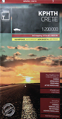
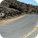
For a long time now we have been trying to find a worthy successor to our old map of Crete, published by Freytag & Berndt, with which we have been traveling around Crete from the very beginning. Apart from its disastrous physical condition, the change is also supported by the fact that it has become obsolete because it was released before 2008. Since then, quite a lot of new roads have appeared on Crete, and some of the gravel roads have gained an asphalt surface. So the time has come to buy a completely new map. At the end of last year's autumn, using promotional prices in one of the online stores, we bought a map of the renowned Terrain publishing house. We put a lot of hopes in it, the more so because last year's attempt to replace the map turned out to be a failure
The Terrain publishing product is a rather compact 1: 200,000 car map sold in a rigid plastic case that will surely perform well in protective functions. It is worth mentioning that the material from which it is made is some artificial material (or paper composite) that is waterproof and very strong. You must use a lot of force to break the map or use some sharp tool. It certainly bodes well when it comes to its lifespan.
The map is supplemented by a few schematic plans of the largest cities of Crete, which will certainly facilitate hiking in their area. The layout of the streets of Rethymno, Chania, Heraklion and Agios Nikolaos is quite well illustrated. On the map of Terrain you will also find the plan of the island of Gavdos, which must also be considered a plus. A positive aspect is also the fact that the names of all villages are written using both the Greek and Latin alphabets.
Our old mapFreytag & Berndt is in really bad condition
Let's move to the minuses, however, because they are the most important and disqualify this map for us as a successor to F & B. Unfortunately, it is really a car map, which does not hide the publisher, classifying it in this category. So it will only work in such situations, when you travel around Crete mainly by car, not getting out of it too often. It is not suitable for hiking and exploratory exploration of Crete, because it is too schematic and simplified. Some of the smaller asphalt roads have not been applied, not to mention some good gravels. This situation is partly due to the fact that the Terrain publishing house offers very detailed maps of Crete divided into three areas covering the central, western and eastern parts of the island. A precise one-piece car map would be too much competition for that series.
More demanding and experienced walkers visiting Crete on their own feet should choose this triple edition of the Crete map for walking.
Oczywiście na mapie nie mogło zabraknąć planu stolicy Krety - Heraklionu
Mapa Terrain jest wodoodporna, co potwierdziliśmy organoleptycznie
Obok ogólnej sieci dróg znajdziecie plany kilku najważniejszych miast, na zdjęciu Ag. Nikolaos
Data publikacji:
Data modyfikacji:
Średnia: 3
Liczba ocen: 2
0.5
1.0
1.5
2.0
2.5
3.0
3.5
4.0
4.5
5.0
Oceniłeś na:
Kreta informacje3 na
5 (0)
liczba ocen
2
Wszystkie treści i zdjęcia występujące w serwisie są naszą własnością.
Wykorzystanie ich w dowolnej formie wymaga pisemnej zgody autorów.
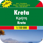
Crete - ExpressMap is a double-sided laminated map in the cover. Its dimensions are small: 100 x 48 cm after unfolding, and in the composite form it is only 11 x 24 cm. The plan of Crete was presented in 1: 150,000 scale. In addition, the publisher on both sides also posted the plans of major cities: Heraklion, Rethymnon, Chania, Agios Nikolaos, Ierapetra and Sitia, which are sketched on a scale of 1:10 000. There is also a small plan of islet Gavdos (1: 150,000).
The Freytag & Berndt map is a classic map on a scale of 1: 150,000, printed on plain good paper. This results in the fact that in terms of physical functionality in comparison with competitors' products it will be very poor. The price for which it is offered, you can buy laminated maps with much longer life and ease of folding.
gość PiotrWie Jeździliśmy na Kretę od 2008r, bywały lata że byliśmy w kilku kawałkach w sumie czterdzieści kilka dni ( samoloty z Wrocławia latały w piątek wieczorem tak że można było polecieć po pracy, powrotem był w poniedziałek w nocy więc za 11 dni urlopu można było być 17 dni, jak się zaplanowało z jakimś świętem to można było być 2 x 17 dni i raz 10 dni) i z roku na rok było coraz więcej ludzi - nie tylko na plażach ale ... (...)
Czy wyspa jest w stanie pomieścić 15 mln turystów, zapewne tak. Pytanie moje: skąd będzie woda?! Jak już brakuje, tama na Aposelemis sucha, gdzie ścieki popłyną, gdzie będą składowane śmieci??? Smutne, że wyspa zamienia się na globalną destynację.. rozumiem, że pieniądze są ważne ale żeby dewastować naturalne tereny np.triopetra, plakias etc... przykro
Można próbować zrozumieć ludzi, którzy z tego żyją. Można też puścić ludzi na żywioł i nie zajmować się takimi głupotami, jak ofiary śmiertelne. Samaria nie jest szlakiem w 100% bezpiecznym (który szlak jest), to głęboki wąwóz, narażony na erozyjne osunięcia skał. Poza ty, to jest region aktywny sejsmicznie i dość kapryśny pogodowo.
Myślę, że tu nie ma miejsca na ustępstwa. (...)
gość PiotrWie Dziś po raz pierwszy ( a jeździmy dużo od 2008 roku i dużo chodzimy po szlakach) widzieliśmy w Grecji ekipę przygotowującą szlak do sezonu. Nie była to co prawda zbyt duża ekipa - dwie osoby z motyką, sekatorem i niewielką piłą ręczną - ale zawsze coś - na wyspach Kanaryjskich ekipa to pierwszy z kosą spalinową a zanim kilka osób zmiatających resztki na bok. (...)
 For a long time now we have been trying to find a worthy successor to our old map of Crete, published by Freytag & Berndt, with which we have been traveling around Crete from the very beginning. Apart from its disastrous physical condition, the change is also supported by the fact that it has become obsolete because it was released before 2008. Since then, quite a lot of new roads have appeared on Crete, and some of the gravel roads have gained an asphalt surface. So the time has come to buy a completely new map. At the end of last year's autumn, using promotional prices in one of the online stores, we bought a map of the renowned Terrain publishing house. We put a lot of hopes in it, the more so because last year's attempt to replace the map turned out to be a failure
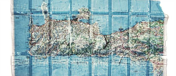


Komentarze
Wypełnij poniższy formularz aby dodać komentarz