Serwis wymaga plików cookies do prawidłowego działania strony. Korzystanie z serwisu bez zmiany ustawień dla plików cookies oznacza, że będą one zapisywane w pamięci urządzenia. Ustawienia te można zmieniać w przeglądarce internetowej.
The best Polish website dedicated to the Greek island Crete and to a small extent of continental Greece. You will find useful information related to visiting Crete that goes beyond the offer of optional tours. On the website you will also find descriptions of the most interesting places that we visited by visiting this largest Greek island. The content complements the current news, photographs and recipes of Greek cuisine.
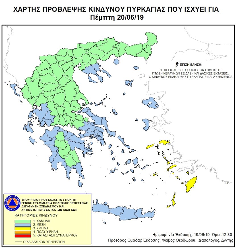
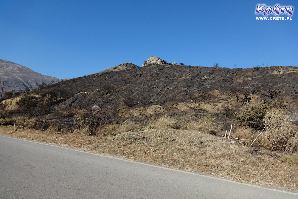
In the first days of June, the Greek civil protection services began re-publishing fire danger maps throughout Greece. These maps can also be checked through our website. You will find them in the main menu under the Fire hazard map button.
Green indicates the lowest risk, while red the highest. This year we have also added the ability to view maps from previous days to see if the risk is increasing. After 19.00, a map of threats for the next day will be published. For tourists, this may be important when planning hiking trips, for example because some of the routes may be closed on days where high risk of fires is forecasted.
Current maps will be published by the end of October. Until then, they will also be downloaded to our website.
Publication of hazard information is part of an integral fire prevention plan and is overseen by the Emergency Response Planning and Response Directorate. This is an international practice especially used in countries at risk of serious fires. The main goal is to coordinate the entities involved in the fight against the element, as well as provide the public with up-to-date information, which may prevent activities that could cause a forest fire due to neglect.
Można próbować zrozumieć ludzi, którzy z tego żyją. Można też puścić ludzi na żywioł i nie zajmować się takimi głupotami, jak ofiary śmiertelne. Samaria nie jest szlakiem w 100% bezpiecznym (który szlak jest), to głęboki wąwóz, narażony na erozyjne osunięcia skał. Poza ty, to jest region aktywny sejsmicznie i dość kapryśny pogodowo.
Myślę, że tu nie ma miejsca na ustępstwa. (...)
gość PiotrWie Dziś po raz pierwszy ( a jeździmy dużo od 2008 roku i dużo chodzimy po szlakach) widzieliśmy w Grecji ekipę przygotowującą szlak do sezonu. Nie była to co prawda zbyt duża ekipa - dwie osoby z motyką, sekatorem i niewielką piłą ręczną - ale zawsze coś - na wyspach Kanaryjskich ekipa to pierwszy z kosą spalinową a zanim kilka osób zmiatających resztki na bok. (...)
 2019-06-19 18:08:32
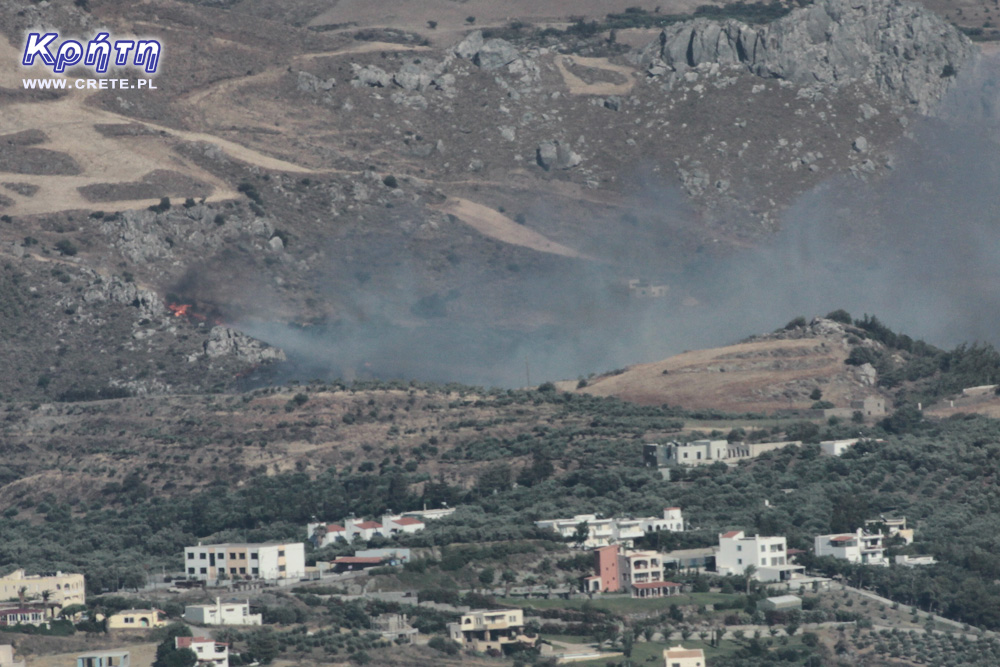

Komentarze
Wypełnij poniższy formularz aby dodać komentarz
lub kliknij w poniższy link aby skorzystać z możliwosci komentowania przez facebooka:
https://www.facebook.com/crete.poland/posts/10156280474047551