Serwis wymaga plików cookies do prawidłowego działania strony. Korzystanie z serwisu bez zmiany ustawień dla plików cookies oznacza, że będą one zapisywane w pamięci urządzenia. Ustawienia te można zmieniać w przeglądarce internetowej.
The best Polish website dedicated to the Greek island Crete and to a small extent of continental Greece. You will find useful information related to visiting Crete that goes beyond the offer of optional tours. On the website you will also find descriptions of the most interesting places that we visited by visiting this largest Greek island. The content complements the current news, photographs and recipes of Greek cuisine.
Revitalization of hiking trails in the western part of Crete
2021-06-04 20:28:56
The area of the commune of Kandanos-Selino is certainly one of those regions of Crete, which is especially eagerly chosen by hiking enthusiasts. This should not come as a surprise, because it is here that you can find many interesting and, what is important, easily accessible routes. It is also worth mentioning that this area is a great starting point for trips to the Samaria Gorge, well-known to tourists and other places located in this area. The great interest of tourists who prefer active recreation has not escaped the attention of the Kandanos-Selino commune authorities, which by revitalizing hiking trails wants to emphasize its attractiveness even more for hikers.
The trail between Sougia and Paleochora
The new project co-financed by the European Regional Development Fund includes the development of a network of hiking trails in the commune. In total, the revitalization works are to cover thirteen walking routes, the total length of which is 166 km. The conducted works have been divided into several stages including: clearing the route of the trail from wild vegetation, introducing a clear, uniform marking, setting up information boards at the beginning and ending points of the route. These activities will be particularly important on routes that have been unattended for many years and traveled by individuals. In total, funds in the amount of PLN 162,000 will be allocated to the works carried out under this project. €.
The trail between Sougia and Lissos
Of course, making the routes available to tourists is not the only goal that the authorities of the Kandanos-Selino commune want to achieve. No less important aspect is also the fact of promoting the biodiversity of these parts of the island not only among tourists visiting Crete, but also among local residents.
At the moment, the revitalization of the following hiking trails is planned as part of this project:
Mam tylko nadzieję że nie zrobią tego w dotychczasowym stylu -przy miejscowości oznaczenie na oznaczeniu, im dalej w szlak tym mniej i niewyraźne. Trzy lata temu rewitalizowali E4 w górach Dikti - na płaskowyżu Katharos gdzie szlak biegnie drogą polną znaków a znaków, zaś przy niewyraźnej ścieżce biegnącej z Katharo na Lhassiti - poza strzałką gdzie zejść z drogi polnej innych oznaczeń brak. Ale może wreszcie ktoś przypilnuje by było to zrobione jak trzeba.
gość PiotrWie
2021-06-04 22:13:40
PS Jak dokładnie przejrzałem listę to rzeczywiście większość stanowią ścieżki istniejące tylko na mapie, ale dwa odcinki ( Soughia - Lissos i Aghia Irini - wąwóż Fugues) są w stanie bardzo dobrym - jasne, wyraźne i oznakowane - co tam chcą robić?? W wąwozie Fuges byliśmy w zeszłym roku - było podejrzanie bezproblemowo jak na Kretę.
Wypełnij poniższy formularz aby dodać komentarz
lub kliknij w poniższy link aby skorzystać z możliwosci komentowania przez facebooka: https://www.facebook.com/crete.poland/posts/10158000250147551
gość PiotrWie : Kolejne rekordy to obraz coraz większego overtourismu Krety. Na szczęście są jeszcze miejsca w Grecji gdzie można znaleźć spokój - obecnie jesteśmy na Ikarii gdzie jest mniej więcej tak jak 15 lat temu na południu i w interiorze Krety - na plażach i górskich szlakach spotykasz pojedyncze osoby.
: I bardzo dobrze, Ci wspaniali ludzie zasługują na prosperite.


 2021-06-04 20:28:56
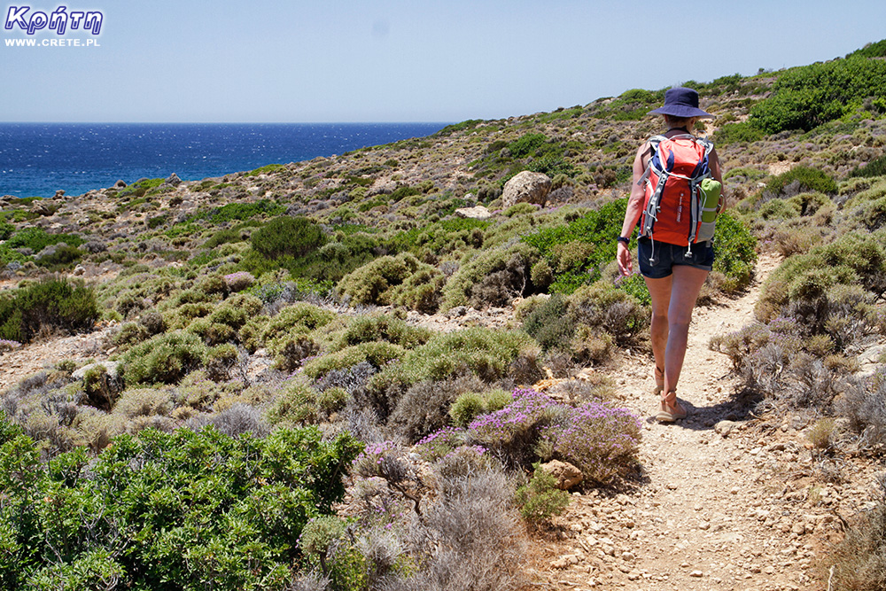
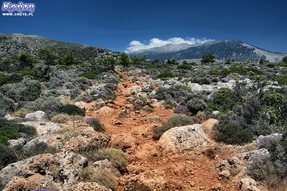 The trail between Sougia and Lissos


Komentarze
Mam tylko nadzieję że nie zrobią tego w dotychczasowym stylu -przy miejscowości oznaczenie na oznaczeniu, im dalej w szlak tym mniej i niewyraźne. Trzy lata temu rewitalizowali E4 w górach Dikti - na płaskowyżu Katharos gdzie szlak biegnie drogą polną znaków a znaków, zaś przy niewyraźnej ścieżce biegnącej z Katharo na Lhassiti - poza strzałką gdzie zejść z drogi polnej innych oznaczeń brak. Ale może wreszcie ktoś przypilnuje by było to zrobione jak trzeba.
PS Jak dokładnie przejrzałem listę to rzeczywiście większość stanowią ścieżki istniejące tylko na mapie, ale dwa odcinki ( Soughia - Lissos i Aghia Irini - wąwóż Fugues) są w stanie bardzo dobrym - jasne, wyraźne i oznakowane - co tam chcą robić?? W wąwozie Fuges byliśmy w zeszłym roku - było podejrzanie bezproblemowo jak na Kretę.
Wypełnij poniższy formularz aby dodać komentarz
lub kliknij w poniższy link aby skorzystać z możliwosci komentowania przez facebooka:
https://www.facebook.com/crete.poland/posts/10158000250147551